Download
3D Flyover
Add to list
More
52.6 km
~3 days
2533 m
Multi-Day
“Embark on a scenic trek through Kahurangi's diverse terrain, bridging history and nature on New Zealand's Anatoki and Waingaro Track.”
The Anatoki and Waingaro Track is a captivating journey through the diverse landscapes of New Zealand's Kahurangi National Park. Spanning approximately 53 kilometers (about 33 miles) with an elevation gain of roughly 2500 meters (8202 feet), this point-to-point trail offers a medium difficulty rating, making it accessible to hikers with a reasonable level of fitness and experience.
Getting to the Trailhead
To reach the trailhead near Tasman, New Zealand, hikers can drive to the end of Aorere Valley Road, which is the nearest known address to the starting point. For those relying on public transport, options are limited, but it's possible to take a bus to Takaka and then arrange for a taxi or shuttle service to the trailhead.
Navigating the Trail
Hikers can utilize the HiiKER app for detailed maps and navigation assistance throughout the trek. The trail is well-marked, but as with any backcountry hike, it's essential to be prepared with a reliable navigation tool.
The Journey Begins
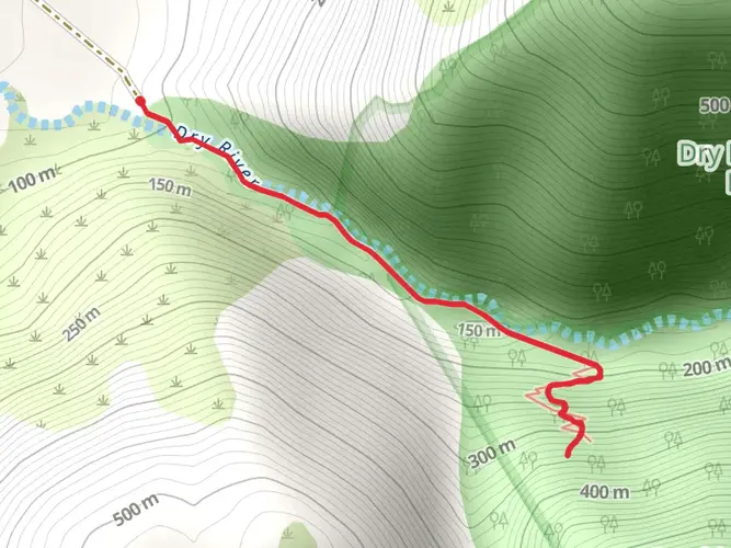
Embarking from the trailhead, hikers will traverse lush beech forests, crossing several swing bridges over the Anatoki River. The initial section is a gentle ascent, allowing hikers to warm up as they become enveloped by the sounds and sights of the forest.
Ascent to the Saddle
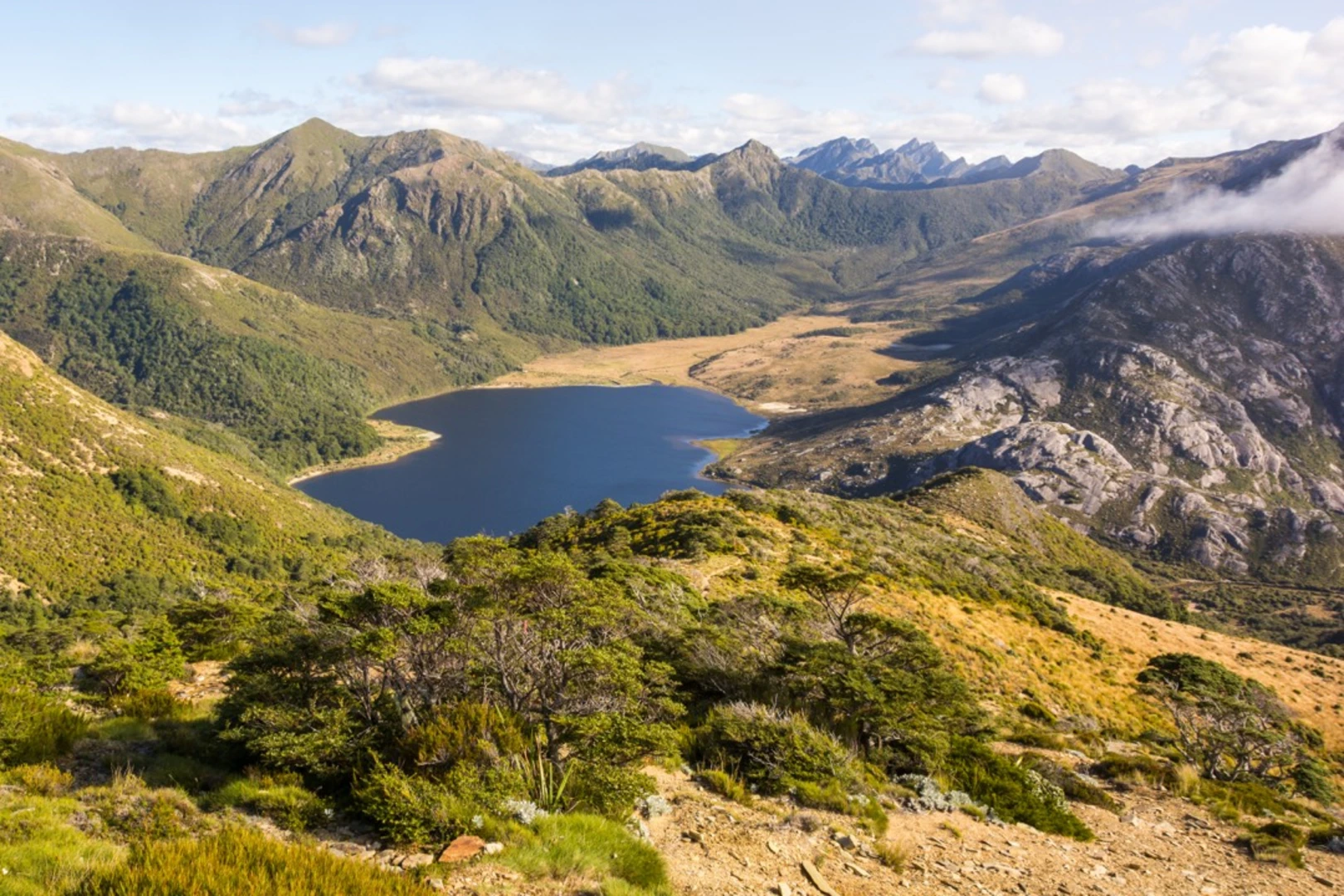
The trail becomes more challenging as it approaches the Anatoki Saddle, with steeper inclines and more rugged terrain. The saddle itself is a highlight, offering panoramic views of the surrounding mountains and valleys. This section covers a significant portion of the elevation gain, so hikers should pace themselves and be prepared for a strenuous climb.
Alpine Flora and Fauna
As the trail ascends, the forest canopy gives way to alpine scrub and tussock fields. This change in vegetation offers opportunities to spot unique wildlife, including the kea, a native alpine parrot known for its intelligence and curiosity. Hikers should be mindful of the delicate alpine ecosystem and stay on the marked trail to minimize their impact.
Historical Significance
The region is steeped in history, with the Aorere Valley being one of the first areas where European settlers tried their hand at gold mining in New Zealand. Remnants of the gold rush era, such as old mine shafts and equipment, can sometimes be seen along the trail, providing a glimpse into the past.
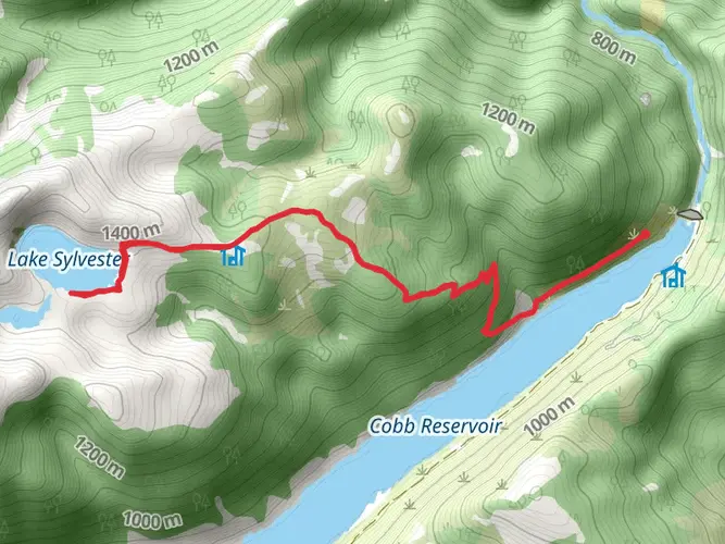
Descending to Waingaro Forks Hut
After reaching the highest point of the trail, hikers will begin a gradual descent towards the Waingaro Forks Hut, which is situated at the confluence of the Waingaro and Anatoki Rivers. This hut serves as a convenient overnight stop for those looking to break the hike into multiple days.
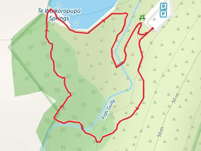
Waingaro Hot Springs
One of the unique features of this trail is the proximity to the Waingaro Hot Springs, located off a side track near the Waingaro Forks Hut. These natural hot springs are a perfect spot for hikers to relax and rejuvenate tired muscles after a long day of trekking.
Completing the Journey
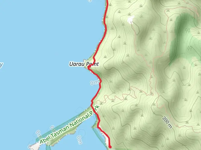
The final leg of the trail follows the Waingaro River downstream, with a mix of flat and undulating terrain. Hikers will pass through more native forest, eventually emerging at the end of the trail near the Golden Bay. From here, hikers can arrange for pick-up or continue their journey in the beautiful Tasman region.
Preparation and Safety
Hikers should be well-prepared with adequate food, water, and gear for changing weather conditions. It's also advisable to inform someone of your hiking plans and expected return time. Always check the weather forecast and trail conditions before setting out, as the trail can become challenging in adverse weather.
By following these guidelines and being prepared, hikers can fully enjoy the natural beauty and historical richness of the Anatoki and Waingaro Track.

What to expect?
Activity types
Frequently asked questions
How long is the Anatoki and Waingaro Track in Kahurangi National Park?
The Anatoki and Waingaro Track is 52.55 km long, or about 32.7 miles. It is a multi-day route in Kahurangi National Park in the Tasman region, and that distance, combined with 2,533 m of climbing, puts it firmly in the demanding backcountry category.
How difficult is the Anatoki and Waingaro Track?
The Anatoki and Waingaro Track is rated Extra Difficult. The route covers 52.55 km with 2,533 m of elevation gain, and the central section between Anatoki Forks Hut and Waingaro Forks Hut is listed by the Department of Conservation at 7 to 10 hours, which reflects the steep, rugged nature of the terrain.
Does the Anatoki and Waingaro Track go past Anatoki Forks Hut and Waingaro Forks Hut?
Yes. The route links Anatoki Forks Hut and Waingaro Forks Hut, two key backcountry huts on this traverse in Kahurangi National Park. DOC lists the section from Anatoki Forks Hut to Waingaro Forks Hut at 7 to 10 hours, making those huts important landmarks for planning daily stages and overnight stops.
Is the Kill Devil Track part of the Anatoki and Waingaro Track?
Yes. The Anatoki and Waingaro Track uses the historic Kill Devil Pack Track as part of the wider route through Kahurangi National Park. DOC describes the descent toward Waingaro through regenerating bush and zigzags down Kill Devil Ridge, so searches for the Kill Devil Track in Takaka are often referring to this same backcountry area.
Where does the Anatoki and Waingaro Track start near Takaka?
The track is in the Golden Bay hinterland of Tasman, with access commonly approached from the Takaka area. The Anatoki side is reached via the Aorere Valley side of Kahurangi National Park, while the Waingaro and Kill Devil side is associated with the Uruwhenua end near Golden Bay, so transport logistics usually need planning in advance.
What kind of trail is the Anatoki and Waingaro Track?
The Anatoki and Waingaro Track is a point-to-point multi-day backcountry trail rather than a short out-and-back walk. At 52.55 km with 2,533 m of ascent, it is better suited to experienced trampers who are comfortable with long days, remote hut-to-hut travel, and variable mountain conditions in Kahurangi National Park.
Comments and Reviews
User comments, reviews and discussions about the Anatoki and Waingaro Track, New Zealand.
5.0
average rating out of 5
1 rating(s)