Download
3D Flyover
Add to list
More
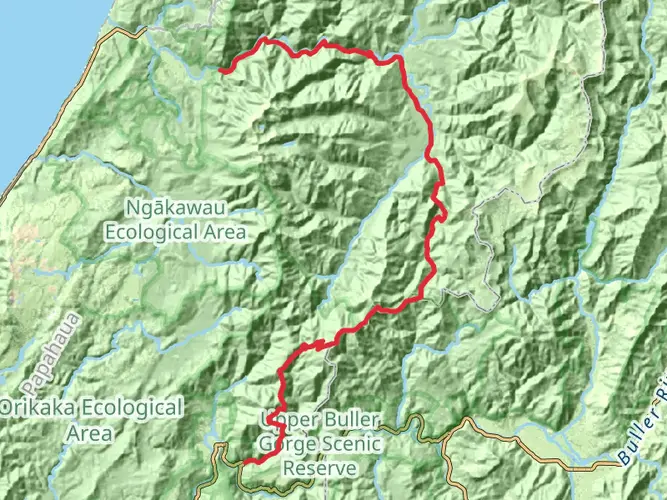
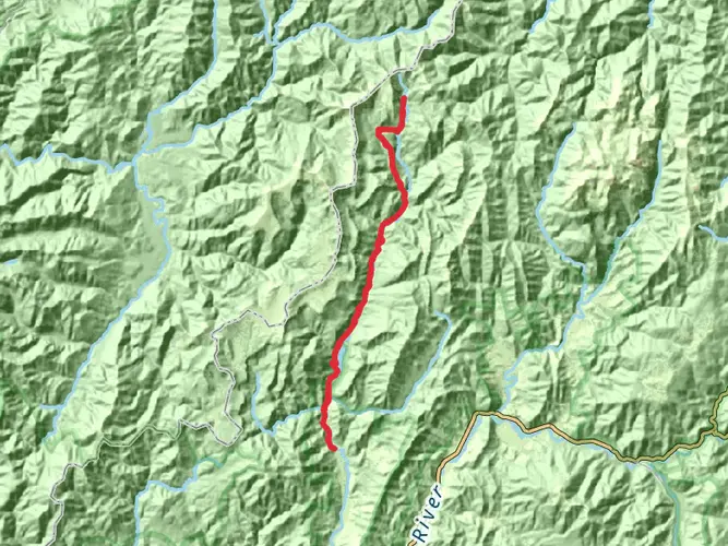
81.8 km
~4 days
3671 m
Multi-Day
“Tackle the Leslie-Karamea's rugged beauty for an unforgettable test of endurance and wilderness immersion.”
Embarking on the Leslie-Karamea Track, hikers will traverse a challenging yet rewarding journey through the heart of Kahurangi National Park, one of New Zealand's largest national parks. This approximately 82 km (51 miles) point-to-point trail, with an elevation gain of around 3600 meters (11,800 feet), is not for the faint-hearted and is estimated to be difficult due to its rugged terrain and remote location.
Getting to the Trailhead
The trailhead is located near Tasman, New Zealand. For those arriving by car, the most common starting point is the Flora car park, which is accessible via a gravel road from Motueka. If you're relying on public transport, options are limited, but shuttle services may be available from nearby towns such as Nelson or Motueka. It's essential to book these services in advance.
The Journey Begins
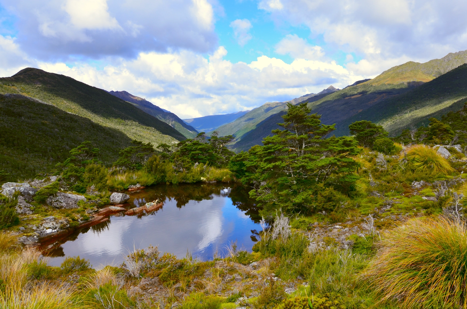
Setting out from the trailhead, hikers will immediately be greeted by the lush native beech forest. The initial section of the trail is a steady climb, which serves as a good warm-up for the legs. As you ascend, the forest canopy occasionally opens up to reveal stunning vistas of the surrounding mountains.
Landmarks and Natural Features
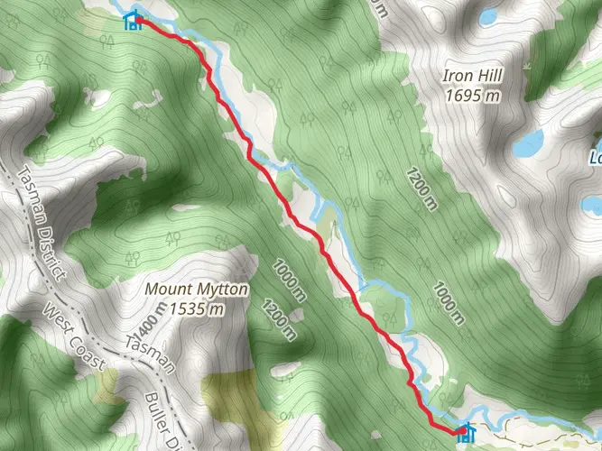
One of the first significant landmarks encountered is the historic Tableland area, which is dotted with alpine huts and features relics from early European settlers who attempted to farm this challenging landscape. The Tableland provides a flat respite before the ascent towards the more demanding parts of the trail.
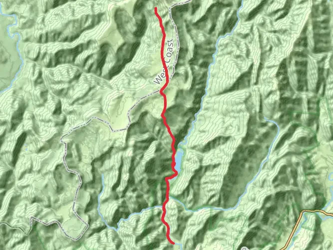
As you progress, the Leslie-Karamea Track leads to the Karamea River, a defining feature of the hike. The river will be your companion for a significant portion of the journey, with multiple crossings that require care and attention, especially after heavy rain.
Flora and Fauna
The trail is a haven for birdwatchers, with the opportunity to spot species such as the South Island kaka, kea, and the elusive kiwi. The dense forest is also home to a variety of native plants, including the towering rimu and kahikatea trees, as well as a diverse array of ferns and mosses that carpet the forest floor.
Historical Significance
The region holds historical significance for both Māori and European settlers. The Māori used these trails for greenstone (pounamu) trading, while Europeans later explored these valleys for mining prospects. The remnants of these past endeavors can be seen along the trail.
Challenges and Navigation
The Leslie-Karamea Track is marked but can be challenging to navigate in places, especially in adverse weather conditions. Hikers should be equipped with a reliable navigation tool such as HiiKER, which provides detailed maps and trail information that can be accessed offline – a crucial feature in this remote area.
End of the Trail
The trail concludes at the Karamea end, where hikers can arrange for a pickup or continue their journey to explore other parts of the Kahurangi National Park. Due to the track's remoteness, it's essential to plan your exit strategy in advance, whether it's a pre-arranged shuttle or a hike out to a more accessible location.
Preparation and Planning
Given the trail's difficulty, hikers should be well-prepared with adequate food, water, and gear for changing weather conditions. It's also recommended to check in with the local Department of Conservation office for the latest track conditions and to leave your intentions with someone before setting out. The Leslie-Karamea Track offers an immersive experience into New Zealand's backcountry, promising both challenges and the rewards of pristine wilderness.

What to expect?
Activity types
Frequently asked questions
How difficult is the Leslie-Karamea Track in Kahurangi National Park?
The Leslie-Karamea Track is a demanding multi-day route of 81.84 km with 3,671 m of climbing, and it is best treated as an extra-difficult backcountry tramp. The track is marked but rough in places, several streams are unbridged and flood-prone, and the Department of Conservation describes the full road-end-to-road-end journey as taking about 6 to 9 days.
How long does the Leslie-Karamea Track take to complete from end to end?
Most parties need around 6 to 9 days to walk the full Leslie-Karamea Track from road end to road end. DOC also breaks out shorter sections, including Flora car park to Salisbury Lodge at 13.2 km in about 4 hours 30 minutes and Salisbury Lodge to Karamea Bend Hut at 18 km in about 6 hours, which shows how committing the terrain is.
Where do you start the Leslie-Karamea Track and where can you park?
A common eastern start for the Leslie-Karamea Track is Flora car park, reached by the unsealed Graham Valley Road above Ngātīmoti, about 36 km from Motueka. Flora car park has a toilet and an information shelter, and the track then goes over Flora Saddle, past Flora Hut, and up to Salisbury Lodge before the main Leslie-Karamea section begins.
Does the Leslie-Karamea Track go past Karamea Bend Hut?
Yes. Karamea Bend Hut is one of the key huts on the Leslie-Karamea Track and sits on the section between Salisbury Lodge and Crow Hut. DOC lists Salisbury Lodge to Karamea Bend Hut as 18 km, and Karamea Bend Hut itself is a standard 22-bunk hut in Kahurangi National Park.
What are the main landmarks on the Leslie-Karamea Track?
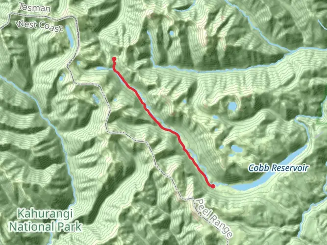
Major landmarks on the Leslie-Karamea Track include Flora Saddle, Flora Hut, Salisbury Lodge on the Tablelands, Splugeons Rock Shelter, Karamea Bend Hut, Crow Hut, and Venus Hut. Farther west, the route continues down the Karamea Valley toward Helicopter Flat Hut and then links out via the Wangapeka side over Little Wanganui Saddle at 1,110 m.
Is the Leslie-Karamea Track the same as the Wangapeka Track?
No. The Leslie-Karamea Track and the Wangapeka Track are separate routes, but they connect in the wider Kahurangi National Park network and share entry or exit points at the western and eastern ends. That makes them easy to confuse when planning a through-trip, especially around the Little Wanganui and Tapawera access points.
Comments and Reviews
User comments, reviews and discussions about the Leslie-Karamea Track, New Zealand.
4.0
average rating out of 5
1 rating(s)