Download
3D Flyover
Add to list
More
77.2 km
~3 days
1610 m
Multi-Day
“Harper Pass beckons adventurers through a historic alpine mosaic, promising both natural splendors and a walk through time.”
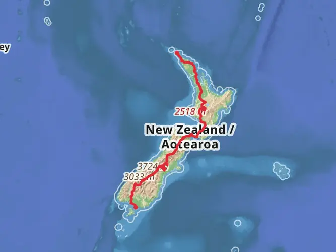
Harper Pass, a historic route traversing the Southern Alps of New Zealand, offers hikers an immersive experience through diverse landscapes, from beech forests to alpine passes. Spanning approximately 77 kilometers (about 48 miles) with an elevation gain of around 1600 meters (approximately 5250 feet), this point-to-point trail is a journey through both natural beauty and history.
Getting to the Trailhead
The trailhead for Harper Pass is accessible from the small settlement near Westland, New Zealand. For those driving, the most common starting point is at the end of Morrison Footbridge Road, which is a turnoff from Lake Sumner Road. Public transport options are limited in this remote area, so hikers often opt for shuttle services or arrange private transportation to reach the starting point.
The Journey Begins
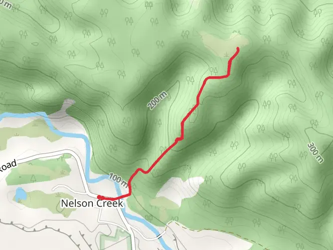
Setting out from the trailhead, hikers are greeted by the lush greenery of lowland beech forests. The initial section of the trail is relatively flat, following the Taramakau River. The soothing sounds of flowing water accompany hikers as they make their way towards the first notable landmark, Locke Stream Hut, which is situated about 17 kilometers (10.5 miles) from the start.
Ascending to Harper Pass
Beyond Locke Stream Hut, the trail begins to ascend more steeply towards Harper Pass. This section can be challenging, with rocky terrain and occasional river crossings that require careful navigation. Hikers should be prepared for changing weather conditions and have appropriate gear for cold and wet environments.
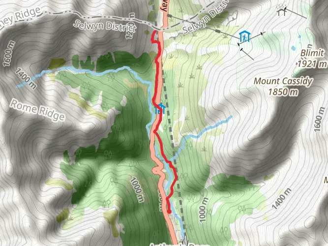
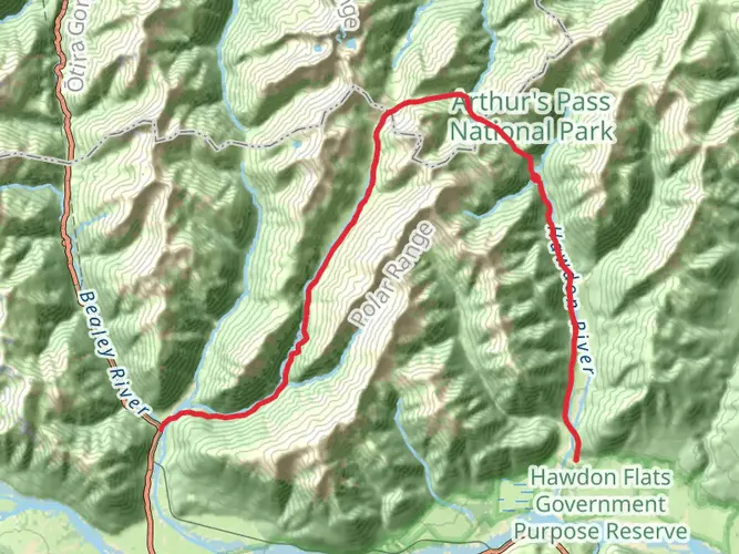
As you approach Harper Pass, the highest point of the trail at around 962 meters (3156 feet), the vegetation becomes sparser, and the landscape opens up to reveal panoramic views of the surrounding mountains. This alpine pass is historically significant as it was once used by Māori as a greenstone (pounamu) trading route and later by European settlers.
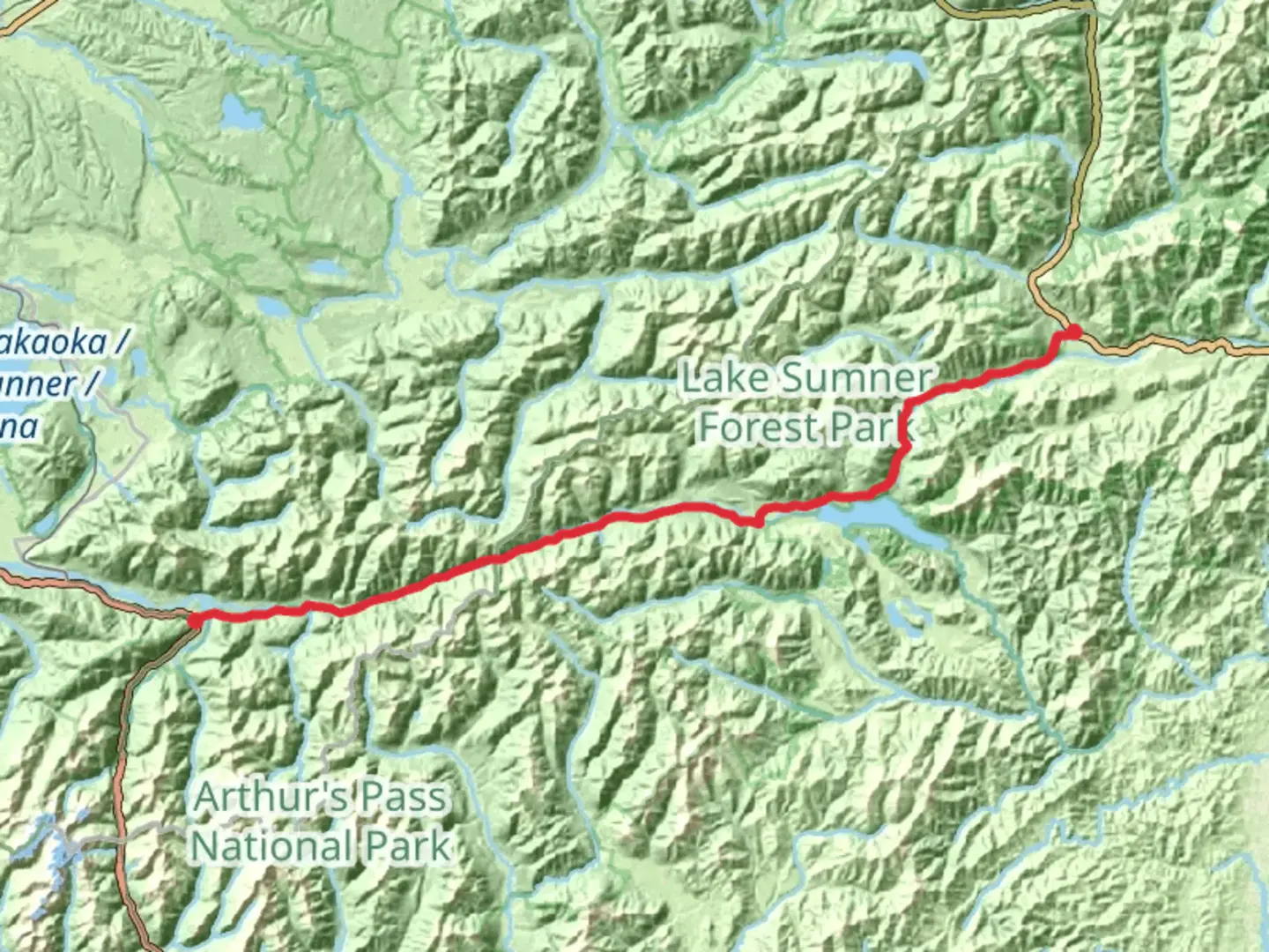
Descending into the East
After the summit of Harper Pass, the trail descends into the eastern side of the Southern Alps. Hikers will notice a change in the environment as they enter the valley of the Hurunui River. The descent is gradual, and the trail meanders through subalpine scrub and tussock grasslands.
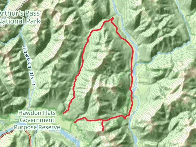
Final Stretch and Wildlife Encounters
The final stretch of the trail is a tranquil walk alongside the Hurunui River, leading to the Hurunui No. 3 Hut, which is a good place to rest before completing the journey. This area is rich in wildlife, and hikers may spot various bird species, including the kea, New Zealand's alpine parrot, known for its intelligence and curiosity.
Completing the Harper Pass Trek
The trail concludes at the Hurunui River bridge, which is about 30 kilometers (18.6 miles) from the pass itself. From here, hikers can arrange for pick-up or continue to the nearby road to meet their transportation.
Throughout the Harper Pass trek, hikers should be self-sufficient, carry a detailed map, and use navigation tools like HiiKER to stay on track. It's essential to be prepared for river crossings, variable weather, and remote conditions. With proper planning and respect for the natural and historical significance of the region, the Harper Pass offers an unforgettable New Zealand hiking experience.

Frequently asked questions
How long is the Harper Pass hike in New Zealand and how many days does Harper Pass usually take?
The full Harper Pass route is 77.21 km with 1,610 m of elevation gain, so it is generally treated as a multi-day tramp rather than a long day hike. The eastern DOC section from Hurunui Swing Bridge to Harper Pass is 21 km one way and listed at about 7 hours 30 minutes, while the full crossing is commonly done over 4 to 5 days.
Where do you start the Harper Pass hike and how do hikers reach the Harper Pass trailhead?
A common eastern access point for Harper Pass is Hurunui Swing Bridge in Lake Sumner Forest Park. Via Lake Sumner Road, the road is suitable for 4WD vehicles only beyond Lake Taylor to Loch Katrine, and from Loch Katrine it is about 9 km, or 2 to 3 hours on foot, to Hurunui Swing Bridge.
Are there huts on the Harper Pass hike and what is Harper Pass Bivvy like?
Harper Pass has several backcountry huts on the eastern side, including Hurunui Hut, No. 3 Hut, Camerons Hut, and Harper Pass Bivvy. Harper Pass Bivvy is a very small basic shelter with 2 bunks, while Camerons Hut has 4 bunks, No. 3 Hut has 16, and Hurunui Hut has 15.
Are there hot pools on the Harper Pass hike?
Yes. On the eastern Harper Pass Track, a hot spring is reached about 2 hours beyond Hurunui Hut on the way toward No. 3 Hut. It is one of the best-known features on this route and sits well before the final climb toward Harper Pass itself.
Can you camp on the Harper Pass hike or do most people stay in huts?
Most trampers on Harper Pass use the huts because the route is long, remote, and naturally broken into overnight stages. There are established hut stops at Hurunui Hut, No. 3 Hut, Camerons Hut, and Harper Pass Bivvy, so hut-based itineraries are the standard way to complete the crossing.
Is the Harper Pass hike dog friendly?
No. Dogs are not allowed on the Harper Pass Track on conservation land. That restriction applies to the DOC-managed track section in Lake Sumner Forest Park, so Harper Pass should be planned as a no-dogs route.
How hard is the Harper Pass hike and what is the terrain like on Harper Pass?
Harper Pass is rated medium overall, but it is still a serious backcountry route because it covers 77.21 km and climbs 1,610 m. The track includes beech forest, river flats, grass sections, and steeper climbing near the pass, and the full west-to-east crossing involves major river crossings outside the easier eastern section.
Comments and Reviews
User comments, reviews and discussions about the Harper Pass, New Zealand.
4.78
average rating out of 5
9 rating(s)