Download
3D Flyover
Add to list
More
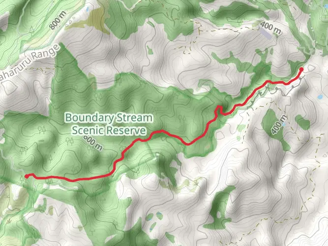
29.1 km
~7 hrs
716 m
Multi-Day
“Embark on a timeless trek amidst ancient New Zealand podocarps, where culture and wilderness intertwine on the serene Lower Whirinaki Track.”
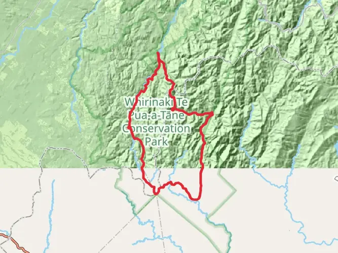
Nestled in the lush forests of New Zealand's North Island, near Whakatane, the Lower Whirinaki Track offers hikers an immersive experience through ancient podocarp forests. Spanning approximately 29 kilometers (around 18 miles) with an elevation gain of roughly 700 meters (about 2300 feet), this point-to-point trail is considered to have a medium difficulty rating.
Getting to the Trailhead
To reach the starting point of the Lower Whirinaki Track, hikers can drive to the end of Old Fort Road, off Minginui Road, which is the nearest known address to the trailhead. For those relying on public transport, options may be limited, and it's advisable to check local services for the latest schedules to the Whakatane area. From there, a taxi or shuttle service can be arranged to the trailhead.
The Journey Through Time
As you embark on the Lower Whirinaki Track, you're stepping into a world that has remained relatively unchanged for millennia. The trail is a testament to the region's rich Maori history, with the Whirinaki Te Pua-a-Tāne Conservation Park being a significant area for local iwi (tribes). The forest is considered a taonga (treasure) and is deeply respected for its biodiversity and cultural heritage.
Flora and Fauna
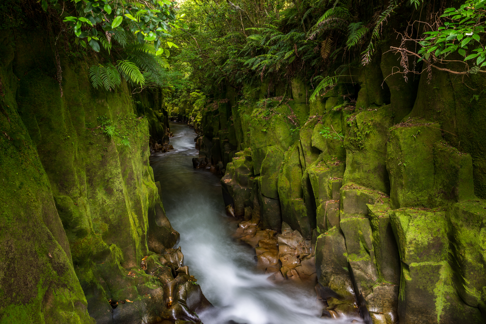
The track meanders through dense native forests, home to towering rimu, totara, and kahikatea trees, some of which are several centuries old. The undergrowth is rich with ferns and mosses, creating a green tapestry that is both enchanting and serene. Birdsong fills the air, with the potential to spot rare species such as the North Island kaka, yellow-crowned parakeet, and the iconic kiwi, which are known to inhabit the area.
Trail Highlights and Landmarks
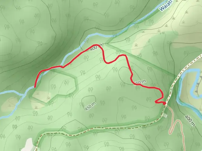
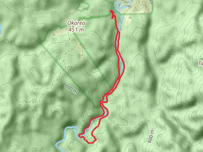
The Lower Whirinaki Track is well-marked, and hikers can rely on the HiiKER app for navigation throughout their journey. The trail is characterized by its gentle inclines and occasional steep sections, contributing to the overall elevation gain. Along the route, you'll encounter the Whirinaki Waterfall, a stunning cascade that provides a picturesque spot for a rest and perhaps a refreshing dip.
Approximately halfway through the hike, the track leads to the Whirinaki Forest Hut, a cozy backcountry hut that offers a place to stay overnight for those who wish to break up their hike into a two-day adventure. Reservations for the hut are recommended, especially during peak seasons.
Safety and Preparation
Hikers should be prepared for changeable weather conditions and carry adequate supplies, including water, food, and a first-aid kit. Sturdy hiking boots are essential, as the terrain can be uneven and occasionally slippery. It's also wise to inform someone of your hiking plans and expected return time due to the remote nature of the trail.
Access and Conservation
The Lower Whirinaki Track is accessible year-round, but the best conditions are typically during the summer and autumn months. Hikers are encouraged to practice Leave No Trace principles to preserve the pristine environment for future generations. This includes packing out all rubbish, respecting wildlife, and staying on marked trails to prevent erosion and protect delicate ecosystems.
By following these guidelines and preparing adequately, hikers can fully enjoy the natural splendor and historical significance that the Lower Whirinaki Track has to offer.

What to expect?
Activity types
Frequently asked questions
How long does the Lower Whirinaki Track take to hike in Whakatane, New Zealand?
The Lower Whirinaki Track is 29.07 km long with 716 m of climbing, so it is best treated as a multi-day hike rather than a short day walk. A practical split is to hike in to Central Whirinaki Hut on day one and finish on day two, using the well-formed Whirinaki Track corridor through Whirinaki Te Pua-a-Tane Conservation Park.
Where do you park for the Lower Whirinaki Track?
The usual access for the Lower Whirinaki Track is from the River Road car park in Whirinaki Te Pua-a-Tane Conservation Park. River Road is reached from Minginui village, and it is the main starting point for many of the park’s longer walks and tramps, including the route toward Central Whirinaki Hut and Whirinaki Waterfall.
Is there hut accommodation on the Lower Whirinaki Track?
Yes. Central Whirinaki Hut is the key overnight stop used on the Lower Whirinaki Track. It sits beside the Whirinaki River, has 25 bunk beds, and is a serviced hut, making it the main overnight option for hikers breaking up this 29.07 km difficult track into a two-day trip.
How hard is the Lower Whirinaki Track?
The Lower Whirinaki Track is rated difficult and covers 29.07 km with 716 m of elevation gain. That combination makes it better suited to hikers comfortable with longer backcountry days, uneven forest terrain, and changeable conditions in Whirinaki Te Pua-a-Tane Conservation Park.
Can you do the Lower Whirinaki Track as an overnight hike?
Yes, the Lower Whirinaki Track is well suited to an overnight trip. The route length of 29.07 km and the presence of Central Whirinaki Hut make a two-day plan the most natural option, especially for hikers who want time to enjoy the Whirinaki River corridor and the old-growth podocarp forest.
What is the transport situation for the Lower Whirinaki Track?
Transport is limited around the Lower Whirinaki Track. The park is reached by road via Te Whaiti Road and Minginui Road, and the most common access point for longer walks is River Road car park near Minginui village. There is no regular trailhead transit service listed for the track, so most hikers arrange a private vehicle or shuttle.
Are dogs allowed on the Lower Whirinaki Track?
Dog access in Whirinaki Te Pua-a-Tane Conservation Park is controlled rather than open access. On nearby DOC-managed tracks in the same park, dogs are allowed only with a DOC permit, so the Lower Whirinaki Track should be treated the same unless a current permit has been arranged in advance.
Comments and Reviews
User comments, reviews and discussions about the Lower Whirinaki Track, New Zealand.
5.0
average rating out of 5
7 rating(s)