Download
3D Flyover
Add to list
More
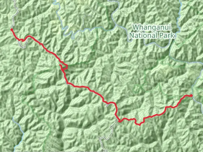
15.4 km
~4 hrs 12 min
674 m
Multi-Day
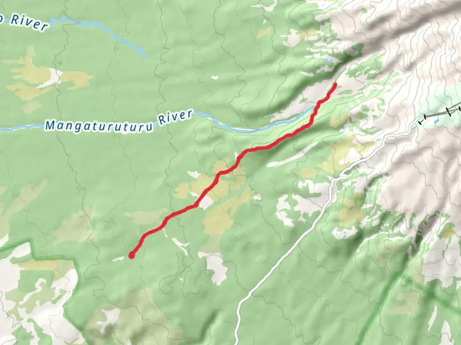
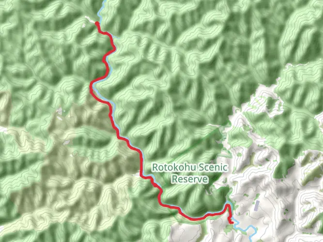
The Atene Skyline Track is a 15.4 km trail that starts in , Whanganui, New Zealand. Based on our data, the hike is graded as Difficult. For information on how we grade trails, please read measuring the difficulty of a hiking trail on hiiker. Also, check our latest community posts for trail updates. This hike can be completed in approx 4 hrs 13 mins. Caution is advised on trail times as this depends on multiple variables. For more info read about how we calculate hike time.

What to expect?
Activity types
Frequently asked questions
How long is the Atene Skyline Track in Whanganui, New Zealand?
The Atene Skyline Track is 15.43 km long. It is usually treated as a full-day tramp, and the route is not a perfect loop, so there is also about 2 km of road walking on Whanganui River Road to get back to the starting car park.
Is the Atene Skyline Track difficult to hike?
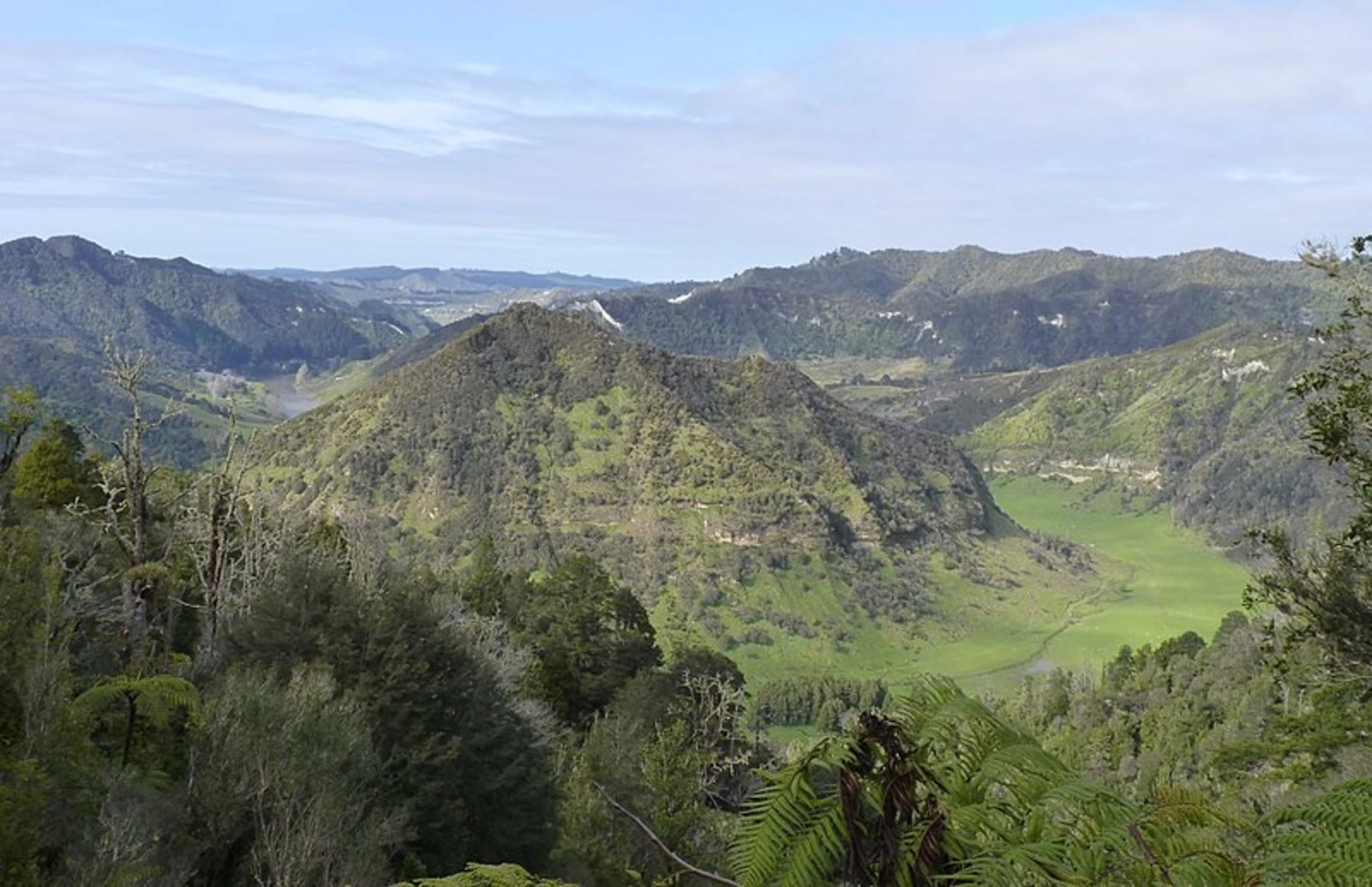
Yes. The Atene Skyline Track is generally considered difficult, with 674 m of elevation gain over 15.43 km. The track includes steep climbing from the river road, a high point at Taumata Trig of about 572 m, and a steep descent back toward Whanganui River Road.
How do I get to the Atene Skyline Track from Whanganui?
The Atene Skyline Track starts from two access points on Whanganui River Road in Whanganui National Park, about 36 km from Whanganui. The track is an almost circular route with separate entry and exit points, so most walkers arrive by road and then return to the car park via the short road section at the end.
Where can I park for the Atene Skyline Track?
Parking for the Atene Skyline Track is on the side of Whanganui River Road near the track entrances. Because the route uses two separate access points rather than a true loop, it is worth checking which end is being used first and allowing for the final road walk back to the parked vehicle.
Is there a campsite on the Atene Skyline Track?
Yes. Atene Skyline Campsite sits around the halfway point of the track and is set up for trampers wanting to split the walk over two days. The campsite has drinking water, a shelter, and a toilet, making it the key overnight stop on the ridge.
What viewpoints are on the Atene Skyline Track?
The Atene Skyline Track is known for ridge-top views above the Whanganui River and surrounding forested hills. Key high points include Taumata Trig, the highest point on the track at about 572 m, and Taupiri Trig, reached after the route passes along sandstone bluffs.
Comments and Reviews
User comments, reviews and discussions about the Atene Skyline Track, New Zealand.
average rating out of 5
0 rating(s)