Download
Preview
Add to list
More
39.3 km
~3 days
319 m
Multi-Day
“Embark on a scenic 24-mile trek through North Carolina's diverse terrains and historical vistas on the Falls Lake Trail.”
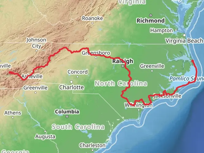
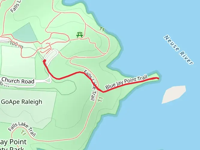
The Falls Lake Trail, also known as the Mountains-to-Sea Trail, is a moderately challenging point-to-point hike that spans approximately 39 kilometers (about 24 miles) with an elevation gain of roughly 300 meters (about 984 feet). This scenic path meanders through the diverse landscapes surrounding Falls Lake, located near Wake County, North Carolina.
Getting to the Trailhead
To reach the trailhead, hikers can drive to the Falls Lake Dam Visitor Center, located at 11405 Falls of Neuse Road, Wake Forest, NC. This is a convenient starting point with parking available. For those relying on public transportation, options are limited, and it's advisable to check the latest schedules and routes for any available services that get close to the area.
Navigating the Trail
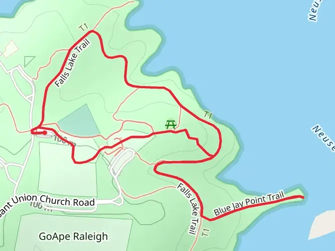
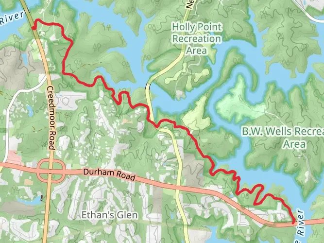
As you embark on your journey, you can rely on HiiKER to help with navigation, ensuring you stay on the correct path. The trail is well-marked with a series of white blazes indicating the Mountains-to-Sea Trail. The terrain is a mix of rolling hills and flat sections, with the trail surface ranging from dirt paths to occasional wooden boardwalks and bridges.
Landmarks and Scenery
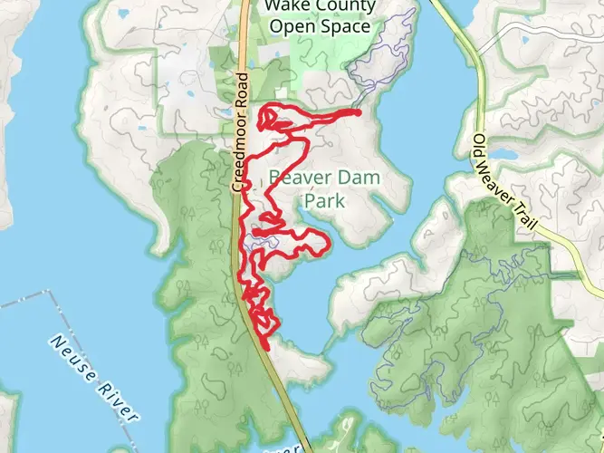
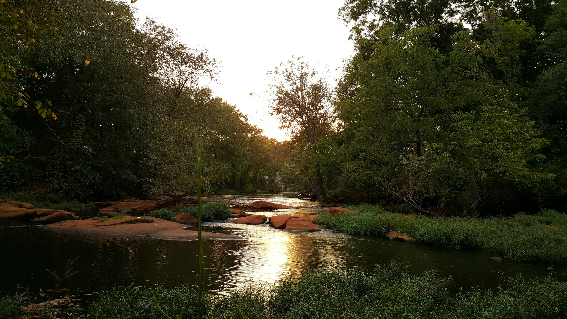
The Falls Lake Trail offers a variety of picturesque landscapes, including dense hardwood forests, wetlands, and open fields. Approximately 10 kilometers (6 miles) into the hike, you'll encounter the Beaverdam Creek area, which is a popular spot for birdwatching and spotting local wildlife such as deer and foxes.
Continuing on, the trail takes you through a series of small elevation changes, leading to stunning overlooks of Falls Lake. The lake itself is a man-made reservoir, created by the U.S. Army Corps of Engineers in the 1970s for flood control and water supply. Along the shores, you'll find remnants of old homesteads and stone walls, hinting at the region's past before the lake's creation.
Flora and Fauna
Throughout the hike, the trail is lined with a diverse array of plant life, including towering pines, oaks, and hickories, as well as a rich understory of ferns and wildflowers, especially vibrant in the spring and summer months. The area is also home to a variety of bird species, making it a delight for birdwatchers.
Preparation and Safety
Given the trail's length and some remote sections, it's important to come prepared with enough water, food, and basic first aid supplies. Weather can be variable, so dressing in layers and carrying rain gear is advisable. Cell service may be spotty in certain areas, so downloading offline maps on HiiKER before setting out is a smart move.
Historical Significance
The Falls Lake area is steeped in history, with nearby Wake Forest being one of the original sites of Wake Forest University before it moved to Winston-Salem. The region also played a role during the Civil War, with several skirmishes occurring in the surrounding areas.
Conclusion
The Falls Lake Trail is a rewarding experience for hikers looking to explore the natural beauty and historical richness of North Carolina. With its varied landscapes, abundant wildlife, and serene lake views, it offers an immersive outdoor adventure for both seasoned hikers and those looking to enjoy a day on the trail.

What to expect?
Activity types
Frequently asked questions
How long does it take to hike the Falls Lake Trail in Wake County, North Carolina?
The Falls Lake Trail is 39.32 km, or about 24.4 miles, so most hikers treat it as a full-day endurance hike or an overnight trip. With only 319 m of climbing and generally easy terrain, strong hikers may finish in 8 to 10 hours, while a more relaxed pace with breaks often pushes the day longer.
Where do you park for the Falls Lake Trail and what are the main access points?
Common access points for the Falls Lake Trail include the Falls Lake Dam area near the visitor center, Beaverdam Access at 14600 Creedmoor Road, Rolling View Access at 4201 Baptist Road, and Shinleaf Access at 13708 New Light Road in Wake Forest. Those access areas make it possible to hike shorter sections or set up a point-to-point shuttle across the full route.
Is the Falls Lake Trail dog friendly?
Dogs are allowed on the Falls Lake Trail within Falls Lake State Recreation Area, but they must stay on a leash no longer than 6 feet. The route is a good fit for trail dogs because the grade is easy overall, but the full 39.32 km distance is still a long outing and warmer months can bring heavy insects.
Is the Falls Lake Trail easy or suitable for beginners and kids?
The Falls Lake Trail is rated easy, with 319 m of elevation gain over 39.32 km, so the challenge comes more from distance than steep climbing. Shorter out-and-back sections from places like Beaverdam, Rolling View, or Shinleaf are better choices for beginners or families than attempting the entire point-to-point route in one go.
How is the Falls Lake Trail marked and is it easy to follow?
The Falls Lake Trail follows a section of the Mountains-to-Sea Trail and is marked with white blazes. The path is generally straightforward, but it passes through multiple access areas around Falls Lake, so paying attention at junctions and using a current map is important, especially when linking the full point-to-point route.
Can you camp along the Falls Lake Trail?
Camping is available in parts of Falls Lake State Recreation Area, and Shinleaf is known for hike-in tent sites that suit backpack-style trips on the Falls Lake Trail. However, current park notices report construction impacts: Rolling View campsites are closed, and Shinleaf and B.W. Wells are also closed at this time, so overnight plans need to match the latest area status.
What is the best time of year to hike the Falls Lake Trail?
Spring and fall are usually the best seasons for the Falls Lake Trail because temperatures are milder and the rolling lakeshore forest is more comfortable for a long hike. Summer is still possible, but insects can be plentiful in the warmer months, especially near wet areas around Falls Lake and Beaverdam Creek.
Comments and Reviews
User comments, reviews and discussions about the Falls Lake Trail, North Carolina.
4.8
average rating out of 5
10 rating(s)