Download
3D Flyover
Add to list
More
60.7 km
~3 days
486 m
Multi-Day
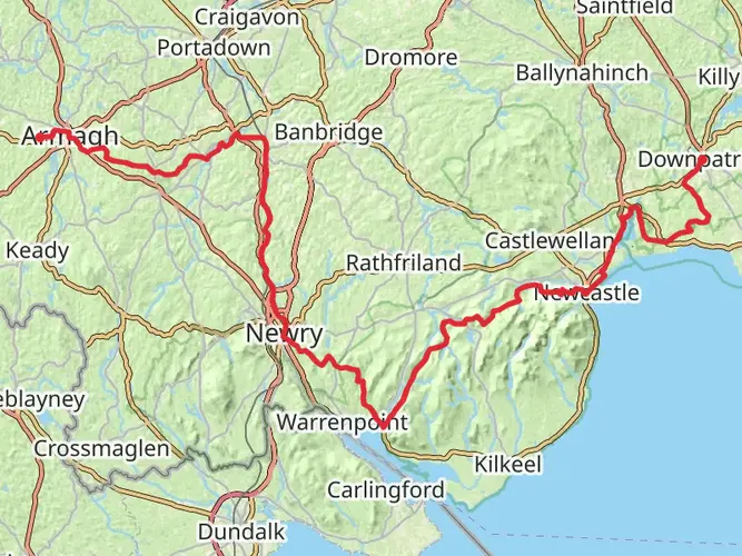
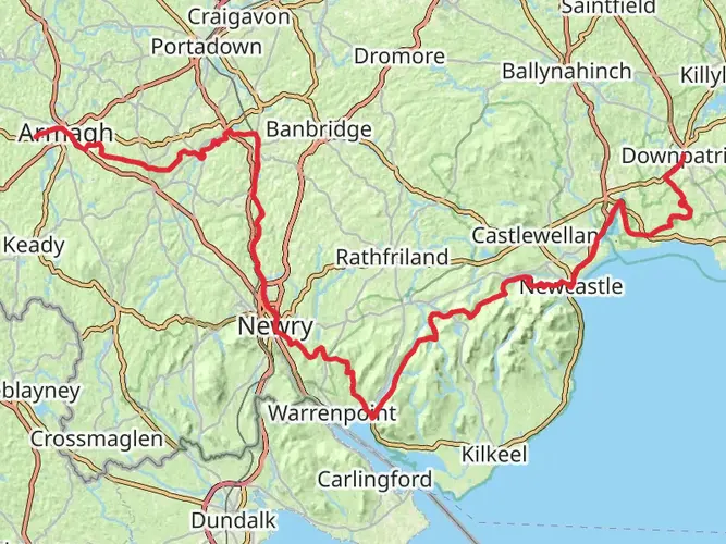
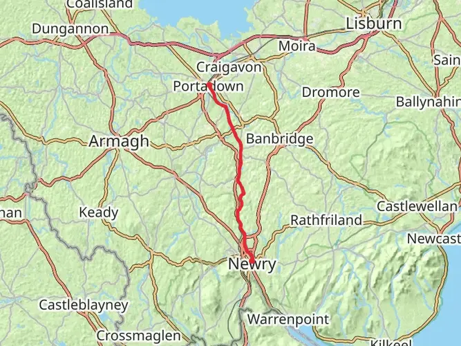
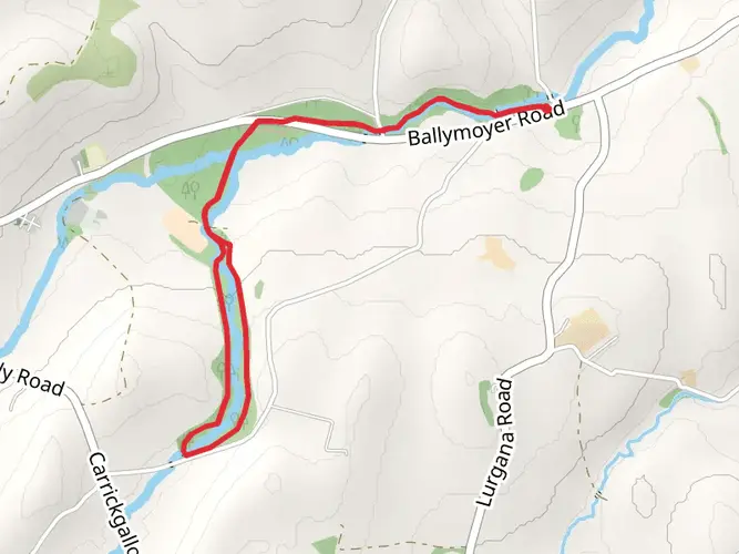
The Scarva to Aughnacloy is a 60.7 km trail that starts in , County Armagh, Northern Ireland. Based on our data, the hike is graded as Easy. For information on how we grade trails, please read measuring the difficulty of a hiking trail on hiiker. Also, check our latest community posts for trail updates. This hike can be completed in approx 2 days. Caution is advised on trail times as this depends on multiple variables. For more info read about how we calculate hike time.

What to expect?
Activity types
Frequently asked questions
How long is the Scarva to Aughnacloy hike and how many days does Scarva to Aughnacloy usually take?
Scarva to Aughnacloy is 60.74 km long with 486 m of total ascent, so it fits well as a 2 to 3 day easy multi-day walk. The modest elevation gain means the challenge is more about covering distance than climbing, and many walkers break it into shorter stages through the towns and villages between Scarva and Aughnacloy.
Is the Scarva to Aughnacloy hike difficult?
Scarva to Aughnacloy is rated easy, which matches its relatively low elevation gain of 486 m over 60.74 km. That usually means a gentler profile than a hill route, but it is still a long-distance walk, so comfort on back-to-back mileage matters more than steep ascents.
Can the Scarva to Aughnacloy hike be done using public transport?
Public transport is workable at the Scarva end because Scarva is served by rail and local bus links, and the Newry Canal corridor is noted as accessible from stations including Scarva. That makes Scarva a practical start point for a linear walk, while onward connections near the route towns can help with shorter stage planning.
Where can you park for the Scarva to Aughnacloy hike?
Scarva is one of the more practical places to start because parking is available in the village area and at Scarva Visitor Centre near the canal corridor. That is useful for a point-to-point walk, especially if the first section follows the flat Newry Canal Way before the route continues northwest toward Aughnacloy.
What is the terrain like on the Scarva to Aughnacloy hike?
The Scarva end of the route is associated with the Newry Canal Way, a flat towpath corridor on the western bank of the old Newry Canal that also forms part of the Ulster Way and National Cycle Network Route 9. That points to generally easy-going surfaces early on, with the overall route profile staying gentle enough to match the easy rating.
What are the main places passed on the Scarva to Aughnacloy hike?
Scarva to Aughnacloy links the southeast of County Armagh with the border area around Aughnacloy, and the wider corridor is associated with places such as Scarva and the Newry Canal Way before continuing through the central countryside toward Tyrone. As a 60.74 km linear route, it is best thought of as a cross-county journey rather than a single out-and-back trail.
Comments and Reviews
User comments, reviews and discussions about the Scarva to Aughnacloy, Northern Ireland.
average rating out of 5
0 rating(s)