Download
3D Flyover
Add to list
More
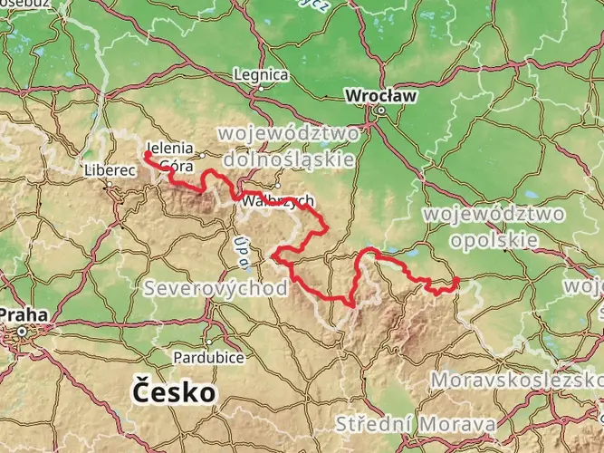
149.6 km
~6 days
2920 m
Multi-Day
“Embark on the Piasts Castles Trail for a historic trek through Poland's scenic heartland and medieval marvels.”
The Piasts Castles Trail, winding through the picturesque landscapes of southwestern Poland, offers hikers a unique combination of natural beauty and historical exploration. Spanning approximately 150 kilometers (about 93 miles) with an elevation gain of roughly 2900 meters (around 9500 feet), this point-to-point trail is a challenging yet rewarding journey that takes you through the heart of the country's medieval history.
Starting near the small town of Walim, the trailhead is accessible by car or public transport. For those opting for public transport, buses from nearby cities such as Wrocław can drop you off in Walim, from where the trailhead is a short walk. If driving, parking is available in the area.
Navigating the Trail
As you embark on the trail, ensure you have the HiiKER app downloaded for up-to-date navigation and trail information. The app will be an invaluable tool for staying on course and locating points of interest along the way.
Historical Significance and Landmarks
The Piasts Castles Trail is named after the Piast dynasty, which ruled Poland from the 10th to the 14th centuries. The trail connects several castles and fortresses that date back to this era, offering a glimpse into the country's feudal past. Notable historical landmarks include the ruins of the Grodno Castle, perched high on a hill overlooking the scenic Lake Bystrzyckie, and the Książ Castle, one of the largest castles in Poland, boasting opulent interiors and expansive gardens.
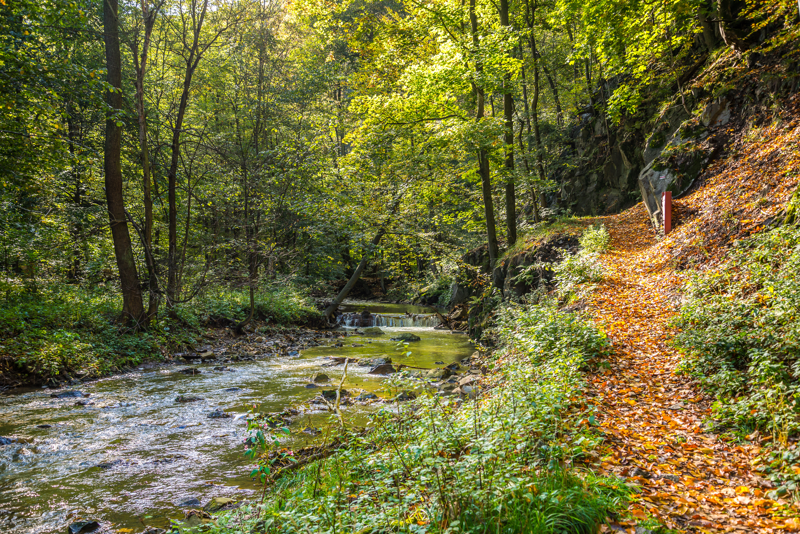
Natural Beauty and Wildlife
The trail meanders through diverse landscapes, including dense forests, rolling hills, and serene river valleys. The Sudetes Mountains provide a stunning backdrop for much of the hike, with opportunities to spot local wildlife such as deer, boars, and a variety of bird species. The autumn months are particularly striking as the foliage turns into a tapestry of vibrant colors.
Trail Conditions and Preparation
Given the trail's difficulty rating, hikers should be well-prepared with appropriate gear, including sturdy hiking boots, weather-appropriate clothing, and sufficient water and food supplies. The trail can be rocky and steep in places, so trekking poles are recommended for additional support.
Accommodation and Resupply Points
Along the route, there are several towns and villages where hikers can find accommodation, ranging from guesthouses to more rustic shelters. Resupply points for food and water are also available, but it's wise to carry enough supplies to last between these points, especially in the more remote sections of the trail.
Conclusion
The Piasts Castles Trail is a journey through time, offering an immersive experience into Poland's rich history set against the backdrop of its natural splendor. Whether you're a history buff or a nature enthusiast, this trail promises an unforgettable adventure. Remember to respect the environment and historical sites, leaving no trace of your visit so that others may enjoy the trail for years to come.

Frequently asked questions
How long does it take to hike the Piasts Castles Trail in Poland?
The Piasts Castles Trail is 149.61 km long with 2,920 m of climbing, so it is usually treated as a multi-day hike rather than a long day walk. Most hikers break it into roughly 6 to 9 days, depending on pace, weather, and how much time is spent at major sites such as Grodno Castle, Książ Castle, and the ruins of Cisy.
Where does the Piasts Castles Trail start and finish?
The Piasts Castles Trail begins near Grodno Castle in Zagórze Śląskie, close to Walim, and the classic route continues west across Lower Silesia to Grodziec Castle. Along the way it links a chain of historic strongholds and landmarks including Stary Książ, Książ Castle, Bolków, Bolczów, Siedlęcin, and Pilchowice.
What are the main castles and landmarks on the Piasts Castles Trail?
The route is known for connecting major medieval sites across Lower Silesia. Standout landmarks include Grodno Castle above Lake Bystrzyckie, Książ Castle in Książański Landscape Park, the ruins of Cisy and Stary Książ, Bolków Castle, Bolczów Castle near Janowice Wielkie, the Ducal Tower in Siedlęcin, and Grodziec Castle at the western end.
Is the Piasts Castles Trail difficult?
The Piasts Castles Trail is rated medium, but the overall effort is significant because the route covers nearly 150 km and climbs 2,920 m. The challenge comes more from the cumulative distance and repeated ups and downs through the Sudetes foothills than from technical terrain, so it suits hikers comfortable with consecutive full walking days.
Can you reach the Piasts Castles Trail from Walim by public transport?
Yes. The eastern end of the Piasts Castles Trail is accessible from Walim, and buses from larger nearby cities such as Wrocław can connect into the area. From Walim, the start near Grodno Castle and Zagórze Śląskie is close enough to reach on foot or with a short local transfer, making it practical to begin without a car.
Is there parking near the start of the Piasts Castles Trail?
Yes. Parking is available around the Walim and Zagórze Śląskie area near the eastern end of the route, which is the usual access point for Grodno Castle and Lake Bystrzyckie. That makes the trail relatively straightforward to start as a point-to-point hike, though a return transfer is usually needed after finishing farther west near Grodziec.
What is the best time of year to hike the Piasts Castles Trail?
Late spring through early fall is the most practical season for the Piasts Castles Trail. From about May to September, trail conditions in Lower Silesia are generally more favorable for a 149.61 km hike, and castle stops such as Grodno and Książ are typically easier to combine with walking days than in the colder, shorter days of winter.
Comments and Reviews
User comments, reviews and discussions about the Piasts Castles Trail, Poland.
4.75
average rating out of 5
8 rating(s)