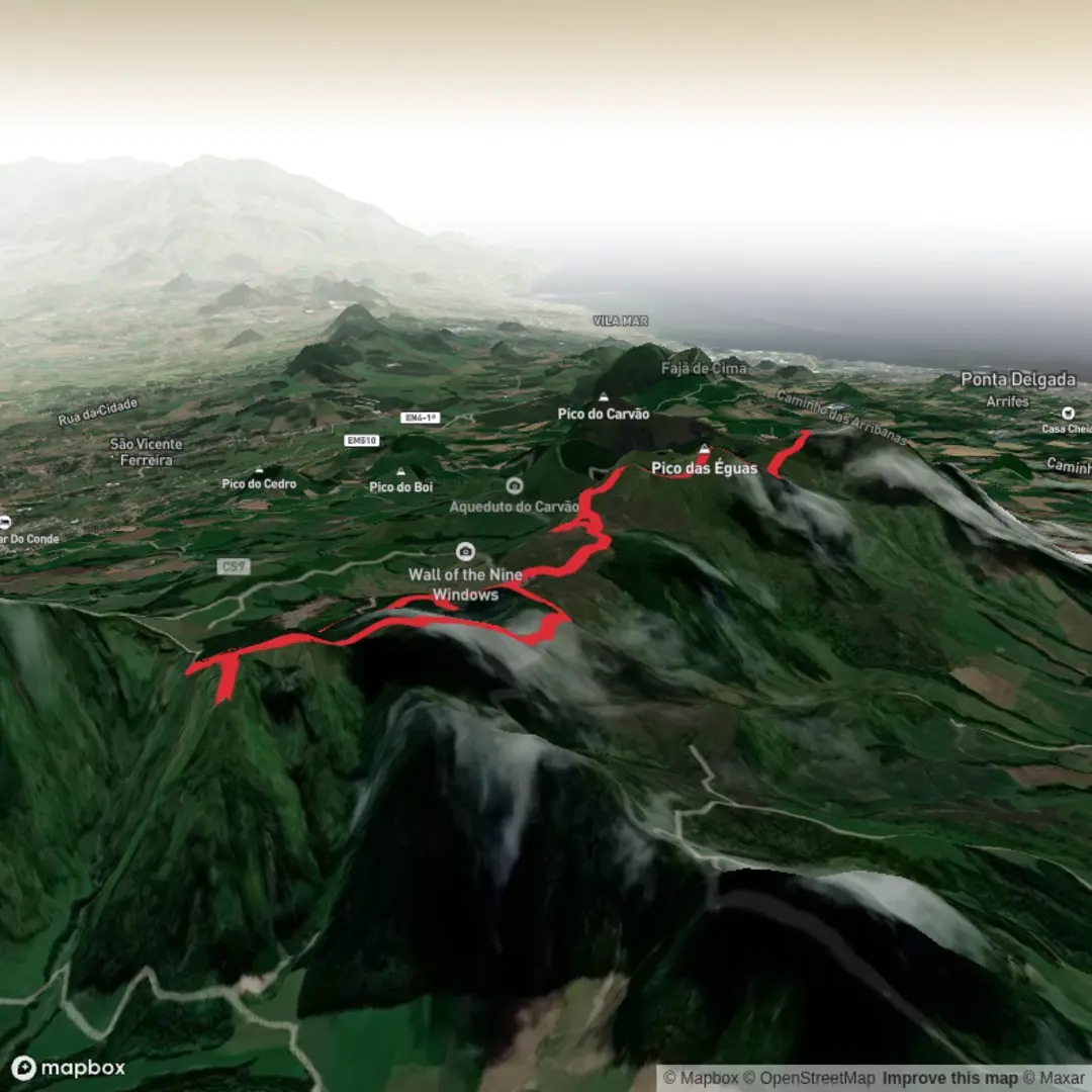
Boca do Inferno and Serra Devassa, Lagao do Canario and Pico das Eguas
Download
3D Flyover
Add to list
More
9.2 km
~2 hrs 26 min
358 m
Loop
“From Boca do Inferno’s theatrical caldera views, the route wanders into misty ridges and hidden lakes.”
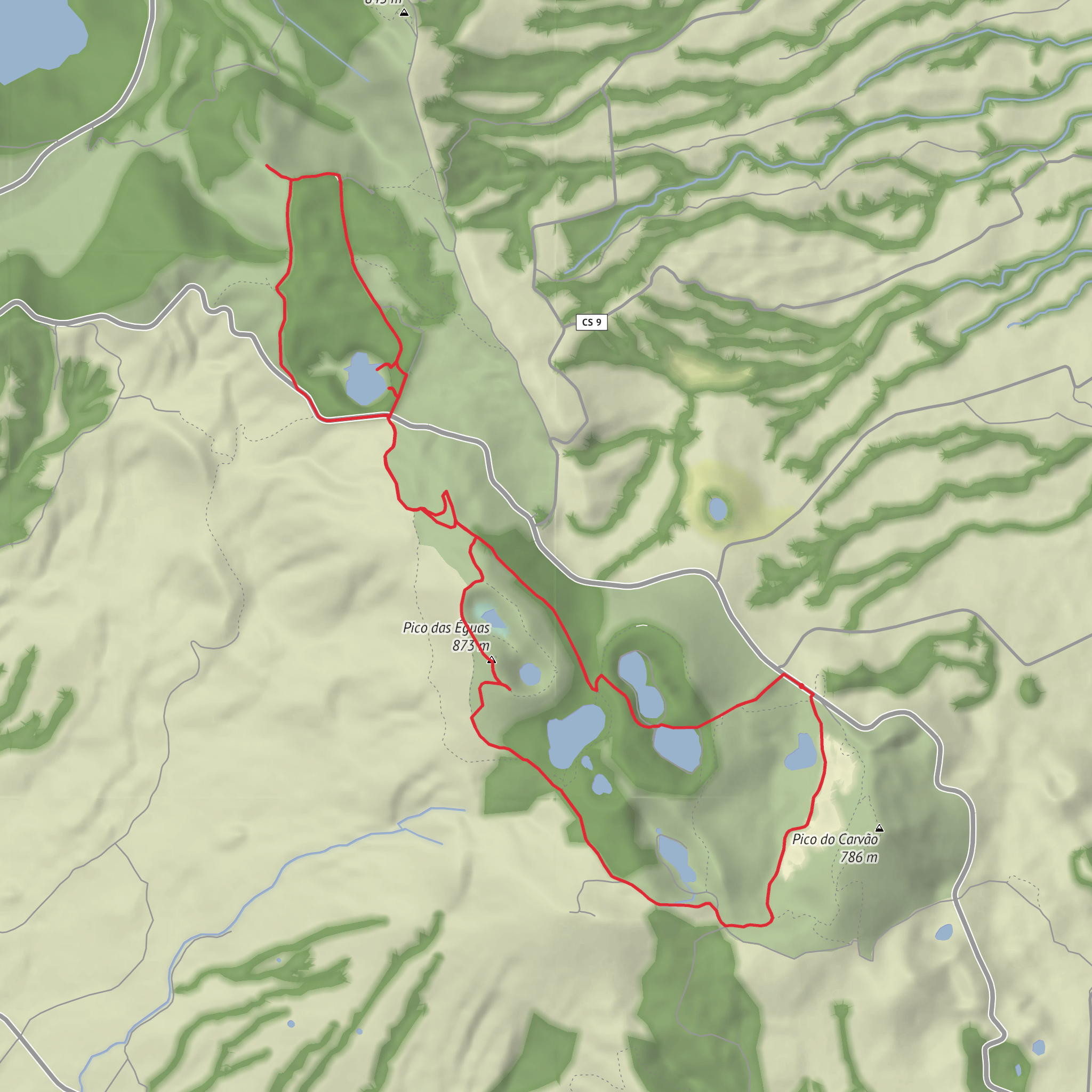
This medium-difficulty circuit explores one of São Miguel’s most dramatic volcanic uplands, linking the famous Boca do Inferno viewpoint with the quieter ridges and crater lakes of Serra Devassa. Expect roughly 9 km / 5.6 mi of walking with about 400 m / 1,310 ft of ascent, mostly on dirt tracks and footpaths that undulate across open high ground. The route is not especially technical in dry weather, but it can feel more demanding than the numbers suggest because the terrain is exposed, often muddy, and frequently affected by mist and wind at elevation. The usual access point is the Lagoa do Canário parking area near the Miradouro da Grota do Inferno, Sete Cidades, São Miguel, Azores, which is the nearest well-known landmark for the trailhead. (parquesnaturais.azores.gov.pt)
The opening section is often the busiest, as many visitors walk only as far as Boca do Inferno. From the parking area, the path heads through woodland near Lagoa do Canário before reaching the viewpoint area, where the landscape suddenly opens into one of the classic panoramas of western São Miguel: the Sete Cidades caldera, the Blue and Green Lakes, Lagoa de Santiago, Lagoa Rasa, and parts of Serra Devassa all spread out below and beyond. This early stretch is short, but it sets the tone for the day with steep crater walls, layered volcanic landforms, and broad views that can change minute by minute as cloud moves through. (turismo.azores.gov.pt)
Terrain and route character
Beyond the viewpoint, the hike becomes quieter and more pastoral as it crosses the Serra Devassa volcanic ridge system. This mountain chain extends southeast of the Sete Cidades caldera and is known for its concentration of small lakes, many occupying old craters or natural depressions. The walking is typically on wide earth tracks, grassy sections, and narrower connecting paths, with a mix of gentle rollers and a few steeper pulls. Pico das Éguas, the high point of the area at about 873 m / 2,864 ft, is one of the key objectives and gives a broader sense of the massif’s shape and the surrounding lake district. (parquesnaturais.azores.gov.pt)
Approximate waypoints can vary depending on the exact variant used, but a useful planning breakdown is: - Lagoa do Canário to Boca do Inferno: about 1.3 km / 0.8 mi one way, with light climbing. (saomiguelguide.com) - Boca do Inferno into Serra Devassa uplands: rolling terrain with gradual ascent onto the ridge system. - Pico das Éguas sector: the main climbing portion, where much of the day’s cumulative elevation gain is felt. - Return via the crater-lake area: gentler but still uneven walking, often with wet ground.
Because the route combines a famous viewpoint with a more open upland circuit, it helps to pace the day as two different hikes in one: a short scenic approach followed by a longer ridge-and-lake traverse.
Landmarks, lakes, and volcanic scenery
Lagoa do Canário is one of the first notable features. It sits in a lush setting near Japanese cedar woodland and contrasts strongly with the more open, windswept uplands beyond. As the route continues, the scenery shifts from enclosed forest edge to broad volcanic moorland, where the landforms become the main attraction: cinder-cone shapes, crater hollows, and a chain of small lakes scattered across the massif. (saomiguelguide.com)
Among the most significant natural landmarks are Lagoas das Éguas Norte and Sul, often described as the highest-altitude lakes on São Miguel, along with Lagoa Rasa. These water bodies are part of a larger cluster of around fifteen small lagoons associated with Serra Devassa. Their appearance changes with weather and season: in bright conditions they reflect the sky and surrounding grasslands, while in fog they can feel remote and almost hidden until you are very close. (turismo.azores.gov.pt)
The viewpoint known as Miradouro da Grota do Inferno or Boca do Inferno is the visual highlight for many hikers, but the ridge itself is equally important for understanding the landscape. Serra Devassa is recognized as a geosite within the Azores Geopark because of its volcanic and geomorphological significance. The area is shaped by basaltic volcanism, monogenetic cones, and associated tectonic structures, all tied to the wider volcanic history of Sete Cidades.
Surfaces
Gravel
Ground
Unknown
Dirt
Asphalt
Concrete
Comments and Reviews
User comments, reviews and discussions about the Boca do Inferno and Serra Devassa, Lagao do Canario and Pico das Eguas, Portugal.
average rating out of 5
0 rating(s)
