Download
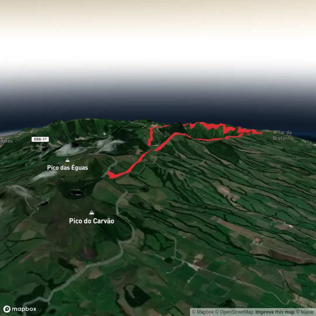
3D Flyover
Add to list
More
12.1 km
~2 hrs 46 min
205 m
Point-to-Point
“A breezy rim walk threads forest, aqueduct history, and dazzling twin-lake volcanic views above Sete Cidades.”
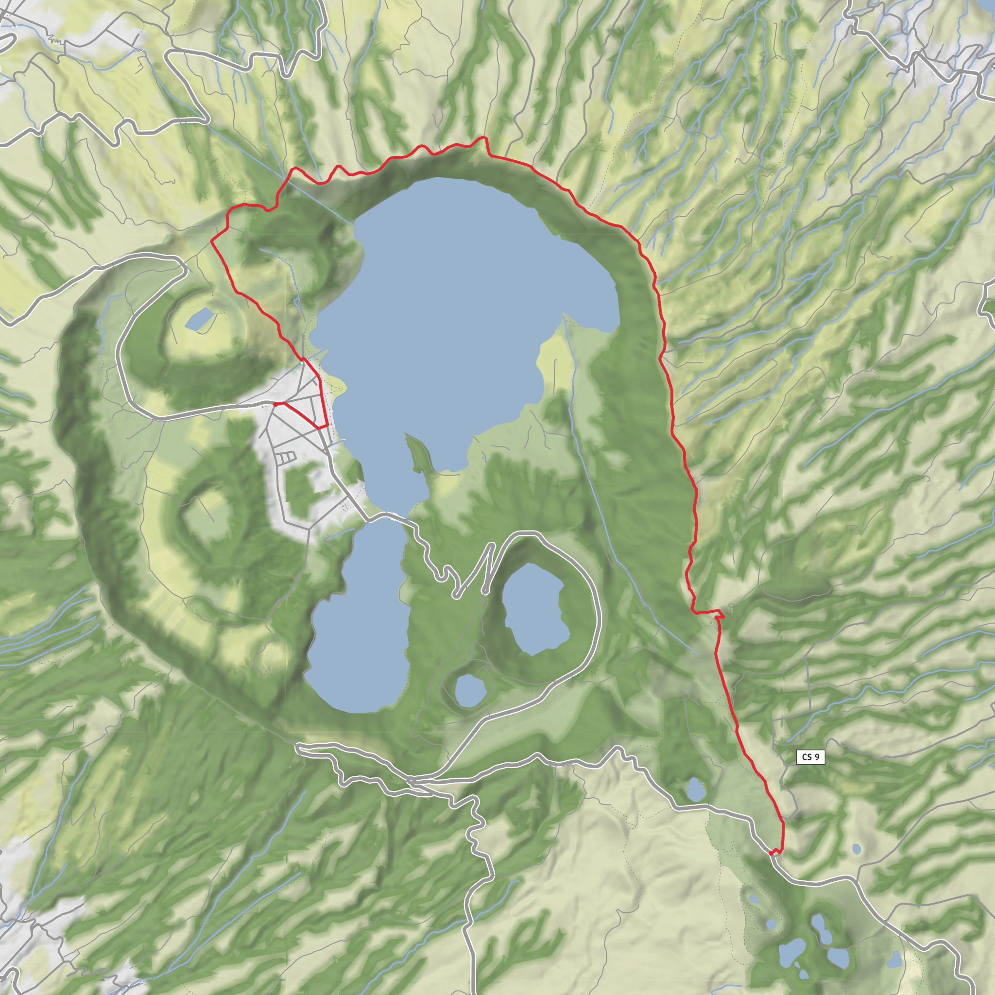
This easy walk of about 12 km / 7.5 miles with roughly 200 m / 656 ft of ascent follows one of São Miguel’s most scenic volcanic rims, linking the forested high ground near Lagoa do Canário with the famous lakes of Sete Cidades. The route is generally known as the Mata do Canário–Sete Cidades trail, and the usual start is beside the road near the Mata do Canário Forest Park / Lagoa do Canário parking area, west of Ponta Delgada and close to the Boca do Inferno viewpoint access road. Official trail information places the start near roadside parking by Mata do Canário and gives the route a length of 11.8 km / 7.3 miles with an average walking time of about 3 hours. (itrails.visitazores.com)
The opening section is gentle and very approachable, which suits the easy rating, but hikers should still expect a few uneven volcanic tracks, short steeper ramps, and muddy or slippery ground after rain. The Azorean climate changes quickly on the ridge, so low cloud, wind, and wet footing can make a straightforward trail feel more serious than the numbers suggest. The route begins on or near asphalt, then moves onto dirt and pumice tracks, with one notably steeper cemented climb before the trail reaches the crater rim. (itrails.visitazores.com)
What the route is like
From the start, the trail passes the old Muro das Nove Janelas aqueduct, a striking stone structure associated with the historic water supply system that once carried water toward Ponta Delgada. Official Azores trail notes describe it as an old aqueduct used in the 17th and 18th centuries, later reconstructed in 1830, and no longer in service. It is one of the most important cultural landmarks on the walk and gives the first part of the route a strong historical character rather than feeling like a purely natural outing. (itrails.visitazores.com)
After the aqueduct, the trail climbs through stands of Cryptomeria japonica and low Azorean vegetation. This section is quieter and more enclosed, with a mix of forest edge, open track, and occasional damp ground. The official trail description notes the presence of Equisetum telmateia and even some rare examples of Platanthera micrantha, an orchid native to the Azores. Birdlife can vary with season and weather, but the combination of woodland, pasture edge, crater slopes, and lakeshore habitat makes this a good area to watch for common island birds and wetland species around the water. (itrails.visitazores.com)
A short but steeper climb brings the route onto the rim above the lakes, where the character of the hike changes completely. Here the trail opens into broad volcanic panoramas over the Sete Cidades caldera, with views not only into the crater but also toward the north coast of São Miguel. One of the key viewpoints on the route is Pico da Cruz, reached after the initial ascent, where the first major views of the lakes appear. From there, the trail continues along the crest on tracks that also serve agricultural access and are known locally as part of the landscape used by the Azores Rallye. (trails.visitazores.com)
Landmarks, lakes, and volcanic scenery
The defining feature of the hike is the volcanic basin of Sete Cidades, one of the best-known landscapes in the Azores. The caldera belongs to the Sete Cidades volcanic complex, and authoritative geological sources describe it as a large collapse caldera roughly 5.3 km in average diameter, with the summit caldera containing the famous twin lakes. The wider protected landscape includes Lagoa Azul, Lagoa Verde, Lagoa de Santiago, Lagoa Rasa, Caldeira Seca, and Caldeira do Alferes, all of which help explain why this route feels so varied despite its modest distance. (azoresgeopark.com)
As the trail continues, it effectively skirts much of Lagoa Azul—the Blue Lagoon—while giving repeated elevated views into the crater. Depending on visibility, hikers may also catch sightlines toward Lagoa Verde and the steep-sided Lagoa de Santiago, one of the most dramatic volcanic lakes on São Miguel. The route eventually descends toward the village of Sete Cidades, where landmarks shown on official mapping include São Nicolau Church and **
Surfaces
Gravel
Concrete
Asphalt
Cobblestone
Dirt
Comments and Reviews
User comments, reviews and discussions about the Mata do Canário and Blue Lagoon, Portugal.
average rating out of 5
0 rating(s)
