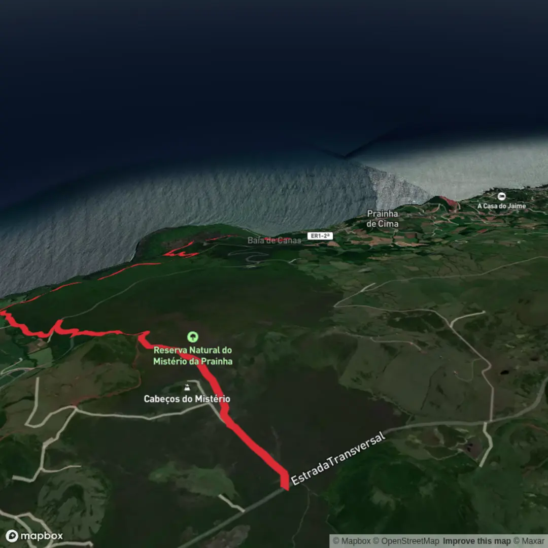
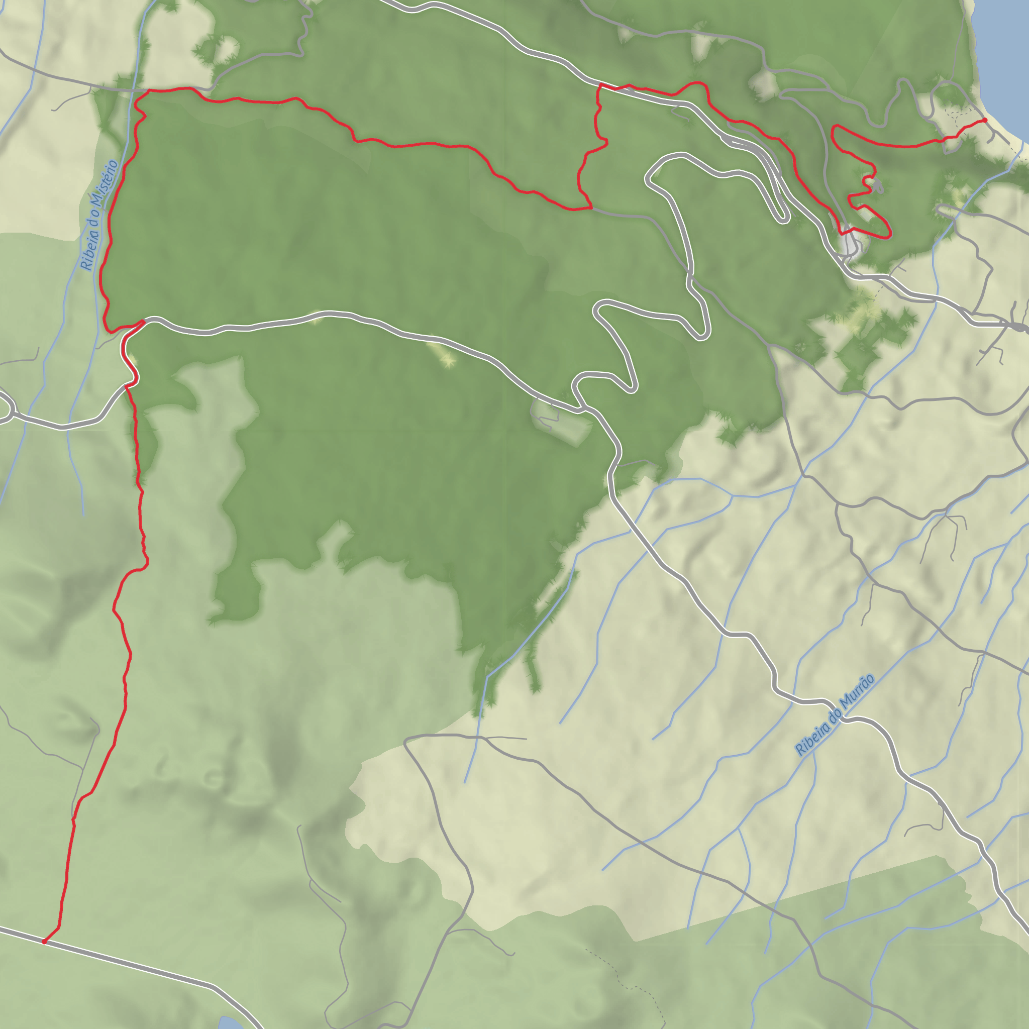
Caminho dos Burros - Vertente Norte to Baia de Canas via Misterio da Prainha and Ponta do Misterio
Download
3D Flyover
Add to list
More
8.9 km
~1 hrs 50 min
40 m
Point-to-Point
“A vivid descent through Pico’s lava-sculpted wilds, ending by a tranquil bay steeped in history.”
This easy coastal-and-volcanic walk on Pico’s north side covers about 9 km / 5.6 miles and is best thought of as a mostly descending route from the high interior toward the sea, even though the overall climbing is minimal. The trail begins on the Planalto Central near Caminho das Lagoas, at roughly 830 m / 2,723 ft above sea level, and finishes near Baía das Canas and the Prainha Forest Park in the parish of Prainha, São Roque do Pico. The “hike head” is therefore best identified as the Caminho das Lagoas area on Pico’s central plateau, rather than a street address, since the start is in a remote upland access zone rather than a village center. (parquesnaturais.azores.gov.pt)
The route follows an old communication path once used by people and pack animals moving across Pico, which explains the name Caminho dos Burros. Historically, these stone-and-earth tracks linked settlements and grazing areas before modern roads made cross-island travel easier. On this northern branch, that older human story is layered over one of Pico’s most striking volcanic landscapes, as the trail crosses the Mistério da Prainha Nature Reserve and ends near Baía das Canas, where old stonework and agricultural traces still reflect traditional land use. (visitazores.com)
Expect a route with strong contrasts: open upland terrain at the start, volcanic cones and lava fields through the middle, then greener woodland and a more sheltered coastal finish. Although the difficulty is generally easy, the footing can still be uneven in places because of lava rock, old rural tracks, and occasional muddy or loose sections, especially after rain. (parquesnaturais.azores.gov.pt)
What the route is like
From the plateau, the trail descends off Pico’s central high ground and heads toward the Cabeços do Mistério area, where the landscape becomes more obviously volcanic. Early on, the walking is relatively straightforward, but the character of the route changes as it enters the reserve and begins weaving through terrain shaped by historic lava flows. The total distance is around 9 km / 5.6 miles, so most hikers can complete it in a half day, but it is worth allowing extra time for stops at viewpoints and for careful footing on rougher ground. (parquesnaturais.azores.gov.pt)
A key landmark is the Mistério da Prainha, a lava field created by historic eruptions from the Cabeços do Mistério. Geopark information describes these flows as pahoehoe-type lava that traveled roughly 3.5 km / 2.2 miles toward the coast, eventually spreading at the shoreline and helping form the broad rocky platform of Ponta do Mistério. This gives the hike much of its identity: instead of a simple countryside walk, it becomes a journey through a young volcanic landscape where the ground, vegetation, and coastline all show the effects of eruption and recovery. (azoresgeopark.com)
As the route continues, there is a split in the broader trail system; for the version heading to Baía das Canas, the turn comes about 1.7 km / 1.1 miles after the junction area, where the path leads through vegetation including incense tree/Australian cheesewood (Pittosporum undulatum), acacias, and Azores laurel toward the Prainha Forest Park. From there, the trail works its way toward the coast and the bay. (trails.visitazores.com)
Landmarks, geology, and coastal scenery
The most significant natural landmark is Ponta do Mistério, a large lava platform created where the flow reached the sea. This section feels very different from the uplands: flatter, darker, and more exposed, with the Atlantic shaping the edge of the lava. The geology here is one of the route’s highlights, because the coastline clearly shows how volcanic material overran the older shore and built outward into the ocean. (parquesnaturais.azores.gov.pt)
Near the end, Baía das Canas adds a cultural landscape element to the walk. The area is known for old vineyard use and stone-built access ways, part of the broader protected landscape traditions of Pico where black volcanic rock was adapted for agriculture. Sources also note an old paved stone path near the bay, a reminder that this was not just wild terrain but a worked landscape shaped by transport, farming, and coastal use over generations. (azoresgeopark.com)
The Prainha Forest Park is
Surfaces
Unknown
Unpaved
Asphalt
Comments and Reviews
User comments, reviews and discussions about the Caminho dos Burros - Vertente Norte to Baia de Canas via Misterio da Prainha and Ponta do Misterio, Portugal.
average rating out of 5
0 rating(s)
