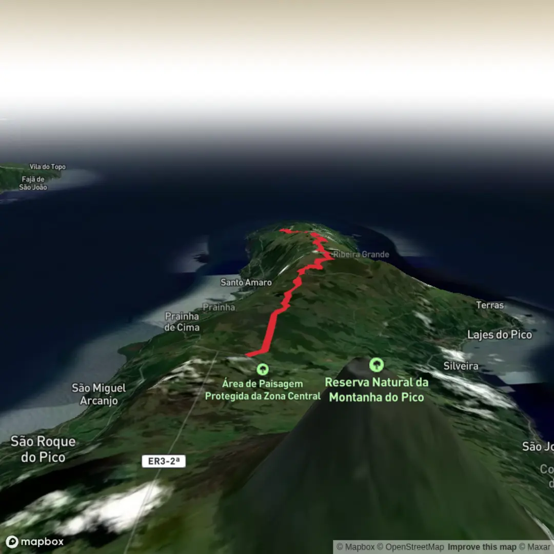
Estrada Transversal to Ribeirinha via Lagoa do Lagoas, Lagoa Seca, Lagoas do Peixinho and Lagoa do Paúl
Download
3D Flyover
Add to list
More
22.0 km
~4 hrs 57 min
334 m
Point-to-Point
“A long, weather-wise crossing of Pico’s misty volcanic heart, threading quiet lakes and lonely uplands.”
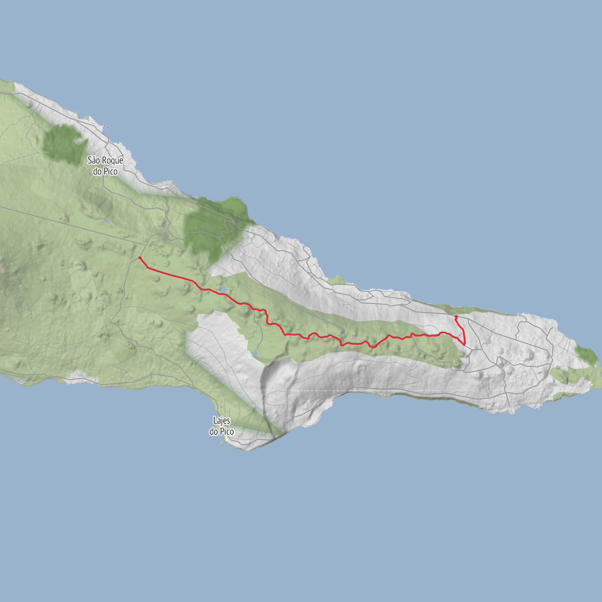
This 22 km / 13.7 mile point-to-point walk crosses the high interior of Pico Island from the Estrada Transversal to Ribeirinha, linking a chain of volcanic lakes through one of the island’s most important wetland and upland landscapes. Official trail information lists it as PR19 PIC, an easy route of about 7 hours, starting beside a Forest Service house on the cross-island road and finishing in the parish of Ribeirinha. Despite the easy rating, the length and exposed plateau make it a full-day outing that needs proper timing, food, water, and weather awareness. (trails.visitazores.com)
The trailhead is near Casa do Guarda Florestal da Serra da Junqueira – Corre Água, on Pico’s central cross-island road. The official start coordinates shown on the trail leaflet are 38°28'14.83"N, 28°18'7.80"W, which correspond to that Forest Service house and roadside junction on the Estrada Transversal rather than a village address. The finish is in Ribeirinha, Lajes do Pico, on the island’s northeast side. (visitazores.com)
Because the route is linear, transport planning matters. By car, the simplest option is to leave one vehicle in Ribeirinha and drive a second to the start, or arrange a pickup at the end. Coming from Madalena on the Longitudinal Road, the Pico Natural Park directions say to turn right toward Lajes do Pico at the junction with the Cross Road, then after roughly 700 m / 0.4 mi look for the left-hand junction marking the start. Public transport on Pico is limited but possible with planning: municipal information for Lajes do Pico lists services between Ribeirinha, Lajes and Madalena, and Pico Airport’s bus transfer page says airport-linked bus service connects settlements including Ribeirinha. In practice, hikers should check current timetables before committing, because frequencies are sparse and not designed around long trail days. (parquesnaturais.azores.gov.pt)
The walking itself is not especially steep, with around 300 m / 985 ft of ascent, but the route’s character is defined by distance, open ground, and changing visibility. Expect broad volcanic uplands, old cinder-cone country, wet ground near the lakes, and stretches where the landscape feels remote even though the gradients stay gentle. If cloud drops onto the plateau, navigation becomes much more serious; the official trail guidance specifically advises against doing this route on foggy days. For route-following, downloading the track in HiiKER before setting out is a sensible precaution. (trails.visitazores.com)
What the route is like
From the Estrada Transversal, the trail heads into Pico’s central highlands, an elevated volcanic zone shaped by old cones, shallow crater lakes, peat-rich hollows, and pasture pockets. Early on, the route gives a strong sense of the island’s interior geology rather than its coastal identity: instead of vineyards and lava seafronts, you are moving through a cooler, wetter upland where water collects in depressions and vegetation shifts toward bog and montane species. (visitazores.com)
One of the first major landmarks is Lagoa do Caiado, followed by Lagoa Seca. The terrain around these lakes is part of the Planalto da Achada, a central plateau recognized as a priority geosite within the Azores UNESCO Global Geopark, and the route also passes through protected areas tied to habitat conservation. These lakes are generally shallow, but they are visually distinctive because they sit among volcanic forms rather than in glacial basins, giving the walk a very different feel from mountain-lake routes elsewhere in Europe or North America. (visitazores.com)
Farther along, the trail reaches
Surfaces
Asphalt
Comments and Reviews
User comments, reviews and discussions about the Estrada Transversal to Ribeirinha via Lagoa do Lagoas, Lagoa Seca, Lagoas do Peixinho and Lagoa do Paúl, Portugal.
average rating out of 5
0 rating(s)
