Download
3D Flyover
Add to list
More
43.6 km
~3 days
2836 m
Multi-Day
“Traverse Flores' wild beauty on a 44-km trek, scaling peaks and exploring volcanic lakes amidst rich biodiversity.”
Embarking on the Great Route of Flores, hikers will traverse approximately 44 kilometers (about 27 miles) of diverse landscapes, with an elevation gain of roughly 2800 meters (around 9186 feet). This point-to-point trail is situated on the Azorean island of Flores, Portugal, and is known for its challenging terrain that rewards adventurers with stunning vistas and an immersive experience in one of the most biodiverse regions of the Azores.
Getting to the Trailhead
The journey begins near the small town of Santa Cruz das Flores, which is accessible by car or local transport. For those arriving by air, the Flores Island Airport is a convenient starting point, with the trailhead just a short drive away. Public transport options are limited, so arranging a taxi or a rental car in advance is advisable to ensure a timely start to the hike.
Trail Overview
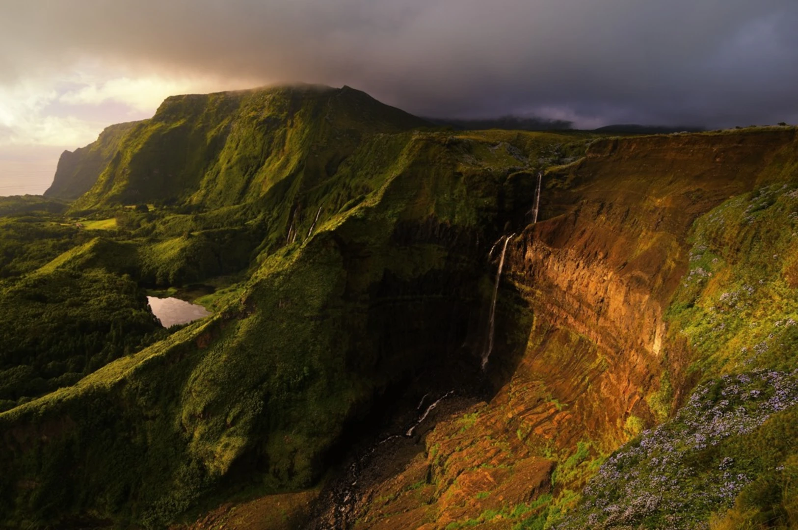
As hikers set out from the trailhead, they will immediately be greeted by the lush, green landscapes that characterize Flores. The trail meanders through dense forests, skirts along cliff tops, and passes cascading waterfalls, providing a constant backdrop of natural beauty.
Key Landmarks and Natural Features
One of the first significant landmarks encountered is the Morro Alto, the highest point on Flores, offering panoramic views of the island's rugged terrain. The trail continues to the Seven Lakes, a series of volcanic crater lakes, each with its unique hue, ranging from deep blues to vibrant greens.
Further along, hikers will come across the Rocha dos Bordões, an impressive geological formation consisting of a multitude of vertical basalt columns. This natural monument is a testament to the volcanic origins of the island and is a popular spot for photography enthusiasts.
Flora and Fauna
The Great Route of Flores is a haven for wildlife lovers. The island's isolation has led to the development of a unique ecosystem, with many endemic plant species such as the Flores heather and the Azores laurel. Birdwatchers may spot the Azorean chaffinch, woodcocks, and the rare Monteiro's storm-petrel.
Historical Significance
Flores has a rich history, with many of the trails following ancient footpaths used by the island's early settlers. The landscape is dotted with old water mills, traditional Azorean houses, and terraced fields that speak to the agricultural heritage of the region.
Navigation and Preparation
Given the trail's difficulty and remote sections, it is crucial to be well-prepared. Hikers should download the trail map onto their HiiKER app before departure, as cell service can be spotty. It's also essential to pack adequate water, food, and weather-appropriate clothing, as conditions can change rapidly.
Conclusion
The Great Route of Flores is a challenging yet rewarding hike that offers a deep connection with nature and a glimpse into the Azorean way of life. With proper preparation and respect for the natural environment, hikers will find this trail to be a truly unforgettable experience.

Frequently asked questions
How long is the Great Route of Flores and how hard is it?
The Great Route of Flores is 43.64 km long with 2,836 m of elevation gain, so it is a serious multi-day outing rather than a casual day hike. It is rated Extra Difficult, and the official Azores trail network describes the route as high difficulty with exposed sections, including stretches that are not advised for people with vertigo.
Where does the Great Route of Flores start and finish on Flores Island?
The Great Route of Flores links Santa Cruz das Flores on the east side of the island with Lajedo on the southwest coast. Official Azores trail information describes it as a linear route crossing much of the island’s coastline, and the Santa Cruz end is close to Flores Airport, making that side the simplest place to begin logistics.
Can the Great Route of Flores be hiked in one day, or is it better as a multi-day route?
Most hikers treat the Great Route of Flores as a multi-day route. At 43.64 km with 2,836 m of climbing and an Extra Difficult rating, it is a demanding undertaking even before factoring in steep coastal terrain, exposed descents, and time spent at landmarks such as Poço da Alagoinha, Rocha dos Bordões, and the lake district around Morro Alto.
What are the main highlights on the Great Route of Flores?
The Great Route of Flores is known for a string of major Flores landmarks rather than a single summit objective. Official trail descriptions highlight Santa Cruz, Ponta Delgada, Ponta do Albernaz, Fajã Grande, Fajãzinha, Poço da Alagoinha, Rocha dos Bordões, and the central plateau near Morro Alto, with long fossil sea cliffs and repeated waterfall viewpoints along the west side of the island.
Is the Great Route of Flores currently fully open?
No. The official Azores Trails listing currently shows the Great Route of Flores with a closure affecting Stage 2. That matters for trip planning because the route is commonly described in two main sections, and any closure on the Ponta Delgada to Lajedo side can prevent a full through-hike of the island route.
How do hikers get to the Great Route of Flores trailhead from Flores Airport?
Flores Airport is in Santa Cruz das Flores, which is the practical access point for the eastern end of the Great Route of Flores. That makes arrival straightforward by rental car or taxi, while public transportation on Flores is limited enough that most hikers arrange road transport in advance for either the start in Santa Cruz or the finish near Lajedo.
Comments and Reviews
User comments, reviews and discussions about the Great Route of Flores, Portugal.
4.67
average rating out of 5
3 rating(s)