Download
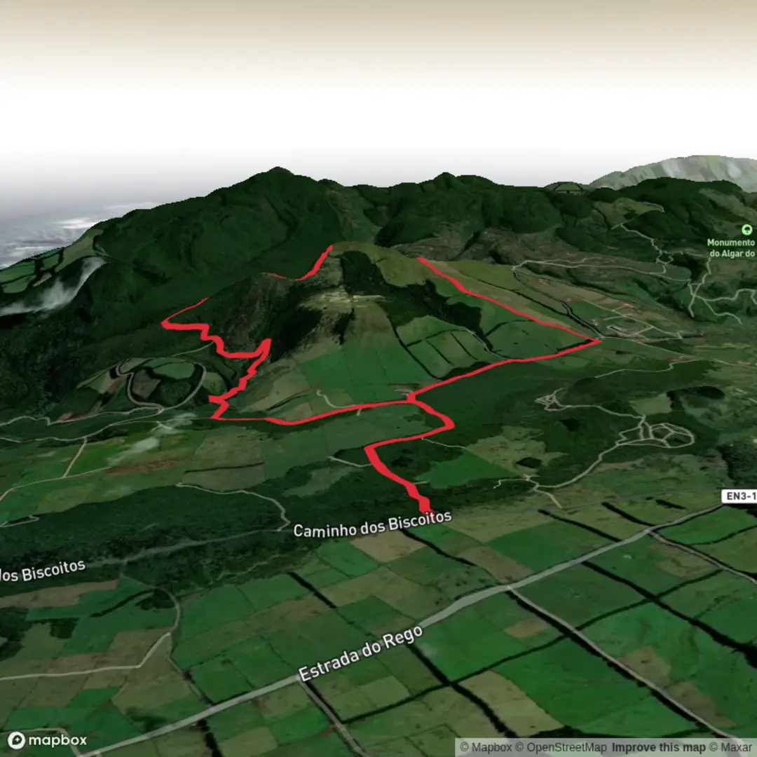
3D Flyover
Add to list
More
9.0 km
~2 hrs 16 min
278 m
Loop
“A windswept volcanic loop through laurel, cedar, and crater-edge views rewards prepared hikers with wild Azorean drama.”
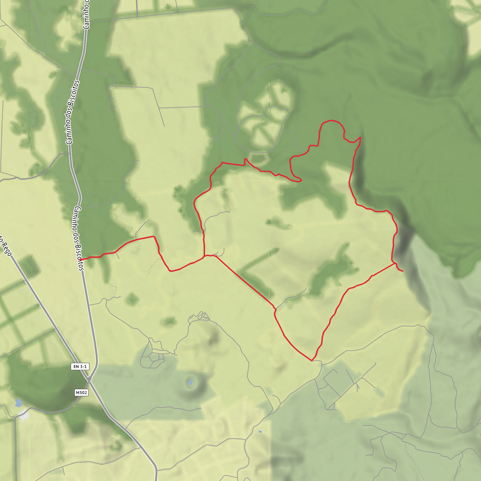
This medium-difficulty loop explores the volcanic interior of Terceira Island in the Azores, covering about 8.8 to 9 km (5.5 to 5.6 miles) with roughly 300 m (about 985 feet) of climbing. The route is officially described as a circular trail with an average walking time of around 2 hours 30 minutes, but many hikers will want longer for viewpoints, photos, and careful footing on uneven ground. It reaches about 704 m (2,310 feet) at its high point near Juncal, so conditions can feel cooler, windier, and more exposed than on the coast. (trails.visitazores.com)
The start is in the Malha Grande area above Biscoitos, beside Regional Road ER 3-1, on the descent toward the parish of Biscoitos. A practical landmark for the trailhead is the signed Rocha do Chambre walking trail parking area near Malha Grande, above Biscoitos on Terceira’s north side. Official trail material places the start at approximately 38°44'56.31"N, 27°15'48.52"W, which corresponds to the Malha Grande roadside trail access near Biscoitos rather than a street address in a built-up village center. (trails.visitazores.com)
By car, the simplest approach is to drive to Biscoitos and continue uphill toward Malha Grande on ER 3-1, where there is a designated trail start area used for this route. If you are relying on public transport, Biscoitos is the key settlement to aim for first; bus connections on Terceira do serve Biscoitos, but service in the island interior is limited, so schedules should be checked carefully in advance and a taxi for the final approach may be the most realistic option if you are not driving. Because the trailhead sits inland above the village rather than in central Biscoitos, public transport is less convenient here than for coastal walks. (horarios.visitazores.de)
What the route feels like
The opening section follows a dirt track that soon becomes a stonier country ճանապարհ, with a gentle sense of entering the island’s upland interior. Early on, the trail passes through habitat where endemic Azorean plants are a major highlight, including Azorean heather, Azores laurel, and Azores juniper. This is a good stretch to settle into the walk before the scenery becomes more dramatic. (trails.visitazores.com)
The route then enters a stand of Japanese cedar and runs beside a watercourse before reaching pastureland. That mix of native vegetation, forestry, wet ground, and open grazing land gives the hike a varied character over a relatively short distance. Expect gates along the route, and leave any gate closed after passing through, as the official guidance emphasizes this because parts of the trail cross working agricultural land. (trails.visitazores.com)
Around the middle of the loop, the scenery becomes much more expansive. A viewpoint over Vale do Azinhal appears after the forest section, with several spots offering slightly different angles into the valley. Soon after, the trees give way to a clearing where you can look toward the crater wall of Pico Alto volcano. From there, the trail continues left along the escarpment toward the high point at Juncal, the top of Rocha do Chambre at about 704 m (2,310 feet). This is one of the most important sections for both scenery and caution: visibility matters, and official guidance recommends doing the walk in good weather because cloud, mist, and wind can reduce both views and route awareness on the higher ground. (trails.visitazores.com)
Landmarks, geology, and historical context
Rocha do Chambre sits in a landscape shaped by Terceira’s volcanic history, and this loop is especially rewarding for hikers interested in geology. The official trail information highlights views of the Pico Alto crater wall, volcanic formations along the descent, and trachytic domes around the high ground. These domes are part of the Natural Reserve of Biscoito da Ferraria and Pico Alto, giving the route a strong sense of walking through a protected volcanic system rather than just across open countryside. (trails.visitazores.com)
The region’s significance is tied to the formation of Terceira itself. The landscape around Rocha do Chambre and Biscoito da
Surfaces
Unknown
Dirt
Grass
Wood
Comments and Reviews
User comments, reviews and discussions about the Rocha do Chambre Loop, Portugal.
average rating out of 5
0 rating(s)
