Download
3D Flyover
Add to list
More
69.8 km
~3 days
900 m
Multi-Day
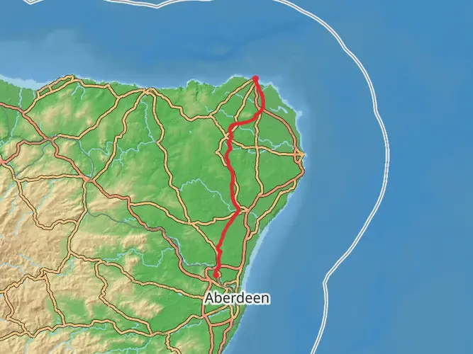
The Deeside Way is a 69.8 km trail that starts in Aberdeen, Aberdeen City, Scotland. Based on our data, the hike is graded as Easy. For information on how we grade trails, please read measuring the difficulty of a hiking trail on hiiker. Also, check our latest community posts for trail updates. This hike can be completed in approx 3 days. Caution is advised on trail times as this depends on multiple variables. For more info read about how we calculate hike time.

What to expect?
Activity types
Frequently asked questions
How long does it take to walk the Deeside Way from Aberdeen to Ballater?
The Deeside Way is 69.85 km long, so most hikers complete it in about 3 to 4 days. A common split is Aberdeen to Drumoak, Drumoak to Banchory, Banchory to Aboyne, and Aboyne to Ballater, with the longest day usually the Banchory to Aboyne section at roughly 24 km.
Is the Deeside Way an easy long-distance walk?
The Deeside Way is generally considered an easy multi-day route. Much of it follows the old Deeside Railway line, so gradients are gentle for long stretches, with the main exception being the Banchory to Aboyne section, which leaves the railway corridor and climbs through woodland below Scolty Hill before descending again.
Where does the Deeside Way start and finish?
The Deeside Way runs between Aberdeen and Ballater in northeast Scotland. The eastern end is at Duthie Park in Aberdeen, and the western end is in Ballater on Royal Deeside, giving the route a point-to-point layout rather than a loop.
Can you do the Deeside Way by public transport?
Yes. The route is well served by buses along the A93 corridor, which links Aberdeen, Drumoak, Banchory, Aboyne, Dinnet, and Ballater. That makes it practical to walk the Deeside Way in sections or return to a start point without needing a car.
Are there good places to park for the Deeside Way?
Parking is available at several useful access points along the Deeside Way. Drumoak has parking by the war memorial, Aboyne has parking near the village center by Victory Hall, and Ballater has public parking including Church Square Car Park, which is a convenient option for the western end of the route.
Is the Deeside Way dog friendly?
The Deeside Way is generally suitable for walking with a dog because it is mainly off-road and follows broad paths and former railway trackbed for much of its length. In Scotland, access rights usually extend to people walking dogs, but dogs should be kept under close control around livestock, wildlife, roads, and other path users.
What is the terrain like on the Deeside Way?
The terrain on the Deeside Way is mostly straightforward, with long sections of level or gently graded path on the former railway line between Aberdeen and Ballater. The route is waymarked for most of its length and includes a mix of old railbed, woodland paths, village links, and some stretches that run close to the A93.
Comments and Reviews
User comments, reviews and discussions about the Deeside Way, Scotland.
4.64
average rating out of 5
11 rating(s)