Download
3D Flyover
Add to list
More
3.5 km
~1 hrs 24 min
427 m
Loop
“A fierce climb from Corrour Bothy, where wild grandeur quickly outweighs the route’s modest scale.”
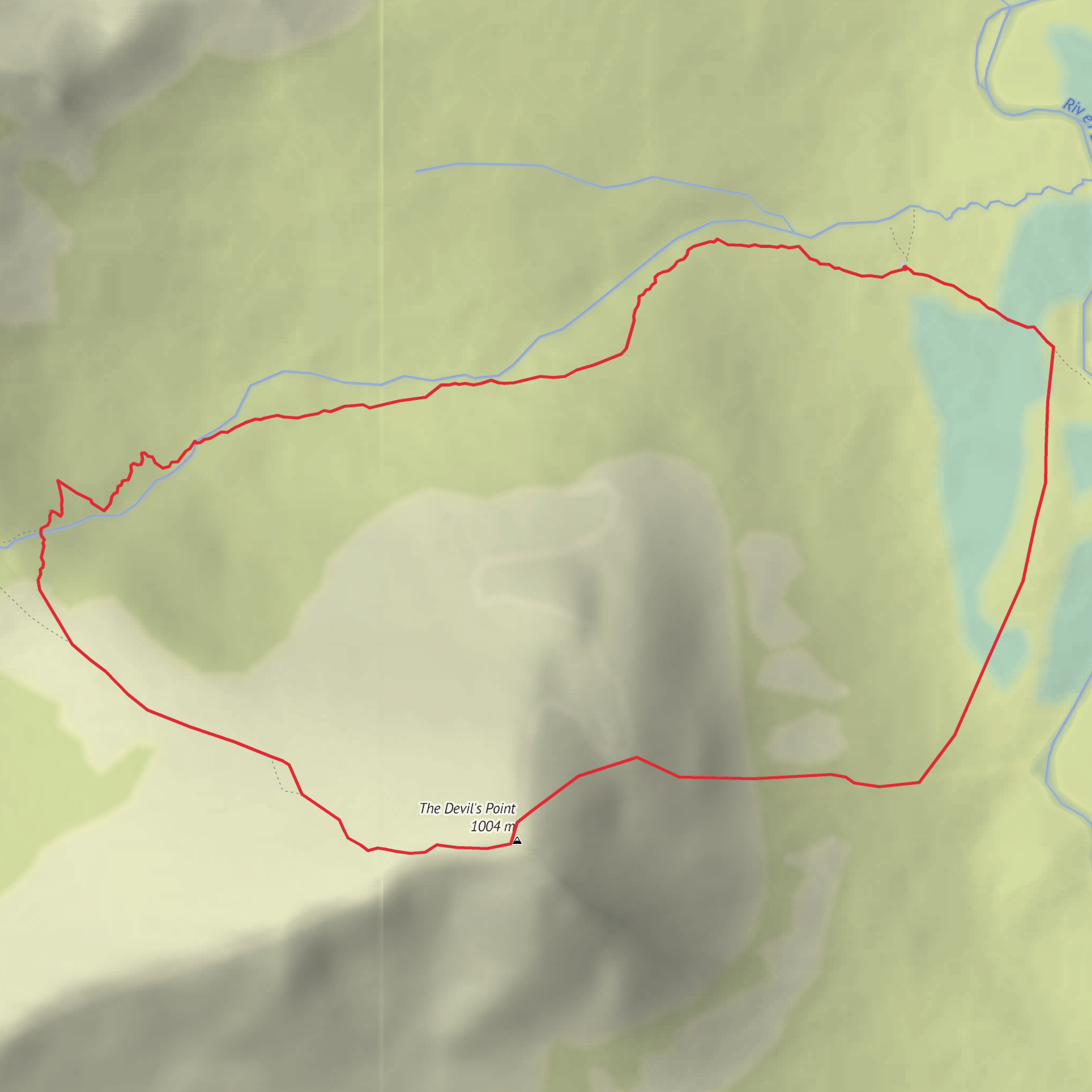
This is a short but very serious mountain ascent from Corrour Bothy to the summit of The Devil’s Point, climbing roughly 3 km / 1.9 miles with about 400 m / 1,312 ft of ascent. Despite the modest distance, the grade, exposure to weather, and remote setting make it feel much bigger than the numbers suggest. This is best treated as a steep, high-mountain outing for experienced hikers who are comfortable with rough paths, loose stone, sudden cloud, and a long approach to reach Corrour Bothy in the first place. The start is at Corrour Bothy in the Lairig Ghru on Mar Lodge Estate, a remote mountain refuge west of the River Dee and most commonly reached from the Linn of Dee car park near Braemar, Aberdeenshire. (mountainbothies.org.uk)
From the bothy, the route heads straight into the mountain environment with very little easing-in. The line climbs behind Corrour Bothy into Coire Odhar, gaining height quickly on a clear hill path that zigzags and then steepens as it works up the corrie. The ground is often a mix of worn path, gravel, stones, and eroded sections, and after rain it can be slick underfoot. In mist, the upper mountain can become confusing, especially where the path weakens among stony ground, so careful navigation is essential and HiiKER should be treated as a core planning and backup tool rather than an optional extra. (walkhighlands.co.uk)
What the climb feels like
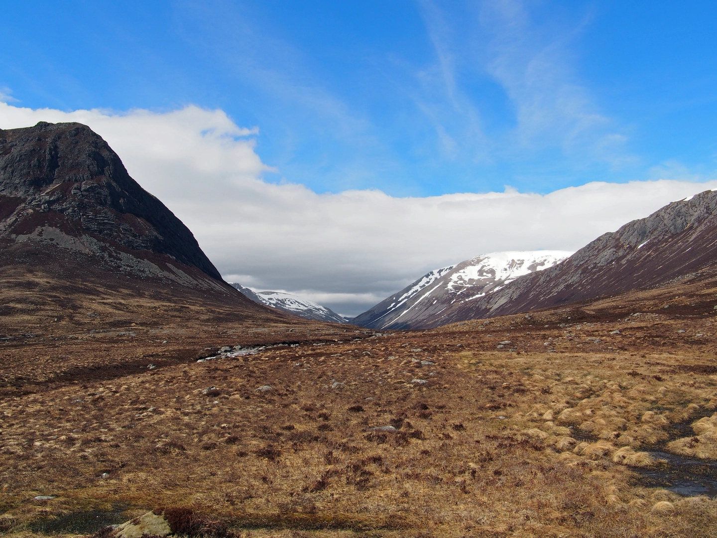
The first section out of Corrour Bothy is the most straightforward to follow, but it is immediately uphill. Expect a sustained pull rather than a gentle warm-up. Over roughly the first 1 to 1.5 km / 0.6 to 0.9 miles, much of the day’s ascent is already underway. As height is gained, views open back across the Lairig Ghru, one of Scotland’s great mountain passes, and the sense of remoteness becomes one of the defining features of the walk. Corrour itself sits on this historic route between Deeside and Speyside, and the bothy began life in 1877 as a deer watcher’s hut before being rebuilt in 1949 and maintained by the Mountain Bothies Association since 1967. (mountainbothies.org.uk)
Higher up, the route leaves the shelter of the corrie floor and becomes more exposed to wind from almost any direction. The summit of The Devil’s Point stands at 1,004 m / 3,294 ft and is a striking rocky top that guards the southern entrance to the Lairig Ghru. Its Gaelic name, Bod an Deamhain, is one of the more famously earthy names in the Cairngorms, and the mountain has a dramatic profile when seen from Deeside. (walkhighlands.co.uk)
The final approach is where the hike earns its Extra Difficult rating. The gradient bites harder, the terrain becomes more broken, and in poor visibility the summit area can feel stark and committing. Even in summer, cold wind, low cloud, and driving rain can turn this into a demanding ascent. Early or late in the season, lingering snow can collect in the corrie and around the upper slopes, adding a serious mountaineering element. (walkhighlands.co.uk)
Landmarks, scenery, and mountain character
One of the most memorable landmarks is Corrour Bothy itself, sitting in a broad, wild setting beneath the western side of the Lairig Ghru. It is one of the best-known bothies in Scotland and a natural staging point for ascents of The Devil’s Point, Cairn Toul, and nearby high tops. From the climb, the eye is repeatedly drawn back to the trench-like line of the pass, the River Dee below, and the huge surrounding Cairngorm plateaux and ridges. (mountainbothies.org.uk)
The landscape here is classic high Cairngorm terrain: vast glacial forms, bare upper slopes, boulder-strewn mountain ground, and a feeling of scale that is much larger than the route from the bothy alone suggests.
Comments and Reviews
User comments, reviews and discussions about the The Devil's Point from Corrour Bothy, Scotland.
average rating out of 5
0 rating(s)
