Download
3D Flyover
Add to list
More
5.6 km
~1 hrs 50 min
426 m
Out and Back
“A brief but bracing climb, where boggy slopes and wide Highland views make the hill feel wilder.”
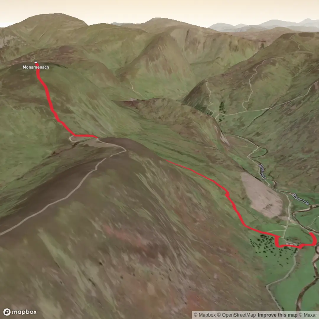
This is a short but demanding hill route in Glen Isla, climbing Monamenach from the high end of the glen on a compact out-and-back of roughly 6 km / 3.7 miles with about 400 m / 1,300 ft of ascent. Although the mileage is modest, the gradient, exposed upland terrain, and often wet or rough ground make it feel much bigger than the numbers suggest. Monamenach itself is a rounded Corbett on the watershed between Glen Isla and Glen Shee, and the usual start is at Auchavan, near the end of the public road at the head of Glen Isla. Walkhighlands gives the start grid reference as NO192696 and notes that there is no public transport to the trailhead. (walkhighlands.co.uk)
For drivers, the nearest practical landmark is Auchavan, Glen Isla, Blairgowrie, Perth and Kinross, Scotland, at the road end beyond the upper glen. The final approach is along a rough, potholed track, and parking is limited; the usual advice is to find a sensible space on the grassy verge area before the bridge and avoid blocking gates, passing places, or turning areas. (walkhighlands.co.uk) If arriving without a car, planning is much harder: Walkhighlands lists no public transport to the start, so the realistic option is a taxi transfer from Blairgowrie or another settlement in eastern Perthshire after reaching the area by regional bus. (walkhighlands.co.uk)
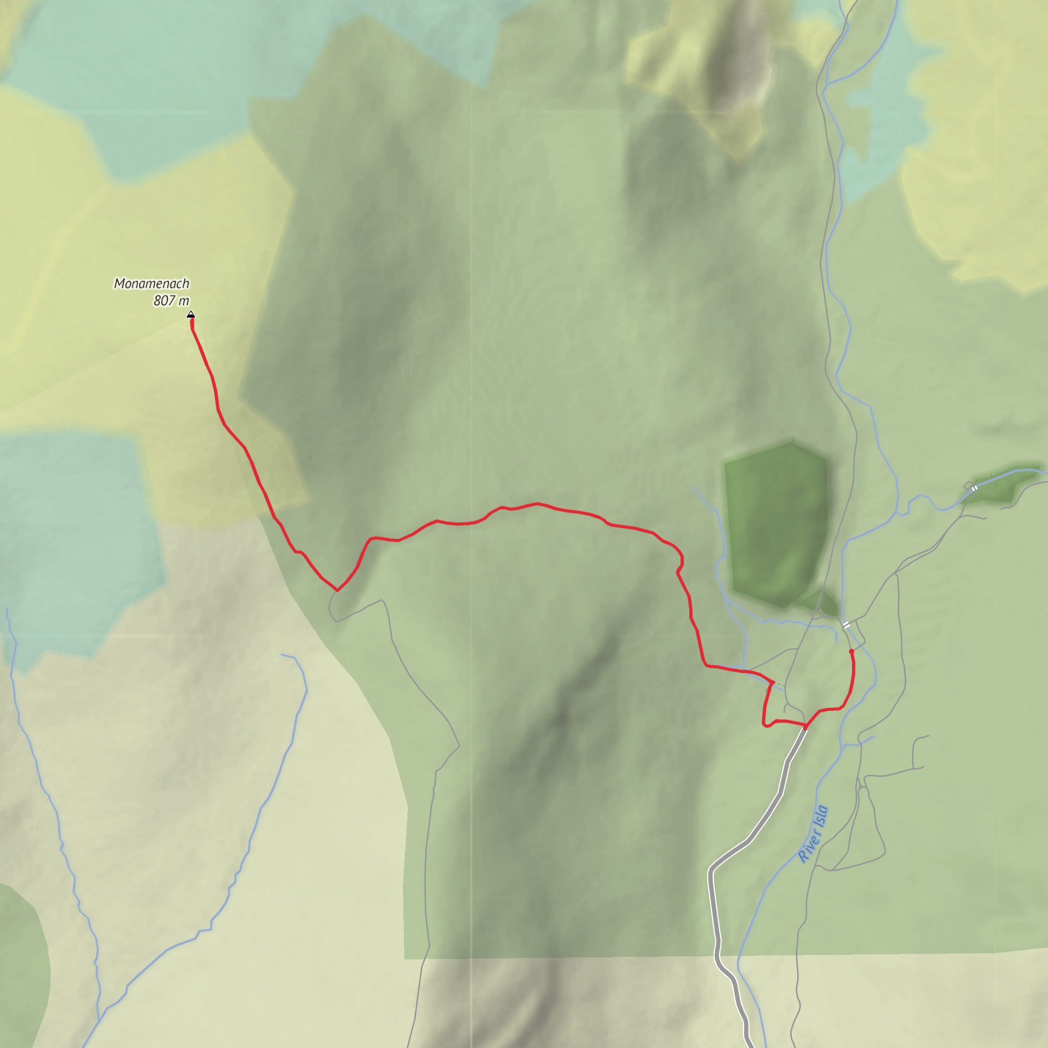
The route begins gently enough on estate ground near Auchavan, but that easy start is brief. After crossing the cattle grid and following the private drive toward Tulchan Lodge, the walk leaves the main track for a fainter grassy line climbing the hillside. Very quickly, the character changes from glen approach to open hill ascent. The path passes through a gap in a drystone wall, crosses the Glaick Burn, and then rises steadily toward the bealach between Monamenach and Creagan Caise. (walkhighlands.co.uk)
What the climb feels like
This is the kind of route where the ascent comes in a concentrated block rather than being spread across a long day. On paper, around 400 to 444 m / 1,300 to 1,457 ft of climbing over roughly 5.25 to 6 km / 3.25 to 3.7 miles sounds efficient; on the ground, it means a fairly steep pull on rough hill track and faint upland path. Walkhighlands describes the terrain simply as a rough hill track and rates the bog factor at 3.5/5, which is a useful warning that even a short outing can involve wet feet, soft verges, and peaty sections after rain. (walkhighlands.co.uk)
Once near the bealach, the route turns onto a rougher and fainter hill path heading north-northwest over open ground toward the summit. Navigation is usually straightforward in clear weather because the broad shape of the hill is uncomplicated, but in mist the rounded terrain can feel featureless. A loaded route on HiiKER is worth having ready before setting out, especially because the upper mountain has only intermittent path definition. The summit is marked by a small cairn near the remains of an old fence. (walkhighlands.co.uk)
Landmarks, scenery, and natural character
One of the pleasures of this route is how quickly the views open up. Looking back, there are increasingly wide views over Auchavan and upper Glen Isla as the climb steepens. Near the top, the outlook shifts dramatically toward the craggy head of the glen, with Walkhighlands highlighting the striking view into Caenlochan Glen, the uppermost part of Glen Isla, while Mount Blair stands out prominently to the south. (walkhighlands.co.uk)
The landscape is classic eastern Highland hill country: rounded heather-clad slopes, grassy sections, burns cutting down toward the glen, old walls and fence lines, and broad moorland shoulders rather than narrow ridges. Expect a mix of estate track, grassy path, heather, and damp ground. In poor weather, the openness can make the hill feel more serious than its height suggests because there is little shelter once above the glen.
Wildlife is typical of the Angus Glens and southern Cairngorm fringe. Hikers should keep an eye out for red deer on the open slopes and moorland birds such as red grouse, meadow pipits, and skylarks in season. In quieter conditions, raptors may also be seen using the updrafts over the glen. Because this is managed upland estate country, it is also wise to be alert for seasonal deer stalking notices and to check access guidance before setting out; estate gates and signs on nearby routes in Glen Isla commonly reference stalking information. (stevenfallon.co.uk)
Difficulty and things to watch out for
Despite the short
Surfaces
Unknown
Asphalt
Grass
Gravel
Comments and Reviews
User comments, reviews and discussions about the Monamenach Out and Back, Scotland.
average rating out of 5
0 rating(s)
