Download
Preview
Add to list
More
5.5 km
~2 hrs 9 min
632 m
Out and Back
“A fierce Arrochar climb where sweeping glen views reward every punishing, weather-bitten step.”
This is a short but very steep hillwalk in the Arrochar Alps area of western Scotland, climbing roughly 5 km / 3.1 miles with about 600 m / 1,970 ft of ascent. Despite the modest distance, the gradient, rough mountain terrain, and often wet underfoot conditions make it feel much bigger than the numbers suggest. An Extra Difficult rating is justified because the route gains height quickly, includes sustained uphill effort, and can become serious in poor visibility, wind, rain, or winter conditions. Anyone planning this walk should be prepared for a demanding ascent rather than a gentle half-day outing.
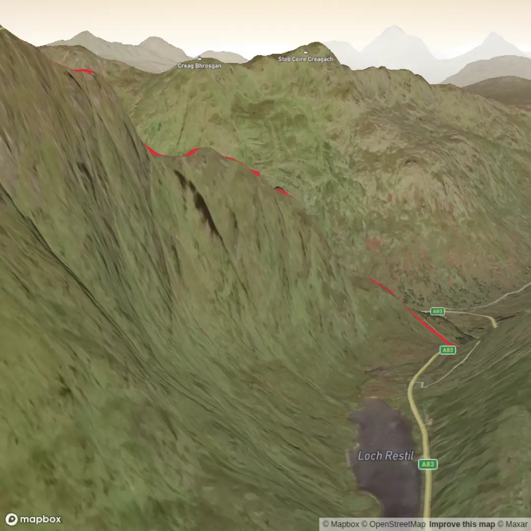
The route is generally associated with the A83 near Rest and Be Thankful, close to Glen Croe, Argyll and Bute, Scotland, which is the nearest well-known landmark for the start area. If you are navigating to the trailhead by road, the most useful reference point is the Rest and Be Thankful viewpoint on the A83, between Arrochar and Cairndow. Parking arrangements can vary depending on the exact line taken, so it is worth checking current access and parking options before setting out. If arriving by public transport, the nearest practical rail access is usually Arrochar & Tarbet station, followed by a taxi connection toward Glen Croe or the A83 start area, as direct public transport to the foot of the hill is limited.
From the outset, expect a sharp transition from roadside or lower glen terrain into open hillside. There is very little easing-in on this mountain. The climb begins assertively and continues that way for much of the route, with the bulk of the elevation gained over a short horizontal distance. On paper, 600 m in 5 km may not sound extreme, but on the ground it means long stretches of steep ascent where pacing matters. Strong boots or trail shoes with excellent grip are important, especially after rain, because the ground can be slick with mud, wet grass, peat, and loose stone.
Terrain and ascent profile
The lower slopes are often the first real test. Depending on the exact line used, hikers can encounter a mix of worn path, grassy trods, boggy patches, and eroded sections. In wet weather, these lower approaches can be surprisingly energy-sapping. The route then steepens further as it rises onto the mountain’s broad upper slopes. Hands may occasionally be useful for balance on steeper ground, though this is more a strenuous hill climb than a technical scramble in normal summer conditions.
As height is gained, the views begin to open dramatically across Glen Croe, one of the most striking glens in the southern Highlands. The road below, famous for its sweeping bends and mountain setting, gives a strong sense of how quickly the route rises above the valley. The upper mountain tends to feel more exposed, with wind becoming a major factor even on days that seem calm lower down. Cloud can descend quickly here, and because the summit area can be broad and feature-light in mist, careful navigation is important. If using a navigation app, HiiKER is the best tool to consult before and during the walk.
The descent deserves as much respect as the climb. On a route this steep, tired legs and slippery ground can make the way down awkward and slow. Many hikers find the descent harder on knees and ankles than expected, particularly if the ground is greasy or if loose gravel has built up on the path. Trekking poles can be very helpful for stability and reducing impact on the return.
Landmarks, scenery, and mountain character
Beinn an Lochain stands among the rugged hills often grouped with the Arrochar Alps, a range known for steep-sided peaks, dramatic corries, and a distinctly mountainous feel despite their relatively accessible location. The mountain’s name is commonly understood as referring to a hill associated with a small loch or corrie hollow, which suits the landscape well: this is a place of folds, basins, and sharply rising slopes shaped by glaciation.
One of the most notable visual features of the wider area is the relationship between mountain and glen. The route gives expansive views toward the Rest and Be Thankful pass, a historic crossing point through the Highlands. The pass takes its name from an old military road built in the 18th century, where travelers reaching the top were said to be grateful the hardest climbing was behind them. That military road was part of the wider network developed after the Jacobite uprisings to improve movement through the Highlands and strengthen government control. Walking in this area, even on a relatively compact route, places hikers in a landscape shaped not only by ice and weather but also by military engineering, transport history, and centuries of Highland travel.
On clearer days, the surrounding peaks create a classic west Highland panorama: ridges, dark glens, and shifting light over rock and heather. The scenery can feel especially dramatic when low cloud moves through the corries or when sunlight breaks across the slopes after rain. Because the mountain rises so abruptly from the glen, the sense of relief is strong, and the summit outlook often feels bigger than the route length would suggest.
Nature and wildlife
The lower and middle slopes typically support heather moorland, rough grasses, mosses, and peatland vegetation, with wetter ground in hollows and drainage lines. In late summer and early autumn, the hillsides can show rich purple heather tones, while spring often brings fresher greens and clearer burns running down from the higher ground.
Wildlife is typical of upland western Scotland. Hikers may spot red deer on quieter slopes, especially early or late in the day, and hear or see upland birds such as meadow pipits, skylarks, and possibly ravens overhead. Birds

Comments and Reviews
User comments, reviews and discussions about the Beinn an Lochain, Scotland.
average rating out of 5
0 rating(s)