Download
Preview
Add to list
More
3.7 km
~1 hrs 10 min
260 m
Out and Back
“A steep little pyramid above Glen Lonan, rewarding careful walkers with airy loch-strewn views.”
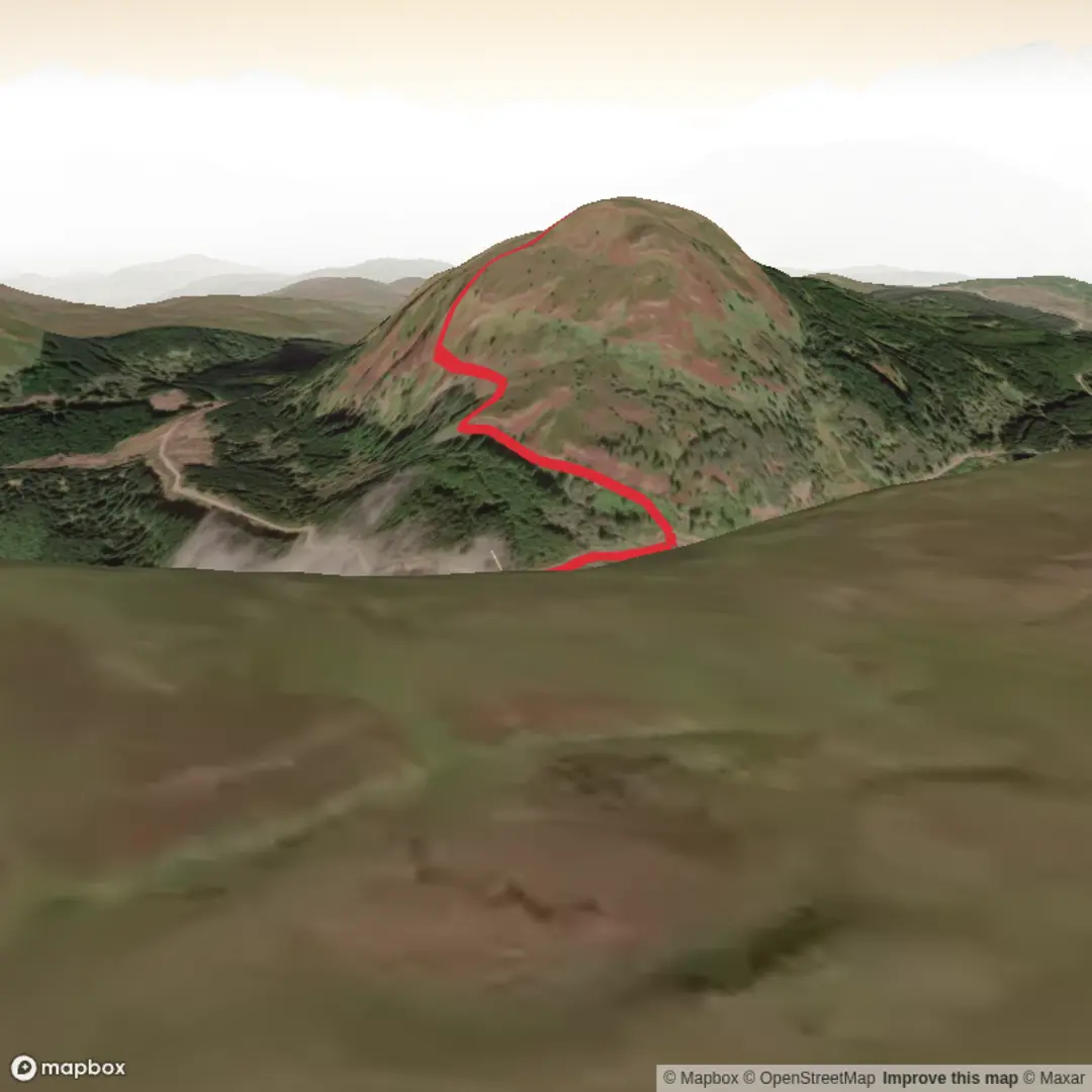
This is a short but punchy hill outing above Glen Lonan in Argyll, climbing roughly 4 km / 2.5 miles with about 300 m / 985 ft of ascent to the 383 m / 1,257 ft summit of Deadh Choimhead. Although the mileage is modest, the gradient, rough ground, faint paths, and potentially wet approach make it feel much more serious than the numbers suggest, so the “difficult” rating is justified for anyone expecting a straightforward hillwalk. The hill rises on the north side of Glen Lonan, east of Oban, and is known for its steep little pyramid shape when seen from the glen. (walklakes.co.uk)
The usual approach is from the quiet Glen Lonan road, south of Taynuilt, with the start most often described near the small bridge and access point just west of Clachadow farm in Glen Lonan. That is the nearest clear landmark for the hike start based on available route descriptions. Drivers generally reach the area from the A85 at Taynuilt, then follow the minor road south into Glen Lonan; parking is typically limited to informal roadside hardstanding or gravel pull-ins, so it is important not to block gates, bridges, tracks, or farm access. Public transport is less direct: Taynuilt is the nearest practical rail and bus hub, with links toward Oban and Glasgow, and from there you would usually need a taxi or a long road walk into Glen Lonan to reach the start. (lonancountryhouseandgardens.scot)
The opening section is often the trickiest part to judge. From the roadside, hikers may need to cross a burn, and that crossing can range from simple stepping stones in dry conditions to a genuine obstacle after rain. Beyond that, an overgrown track or path usually leads through woodland and toward forestry tracks on the lower slopes. Reports suggest the line is there, but it can be easy to miss at the bottom, especially if vegetation is high. This is a route where advance planning on HiiKER is worthwhile, because the path becomes increasingly faint higher up and the hill is not one of those summits with a heavily worn, obvious trod from bottom to top. (walkhighlands.co.uk)
What the climb feels like
Once above the lower woodland, the character changes quickly. The route steepens onto open hillside with a mix of grass, heather, occasional scree, and uneven ground. Some walkers describe a faint but persistent path continuing toward the summit, while others note stretches of rougher, less efficient walking where deer tracks are the best line available. On a short hill like this, that matters: 300 m / 985 ft of ascent packed into around 4 km / 2.5 miles means there is not much flat recovery ground. Expect a sustained climb rather than a gentle warm-up. (walkhighlands.co.uk)
The southern side of the hill has craggy features, and while this is not a technical scramble by the standard route, the terrain can feel awkward in poor visibility or when wet. Underfoot, the combination of damp grass, peat, heather, and loose stones can be slippery, and after prolonged rain the lower glen and burn crossings become more committing. In mist, the hill’s modest height should not be underestimated; the summit area may be simple in clear weather, but route-finding on descent can become much less obvious when the faint trods disappear into rough ground. (walkhighlands.co.uk)
Landmarks, views, and atmosphere
One of the pleasures of Deadh Choimhead is how quickly it opens out over Glen Lonan. As height is gained, the glen spreads below with its patchwork of pasture, rough grassland, woodland, and the quiet minor road threading through it. The hill’s forested lower slopes and open upper ground create a strong contrast, and from higher up there are views toward Loch Etive and Loch Nell, with wider mountain panoramas when cloud allows. The summit itself is marked by a cairn incorporating a destroyed trig point, giving a clear focal point at the top.

Comments and Reviews
User comments, reviews and discussions about the Deadh Choimhead, Scotland.
average rating out of 5
0 rating(s)