Download
3D Flyover
Add to list
More
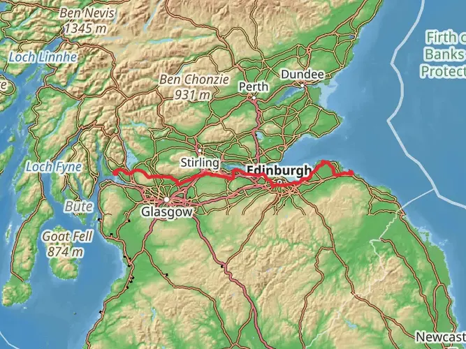
97.3 km
~4 days
744 m
Multi-Day
“Embark on St Margaret's Way, a historic and scenic hike from Edinburgh to St Andrews.”
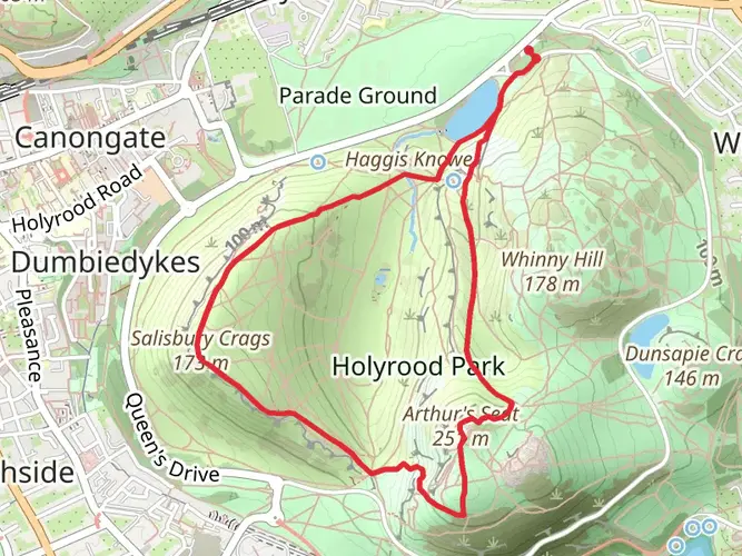
St Margaret's Way is a captivating long-distance trail that spans approximately 97 kilometers (around 60 miles) with an elevation gain of around 700 meters (about 2300 feet). This point-to-point trail begins near the vibrant City of Edinburgh, Scotland, and offers a medium difficulty rating, making it accessible to hikers with a moderate level of experience.
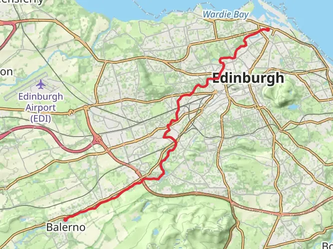
Getting to the Trailhead The starting point of St Margaret's Way is conveniently accessible from Edinburgh. Hikers can opt to drive to the trailhead, which is located near the city center, or they can use public transportation. Buses and trains frequently run from various points within Edinburgh and the surrounding areas, dropping off near the trail's beginning. For those using HiiKER to navigate, the app will provide precise directions and parking information.
Historical Significance The trail is named after Queen Margaret of Scotland, a pious figure from the 11th century known for her charitable works and devout Christian faith. As hikers embark on this journey, they will be following in the footsteps of ancient pilgrims who traveled to St Andrews, which was once the ecclesiastical capital of Scotland and a significant pilgrimage site.
Trail Experience The route takes hikers through a variety of landscapes, including serene woodland paths, rolling hills, and coastal trails. The initial section from Edinburgh leads through urban settings before transitioning into the more rural and natural environments of the Scottish countryside.
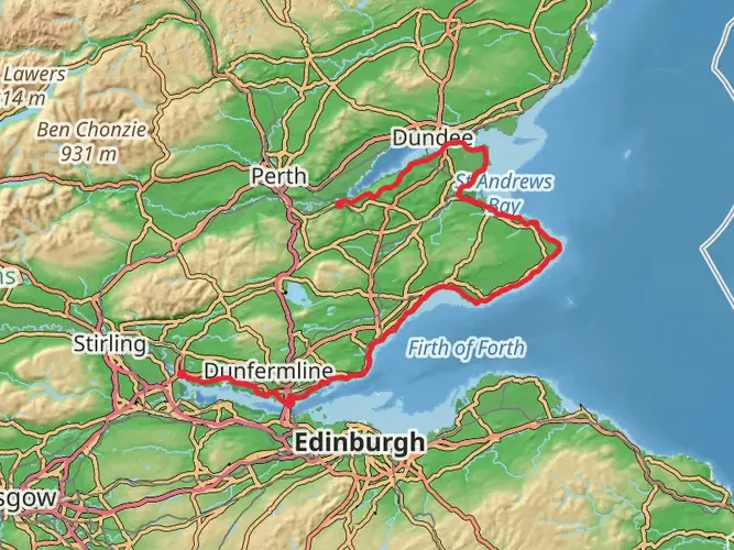
Landmarks and Nature One of the first significant landmarks encountered is the iconic Forth Bridge, a UNESCO World Heritage site. This engineering marvel is a sight to behold and marks an early milestone on the journey. As the trail progresses, hikers will pass by Loch Leven, a large freshwater loch that is home to an array of birdlife, including breeding pairs of pink-footed geese and a castle where Mary, Queen of Scots, was once imprisoned.
The trail meanders through the Lomond Hills Regional Park, offering stunning views and a chance to spot local wildlife such as red squirrels and roe deer. The elevation gain is gradual and spread out across the route, with the highest points within the Lomond Hills.
Coastal Path and St Andrews Approaching the final stages, the trail joins the Fife Coastal Path, where the North Sea's fresh breezes accompany hikers. The coastal path provides a different terrain and showcases the rugged beauty of Scotland's shoreline.
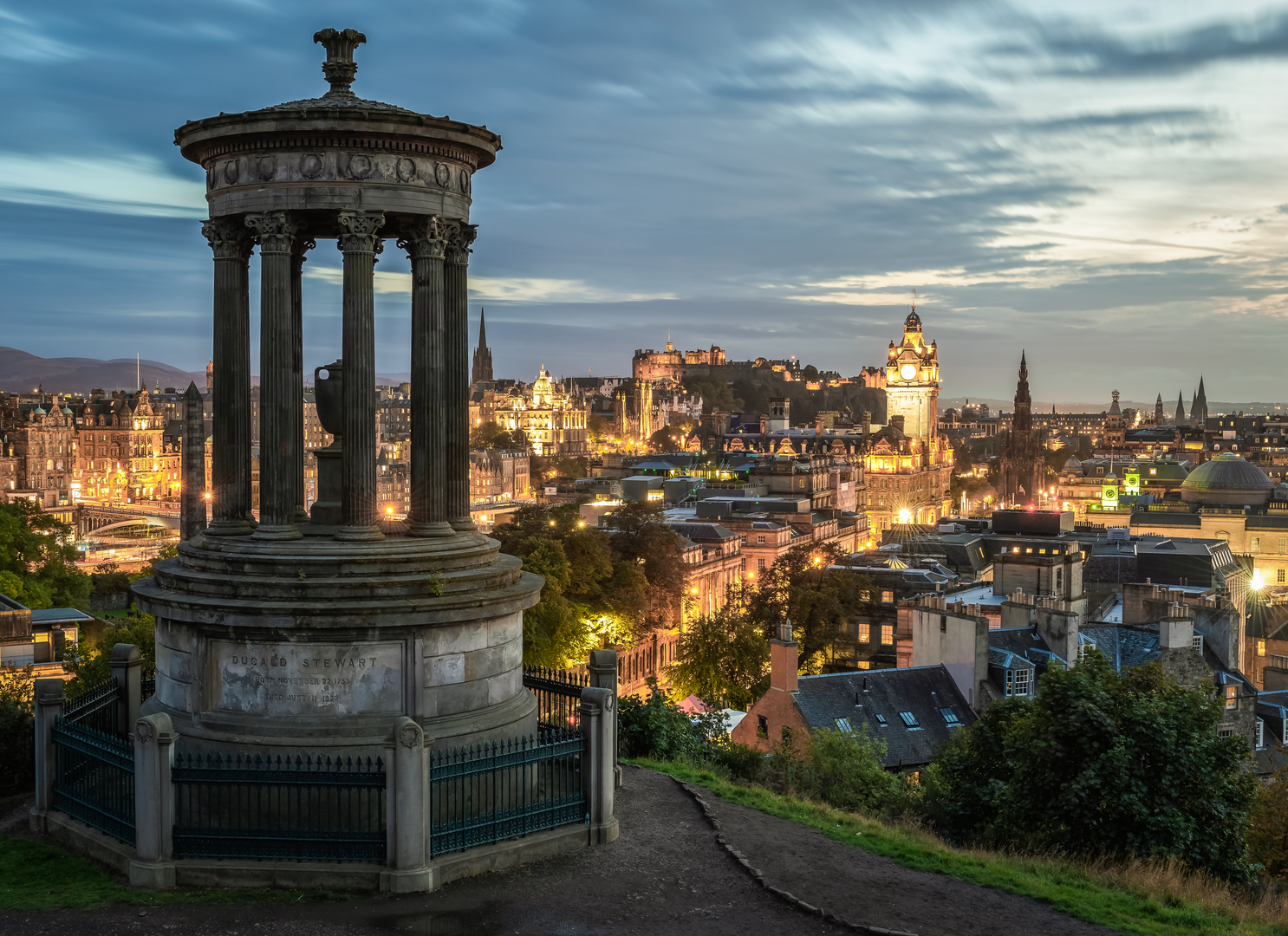
The endpoint of St Margaret's Way is the historic town of St Andrews, known for its ancient university, the third oldest in the English-speaking world, and the renowned Old Course, a must-see for golf enthusiasts. The town's rich history and medieval ruins, including the cathedral and castle, offer a rewarding conclusion to the journey.
Preparation and Planning Hikers should be prepared for the Scottish weather, which can be unpredictable, and pack accordingly. Waterproof gear is essential, as well as layers to accommodate temperature changes. It's advisable to plan for accommodations in advance, as the trail can take several days to complete, and overnight stops will be necessary.
For navigation, HiiKER provides detailed maps and trail information, ensuring that hikers can stay on the correct path and be aware of upcoming terrain changes or points of interest.
With its blend of historical significance, diverse landscapes, and cultural highlights, St Margaret's Way is a trail that offers a rich and immersive hiking experience through the heart of Scotland.

What to expect?
Activity types
Frequently asked questions
How long is St Margaret's Way and how many days does St Margaret's Way usually take?
St Margaret's Way is 97.28 km long with 744 m of total ascent, so it is generally approached as a multi-day walk rather than a single-day outing. Most walkers split it into about 4 to 6 days, depending on pace, overnight stops, and how much time is spent in places such as North Queensferry, Kirkcaldy, and St Andrews.
Where does St Margaret's Way start and finish in Scotland?
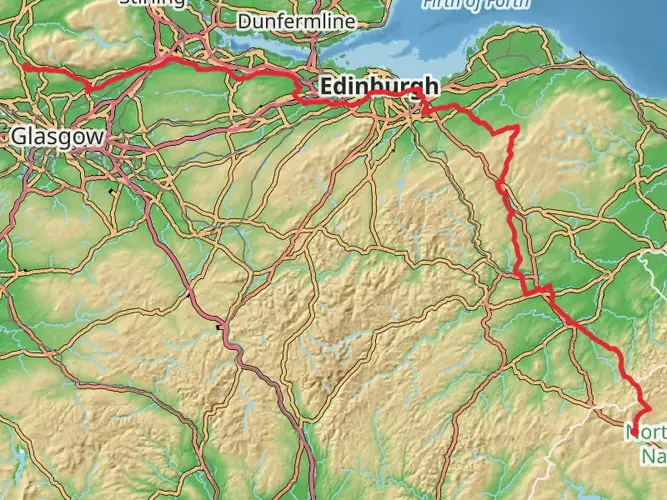
St Margaret's Way starts in central Edinburgh and finishes in St Andrews on the east coast of Fife. The route crosses the Forth Road Bridge on its dedicated walking and cycling path, drops into North Queensferry, then continues through Fife communities before entering St Andrews by Lade Braes and the West Port on the way to the cathedral area.
Is St Margaret's Way an easy walk or is St Margaret's Way challenging?
St Margaret's Way is generally considered an easy long-distance route. The total elevation gain is 744 m spread across nearly 97.3 km, so the challenge comes more from the overall distance and back-to-back walking days than from steep mountain terrain.
What towns and landmarks does St Margaret's Way pass on the way to St Andrews?
St Margaret's Way links Edinburgh with St Andrews and passes key places tied to Scotland's pilgrimage history. Named points on or closely associated with the route include the Forth Road Bridge, North Queensferry, Burntisland, Kinghorn, Kirkcaldy, Earlsferry, Ceres, Lade Braes, West Port, Dunfermline on the St Margaret's Loop, and the cathedral precinct in St Andrews.
Can St Margaret's Way be reached by public transport at the start and finish?
Yes. The Edinburgh start is straightforward to reach by city transport, and the finish in St Andrews is well served by regional buses. North Queensferry on the route also has a railway station, which can be useful for breaking up the walk or arranging a return journey after reaching St Andrews.
Does St Margaret's Way follow the coast or is it mostly inland?
St Margaret's Way includes both coastal and inland walking. After leaving Edinburgh and crossing into Fife, it uses scenic coastal sections around places such as North Queensferry, Burntisland, Kinghorn, and Kirkcaldy, then continues through inland communities and farmland before the final approach into St Andrews.
Comments and Reviews
User comments, reviews and discussions about the St Margaret's Way, Scotland.
4.65
average rating out of 5
17 rating(s)