Download
3D Flyover
Add to list
More
9.5 km
~1 hrs 59 min
50 m
Loop
“Garlieston’s coastal loop blends quiet bays, flower-rich woods, clifftop drama and haunting castle ruins.”
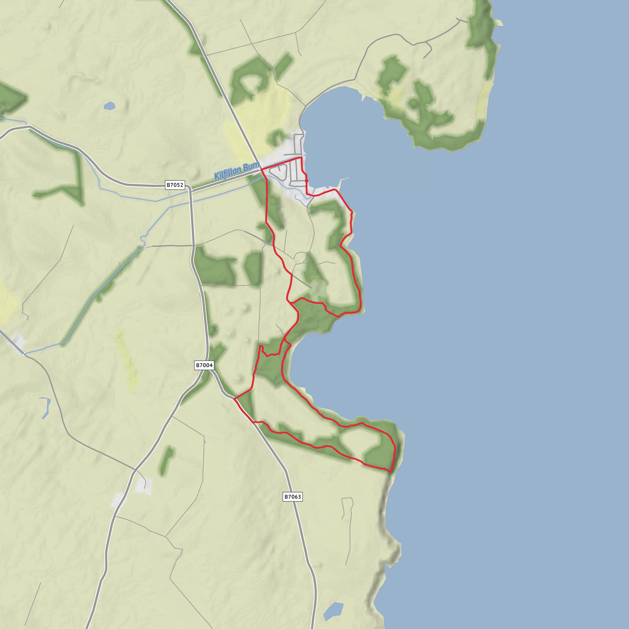
This easy coastal loop near Garlieston in Dumfries and Galloway covers about 10 km / 6.2 miles with roughly 100 m / 330 ft of ascent, making it a very manageable outing for most walkers who are comfortable with uneven coastal paths. The route is generally low-level and never feels mountainous, but it has enough variety to stay interesting: village shoreline, woodland, bay views, open clifftop walking, and the striking ruins of Cruggleton Castle. Expect around 2.5 to 3 hours at a relaxed pace, longer if you stop often for views, wildlife, or to explore the castle site. The terrain is mostly good path, tracks, field-edge walking and short grassy sections, though some stretches can become muddy after rain, especially through the wooded shoreline sections. (walkhighlands.co.uk)
The walk starts by the car park in Garlieston, just south of The Harbour Inn, 18 South Crescent, Garlieston, Newton Stewart DG8 8BQ, with public toilets nearby. If arriving by car, Garlieston is the practical trailhead and the usual place to park before heading south along the seafront. For public transport, this is a more awkward walk to reach directly: current local transport information is best checked through Dumfries and Galloway Council timetables and a journey planner before setting out, as services in this part of the Machars can be limited and infrequent. (walkhighlands.co.uk)
The opening section is gentle and straightforward, leaving the village along the shore before joining a narrow coastal path. This first part is a good warm-up, with very little climbing and easy orientation. The path threads past the edge of the Galloway House estate, where mature trees begin to close in around the route and the walk takes on a more sheltered, wooded character. Although the overall elevation gain is modest, the route undulates enough to keep boots working, especially as it bends around the bay and later rises onto the clifftop near Sliddery Point. (walkhighlands.co.uk)
What to expect on the route
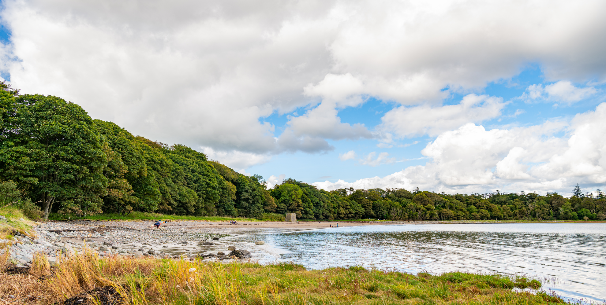
Rigg Bay is one of the highlights early on. The bay is broad, quiet, and scenic, with a mix of shoreline views and wooded backing that gives the route a distinctly sheltered feel compared with more exposed coastal walks. Around the bay, the path stays close enough to the sea to give frequent views across the water, while picnic spots and pauses in the trees make this a good place for a break. The route then continues through mixed woodland, where the atmosphere changes from open coast to enclosed, leafy shoreline. In spring especially, this section can be rich with ground flora such as bluebells, campion, primroses, dog’s mercury and wild garlic, while the older trees around Sliddery Point create a more twisted, wind-shaped coastal woodland. (walkhighlands.co.uk)
Wildlife interest is one of the strengths of this walk. The combination of bay, cliff edge, woodland and farmland means walkers should keep an eye out for coastal birds, garden and woodland songbirds, and seasonal butterflies in calmer weather. The shoreline and open views across Wigtown Bay also make this a rewarding route for anyone who enjoys scanning the water and mudflats for birdlife. Because parts of the route pass through farmland and along field boundaries, it is worth being alert for livestock and following local access guidance carefully. (scotlandstartshere.com)
Navigation is usually uncomplicated in fair conditions because the route is waymarked in places and naturally follows the coast, but it is still worth loading the route on HiiKER before setting out. That is especially useful where paths split near the gardens and picnic area, and again where the route leaves the woodland for field-edge and clifftop sections. In wet weather, some of the narrower shoreline path can be slippery with mud and roots, so footwear with decent grip is more important than the easy grading might suggest.
Landmarks and historical interest
One of the most unusual historical features on this walk is the connection to the Mulberry Harbours. Rigg Bay was used during the Second World War to test components of the prefabricated harbour system later deployed after the D-Day landings in Normandy. Interpretation on the route explains this wartime role, and remnants associated with those trials can still add an extra layer of interest to the bay. Garlieston itself is closely tied to that story, so this is a walk where the scenery and military history are unusually well linked
Surfaces
Unknown
Gravel
Asphalt
Comments and Reviews
User comments, reviews and discussions about the Rigg Bay and Cruggleton Castle Loop, Scotland.
average rating out of 5
0 rating(s)
