Download
3D Flyover
Add to list
More
9.0 km
~2 hrs 21 min
335 m
Loop
“Heather-clad slopes, sweeping views, and layered history make this a rewarding Ayrshire hill circuit.”
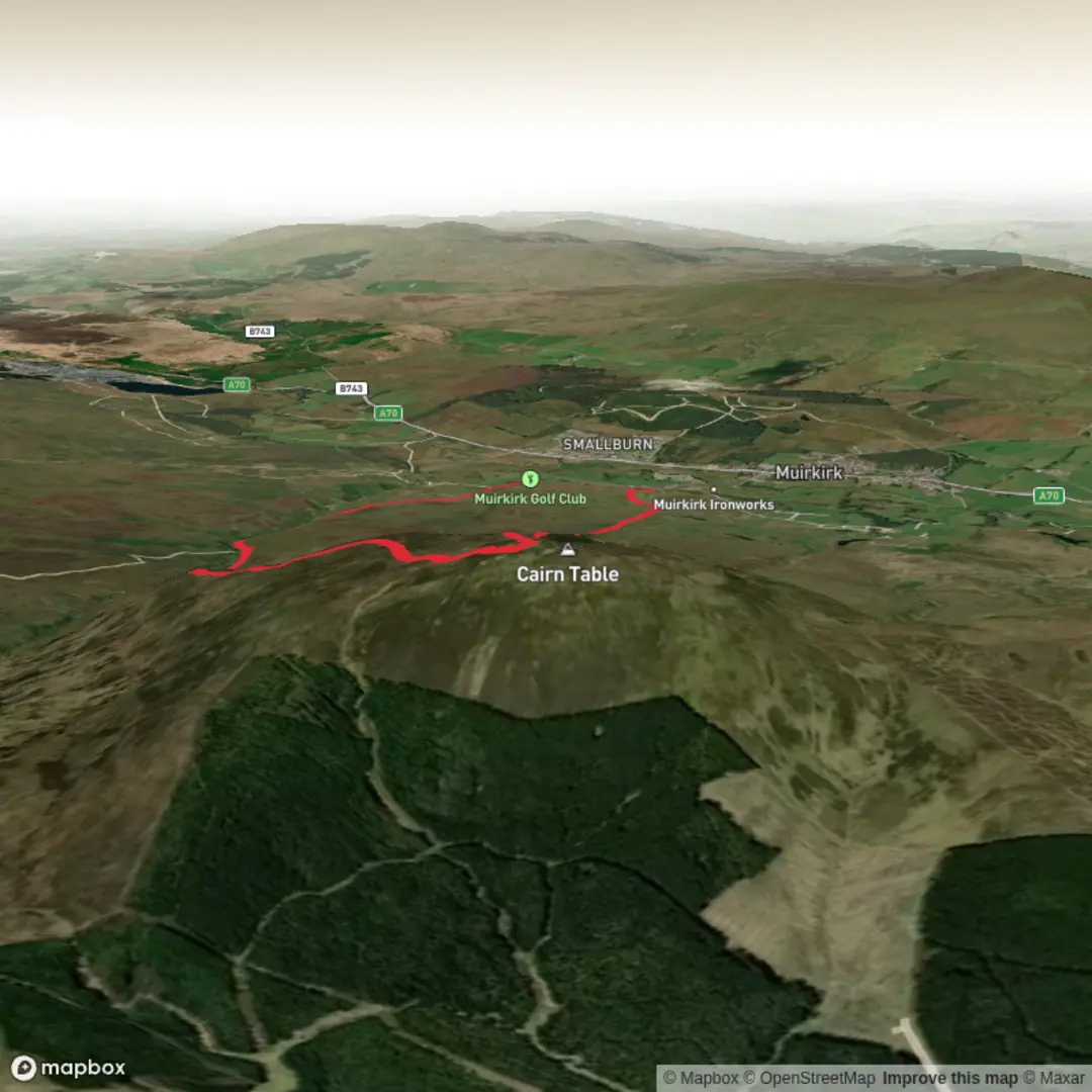
This medium circular walk climbs one of Ayrshire’s best-known hills from the hamlet of Kames, just outside Muirkirk in East Ayrshire, and packs a lot into roughly 8.75 to 9 km / 5.4 to 5.6 miles, with about 353 m / 1,158 ft of ascent. The route is generally considered moderate: the distance is manageable for most regular walkers, but the climb is steady, the upper hill can feel exposed in poor weather, and some lower sections are often wet or boggy even after dry spells. The usual start is the walkers’ car park beside the Kames Institute in Kames, near Muirkirk, with the trailhead about 1 km / 0.6 miles from bus stops in Muirkirk. (walkhighlands.co.uk)
By car, the simplest approach is to head for Kames near Muirkirk and use the walkers’ car park beside the Kames Institute, which is the recognized starting point for the loop. By public transport, there is no bus directly to the trailhead, but services including the 46 from Cumnock/Ayr and the X76 from Glasgow stop in Muirkirk, from where it is about a 1 km / 0.6 mile walk to the start. For planning the route itself, it is worth loading the walk on HiiKER in advance, especially because waymark colours on local boards may not always match perfectly and the moorland sections can feel less obvious in mist. (walkhighlands.co.uk)
What the route is like
From Kames, the route begins gently enough on paths and tracks before crossing farmland and entering open hillside. Early on, the walk passes through ground marked by springs, rough pasture, and traces of older industrial activity, so underfoot conditions can change quickly from firm aggregate track to soft, peaty, waterlogged sections. Duckboards, bridges, and newer pathwork help over some of the wettest ground, but waterproof footwear is still the safer choice for most of the year. (walkhighlands.co.uk)
As the loop gains height, the climb becomes more defined along the spur known as The Steel. This is where the walk starts to feel more like a proper hill outing rather than a countryside circuit. The ascent is not technical, but it is sustained enough to raise the effort level, and in wind, rain, or low cloud the hill can feel much bigger than the numbers suggest. Near the top, walkers usually choose between a more gradual line and a narrower, rougher path for the final pull to the summit. (walkhighlands.co.uk)
The summit of Cairn Table stands at 593 m / 1,946 ft and is crowned by a large cairn, a trig pillar, and a direction indicator. On a clear day, the views are one of the main rewards of the walk, stretching widely across Ayrshire and beyond, with Arran often visible to the west and Ben Lomond sometimes seen to the north. Because the top is broad, open, and popular, it can be breezy and feel crowded on fine weekends, so an extra warm layer is useful even in summer. (walkhighlands.co.uk)
Landmarks, wildlife, and local character
One of the most interesting aspects of this loop is how much local history is built into the landscape. Around the lower slopes are relics of lead, coal, and iron ore mining, reminders that this was once a hard-worked industrial upland rather than empty moor. The return leg follows part of the old Muirkirk to Sanquhar drovers’ road, a historic route once used to move livestock and later associated with coach traffic between Glasgow and Dumfries. Near the end of the walk, the track passes a monument to John Loudon McAdam, the road engineer whose name gave rise to “tarmacadam,” as well as the ruins of his house at Springhill. (walkhighlands.co.uk)
The summit itself also carries historical significance. The large cairn on Cairn Table was built in 1920 as a memorial to local men and women who were killed or served in the First World War. Just to the east are the remains of older prehistoric cairns, showing that this hill has been a notable landmark for far longer than the modern memorial era. That layering of prehistory, war remembrance, and industrial heritage gives the walk a stronger sense of place than many hills of similar height. (walkhighlands.co.uk)
Nature on the route is typical of the southern Scottish uplands: open moorland, heather, rough grassland, springs, and burn-cut slopes. In late summer, the heather can be especially striking on the descent. Birdlife is one of

Surfaces
Dirt
Gravel
Asphalt
Unknown
Comments and Reviews
User comments, reviews and discussions about the Cairn Table Loop, Scotland.
average rating out of 5
0 rating(s)