Download
3D Flyover
Add to list
More
5.2 km
~1 hrs 36 min
350 m
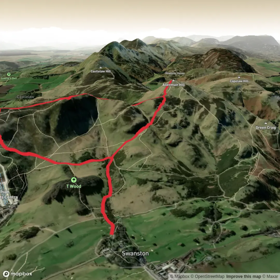
Loop
“A steep, spirited Pentland loop with airy ridges and grand city-to-hill panoramas.”
This short but punchy loop in the northern Pentland Hills packs a lot into roughly 5 km / 3.1 miles, with about 400 m / 1,312 ft of ascent, so the “difficult” rating is well deserved. The route climbs quickly onto two prominent summits—Caerketton Hill and Allermuir Hill—where the reward is a broad sweep of views over Edinburgh, the Firth of Forth, and deeper into the Pentland range. Expect a steep, sustained effort rather than a long day out, with exposed ground, rough hill paths, and sections that can feel much harder in wind, rain, or low cloud. Walkhighlands gives a very similar outing from the Hillend side at 6 km / 3.75 miles with 385 m / 1,263 ft of ascent, which aligns closely with your figures. (walkhighlands.co.uk)
The most practical start point is near Hillend Upper Car Park, Midlothian Snowsports Centre, Biggar Road, Edinburgh EH10 7DU, on the south side of the city at the edge of the Pentland Hills Regional Park. Another nearby access point often used for these hills is Swanston car park, Edinburgh EH10 7DS, but for a compact Caerketton–Allermuir loop, Hillend is the clearest landmark and easiest place to navigate to. Pentland Hills Regional Park specifically lists Hillend Upper and Swanston as official access points, and Walkhighlands identifies the start for the comparable route as the lower car park below the snowsports centre. (pentlandhills.org)
If arriving by public transport, the simplest plan is to take a bus toward Hillend / the Snowsports Centre and walk up to the trail start from there. Walkhighlands notes bus access to Hillend / Snowsports Centre, and the Pentland Hills park authority recommends public transport where possible because parking can be limited. There is no train service directly into the regional park, so bus plus a short walk is the usual non-car option. For driving, Hillend Upper Car Park is the most straightforward navigation target. (walkhighlands.co.uk)
What the route feels like
From the Hillend side, the route begins with an immediate sense of climbing into open hill country. The lower slopes are shaped by the snowsports area, so the first part can feel more managed and developed than a remote mountain walk, but that changes quickly as the path steepens and gains the ridge. The ascent onto Caerketton Hill is the first real test: short, direct, and often breathless, especially if the ground is wet or the wind is blowing across the slope. Walkhighlands describes this section as a steep climb onto Caerketton, and notes rougher, wetter terrain in places. (walkhighlands.co.uk)
Caerketton Hill rises to about 478 m / 1,568 ft above sea level and forms one of the northeastern high points of the Pentlands. The summit is marked by a cairn, and this is where the route starts to feel much bigger than its mileage suggests. On a clear day, the outlook opens across Edinburgh’s skyline and north toward the Firth of Forth, while the rest of the Pentlands stretch away to the southwest. (en.wikipedia.org)
After Caerketton, the loop continues along the ridge toward Allermuir Hill. This middle section is not especially long, but it is not flat either: there are undulations, stonier patches, and a noticeable drop to a col before the second climb begins. Walkhighlands notes the ridge line, the steep north side around Caerketton Crags, and the descent to a bealach at around 415 m / 1,362 ft before the final pull up Allermuir. (walkhighlands.co.uk)
The climb to Allermuir Hill is another steep effort, with a brief easing before the summit. At the top, there is a trig point and view indicator, and this is one of the best viewpoints close to Edinburgh. Walkhighlands highlights the panorama over the city, the Firth of Forth, and the central Pentlands, including hills such as Carnethy Hill and Scald Law. (walkhighlands.co.uk)
Terrain, navigation, and what to watch for
Although the distance is modest, this is not a casual stroll. The main challenges are the gradient, exposure, and underfoot conditions. Paths can be rocky, muddy, or slick after rain, and the open ridgeline offers little shelter. In poor weather

Surfaces
Unknown
Unpaved
Comments and Reviews
User comments, reviews and discussions about the Caerketton Hill and Allermuir Hill Loop, Scotland.
average rating out of 5
0 rating(s)