Download
3D Flyover
Add to list
More
12.4 km
~3 hrs 2 min
333 m
Loop
“A colourful Pentlands loop threads woodland, reservoirs, and breezy ridges with sweeping cityward views.”
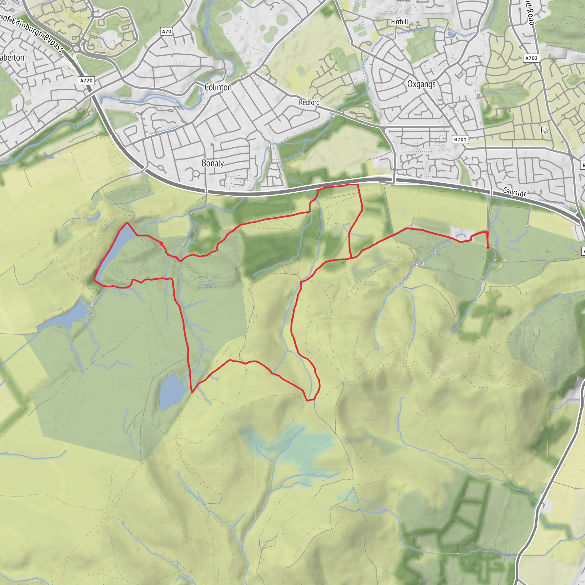
This roughly 12 km / 7.5 mile loop in the northwestern Pentland Hills gives a varied half-day outing with reservoirs, open hillside, broad views over Edinburgh, and a good mix of estate tracks, hill paths, and rougher moorland sections. With around 300 m / 985 ft of ascent, it sits comfortably in the medium category: not especially long, but with enough climbing, exposure, and underfoot variation to demand decent footwear, a weather layer, and careful pacing. The route is typically approached from Bonaly Country Park, Bonaly Road, Edinburgh EH13 0PB, which is the nearest well-known access point and has upper and lower car parks. (pentlandhills.org)
The opening section is usually the gentlest. From Bonaly Country Park, paths and tracks lead through woodland and out toward Torduff Reservoir, a Victorian-engineered reservoir on the edge of the Pentlands. This early part of the walk is useful for settling into the day before the climbing begins, and it also gives one of the route’s strongest contrasts: city-edge woodland quickly giving way to open hill country. Expect firm paths at first, but after rain the ground can become muddy, especially where tracks meet grassy slopes and drainage lines. (pentlandhills.org)
Climbing toward White Hill and Capelaw Hill
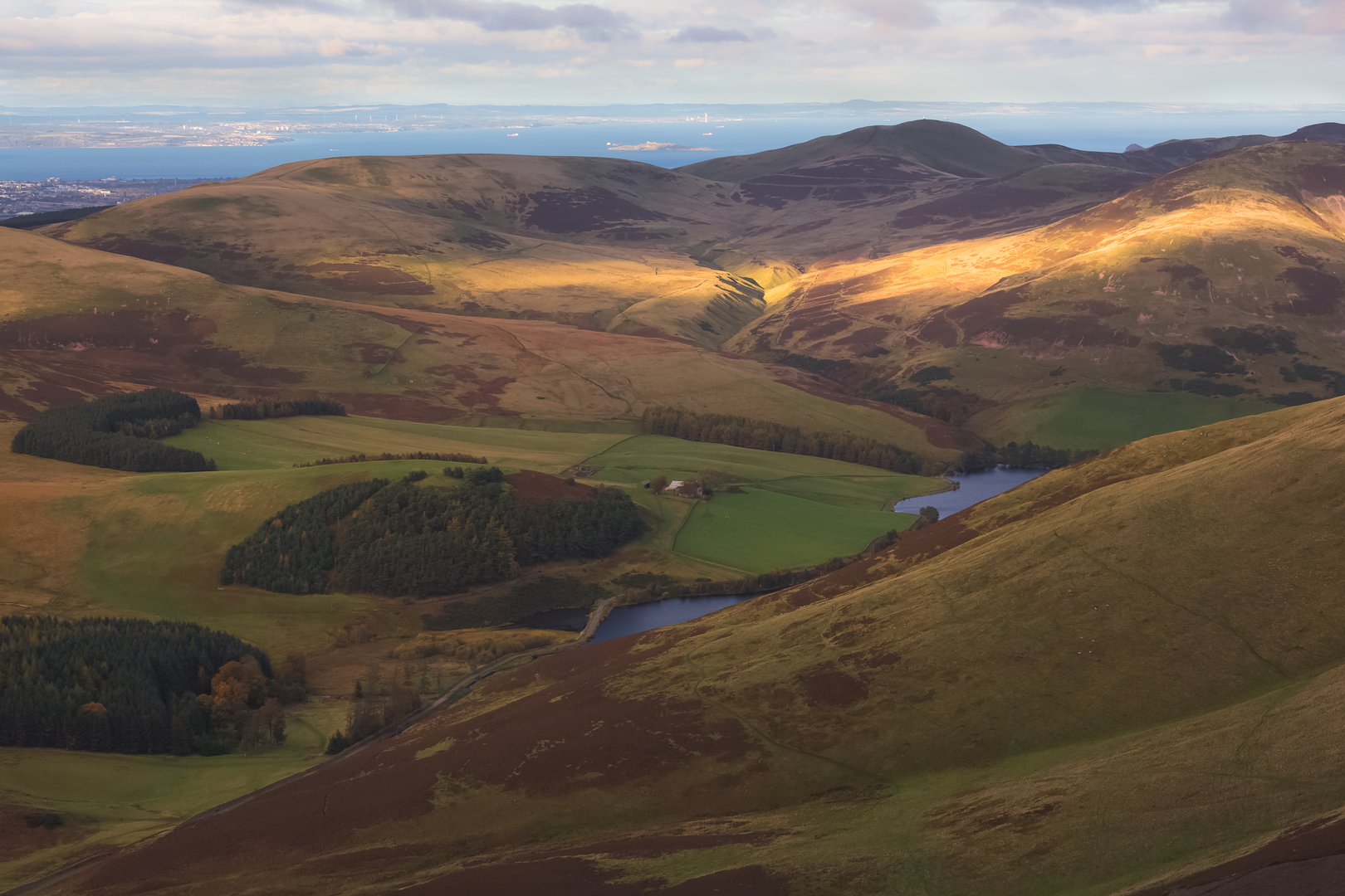
After the reservoir section, the route begins to rise more decisively toward White Hill and then Capelaw Hill. The gradients are not alpine-steep, but they are sustained enough to be felt, especially if the ground is wet or the wind is pushing across the slope. White Hill is often the first place where the landscape opens fully, with views back over Edinburgh, the Firth of Forth, and the northern edge of the Pentlands. Capelaw Hill, at the western end of the northern Pentland ridge, continues that open character and feels more exposed, with broad grassy shoulders and a more upland atmosphere than the lower reservoir paths. (ramblers.org.uk)
Navigation on these upper sections is usually straightforward in clear weather, but mist can flatten the terrain and make junctions or faint trods less obvious. This is the kind of route where it is worth checking the line in HiiKER before leaving the main tracks, particularly around broad saddles and bypass paths around the hill flanks. Some sections may be on narrower, less distinct paths through grass or heather, and there can be boggier patches after prolonged rain. (colinhendersonphoto.com)
One of the more interesting historical details on Capelaw Hill is that the hillside preserves evidence of older land use and water engineering. Historic Environment records note 19th-century catch-drains on the northwest face of Capelaw, dug to divert rain and spring water toward Bonaly Reservoir. The wider Capelaw area was also formerly common land until its division in 1709, after which it was apportioned between local landowners and quickly developed in part as moorland farm ground. That means the landscape here is not just scenic upland: it is also shaped by centuries of grazing, estate management, and water supply works tied to Edinburgh’s growth. (canmore.org.uk)
Reservoirs, moorland, and what to watch for
The loop’s middle and later stages link hill ground back toward the reservoir basin, often with long views over Torduff Reservoir and nearby Clubbiedean Reservoir. These water bodies are a defining feature of this side of the Pentlands and help break up the route visually, especially when the light is shifting across the hills. The terrain around them can feel deceptively easy after the higher ground, but this is often where tired legs notice uneven surfaces, loose stones on tracks, and wet patches near burns and drainage channels. (pentlandhills.org)
Nature on this route is typical of the Pentland Hills’ mosaic of woodland, rough pasture, heather moorland, and reservoir margins. The Regional Park describes the area as a protected landscape with farmed land, heather moorland, reservoirs, woodland, and hills, so hikers can expect a changing mix of habitats rather than one continuous environment. Around the woods and lower paths, common
Surfaces
Unknown
Gravel
Asphalt
Ground
Dirt
Grass
Cobblestone
Wood
Unpaved
Paved
Comments and Reviews
User comments, reviews and discussions about the Capelaw Hill, Torduff Reservoir and Hill and White hill Loop, Scotland.
average rating out of 5
0 rating(s)
