Download
3D Flyover
Add to list
More
13.4 km
~3 hrs 38 min
573 m
Loop
“A stirring Pentlands circuit blending shimmering reservoirs, airy ridges, and a hard-earned summit panorama.”
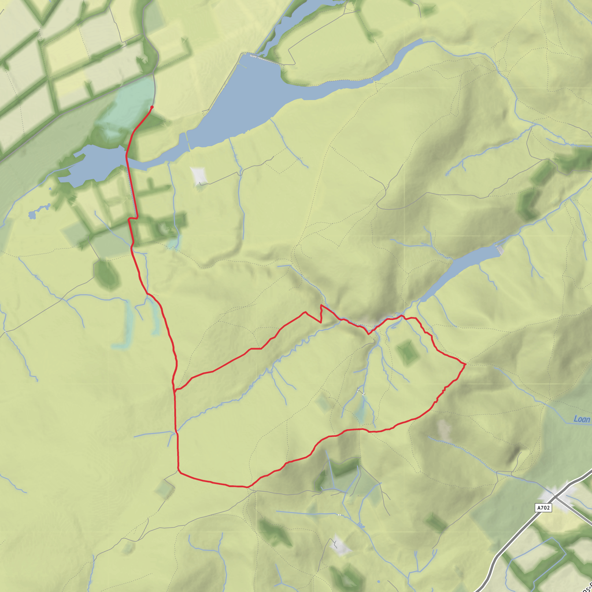
This is a rewarding Pentland Hills circuit of about 13 km / 8.1 miles with roughly 600 m / 1,970 ft of ascent, starting near Threipmuir Reservoir car park by Redford Bridge, Balerno, Edinburgh EH14, a well-known access point on the north side of the reservoir. The route links waterside walking with a steady hill climb to Scald Law, 579 m / 1,900 ft, the highest summit in the Pentlands, before returning by Loganlee Reservoir and the glen below the ridge. The overall difficulty sits comfortably in the medium range: there are good paths in places, but also sustained climbing, exposed high ground, and sections that can become muddy, windy, or slippery after rain. (fionaoutdoors.co.uk)
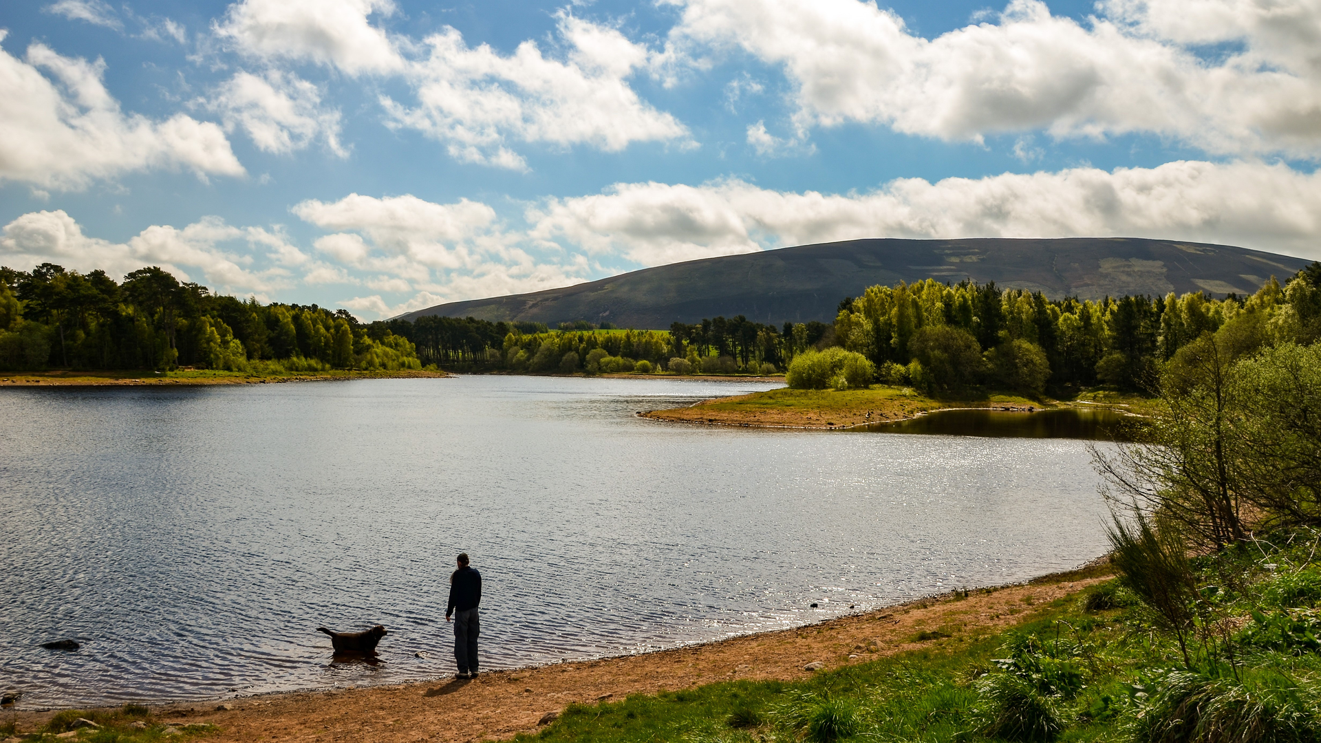
The walk usually begins by crossing Redford Bridge at the western end of Threipmuir Reservoir, then heading into the lower slopes above the water. Early on, the terrain is relatively gentle, giving you time to settle in before the route steepens onto the open hillside. Threipmuir itself is one of the chain of reservoirs built to support Edinburgh’s water supply, and the bridge and surrounding access tracks mark one of the classic gateways into the regional park. Expect broad views to open quickly behind you, especially back across the reservoir basin and toward the northern edge of the Pentlands. (edinburgh.gov.uk)
Climb to the high ground
From the reservoir side, the route rises onto the ridge system that leads toward Scald Law. This is the most physically demanding part of the day, with most of the 600 m / 1,970 ft of ascent gained over the middle section of the hike. The climb is not technical, but it is sustained, and in poor weather the upper slopes can feel much more serious than the distance suggests. On clear days, the reward is a wide sweep of views over the Pentlands, the reservoirs below, and far beyond to the Borders and, in especially clear conditions, more distant western and Highland peaks. (midlothian.gov.uk)
Scald Law is the standout landmark of the route. At 579 m / 1,900 ft, it is the highest point in the Pentland Hills, and the summit gives the walk its real mountain feel despite being so close to Edinburgh. The ridge around here is rounded rather than rocky, but it is exposed, and strong winds are common. Low cloud can also reduce visibility quickly, so this is a route where checking conditions beforehand and carrying reliable navigation is important; if you are planning the walk, mapping and route-following with HiiKER is the best fit for keeping track of junctions and line of descent in mist. (en.wikipedia.org)
Loganlee Reservoir and the return leg
After the summit, the route drops toward The Howe and Loganlee Reservoir, changing the character of the walk from upland ridge to sheltered reservoir scenery. The descent can be hard on the knees, especially if the ground is wet, and some sections may be loose or greasy underfoot. Loganlee sits in a striking hollow beneath the hills and is one of the most attractive waters on this side of the Pentlands. The burn and surrounding slopes create a quieter, more enclosed atmosphere than the open ridge above, and this contrast is one of the reasons the circuit feels so complete. (walkingbritain.co.uk)
The return toward Threipmuir follows the lower glen and reservoir-side tracks, with the chance to look back up at the skyline you have just crossed. Around Logan Burn and the reservoir margins, look for wet ground, rushes, and rough grassland that support a mix of upland birds. Depending on season and luck, hikers may spot skylarks, meadow pipits, curlews in suitable habitat, and birds of prey quartering the slopes. Around the water, ducks and other waterfowl are common, while the surrounding moorland and grassland can also hold hares and grazing sheep. The Pentlands are not remote wilderness, but they do support a rich patchwork of upland and freshwater habitats. (pentlandhills.org)
Landscape, geology and history
This route passes through a landscape shaped by both ancient geology and 19th-century engineering. The Pentland Hills are formed from very old sedimentary and volcanic rocks, with a geological story stretching back hundreds of millions of years. Their long rolling ridges, glens, and reservoir basins create the distinctive scenery seen throughout the walk. (scottish-places.info)
The reservoirs are a major part of the area’s historical significance. Threipmuir Reservoir was completed in the mid-
Surfaces
Unknown
Dirt
Gravel
Asphalt
Grass
Ground
Comments and Reviews
User comments, reviews and discussions about the Redford Bridge, Threipmuir Reservoir, Loganlee Reservoir and Scald Law, Scotland.
average rating out of 5
0 rating(s)
