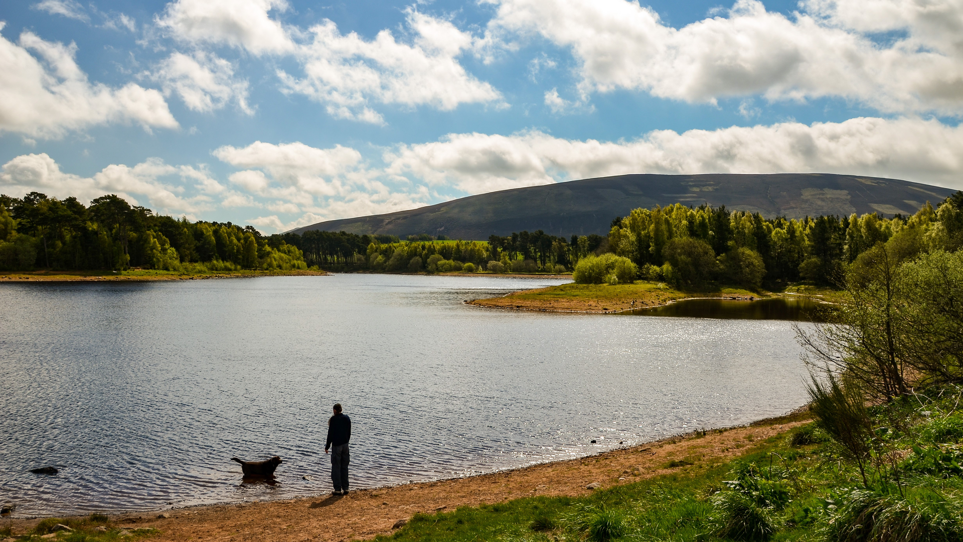
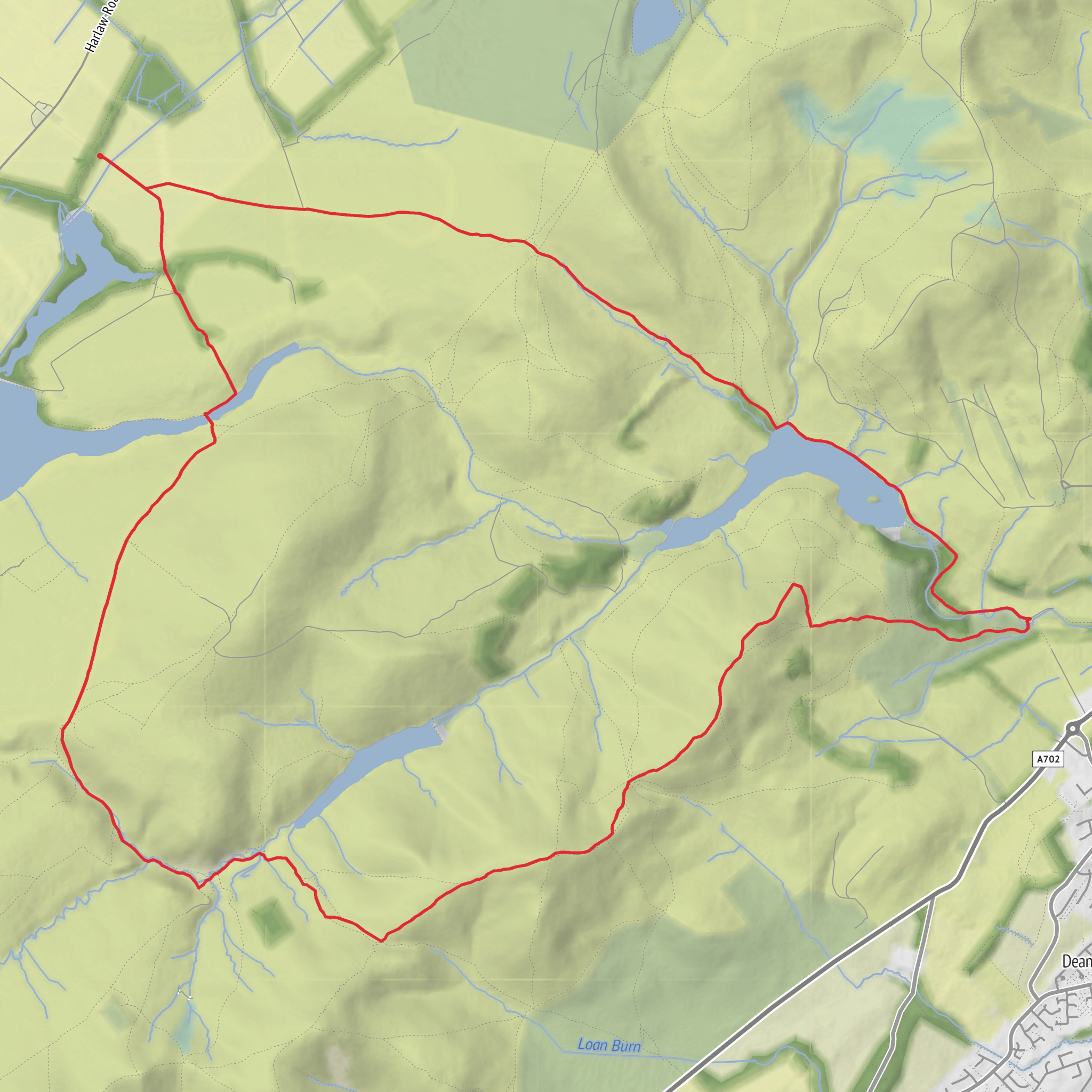
Threipmuir Reservoir, Carnethy Hill, White Craig Heads and Glencorse Reservoir Loop
Download
3D Flyover
Add to list
More
16.2 km
~4 hrs 20 min
661 m
Loop
“Reservoir calm gives way to a bracing Carnethy climb, then sweeping ridges and storied return.”
This is a varied Pentland Hills circuit that mixes reservoir-side walking, a sustained hill climb, broad upland ridges, and a quieter return through one of the most historically layered landscapes on Edinburgh’s doorstep. At around 16 km / 10 miles with roughly 700 m / 2,300 ft of ascent, it fits a solid medium day out, though the climb onto Carnethy Hill and the exposed ground around White Craig Heads can make it feel harder in wind, rain, or winter conditions. The route is best suited to hikers who are comfortable with steep hill paths, changeable weather, and sections where the terrain can be wet, rough, or less forgiving underfoot.
The usual starting point for this loop is the Threipmuir Reservoir car park, near Balerno, EH14 7JT, which is one of the main western access points into the Pentland Hills Regional Park. The car park sits beside Threipmuir Reservoir and gives quick access to the tracks and hill paths leading toward Carnethy Hill and the upper Pentlands. (pentlandhills.org)
If arriving by car, Threipmuir is the most straightforward trailhead, though parking can be busy on fine weekends. The Pentland Hills Regional Park specifically notes ongoing capacity issues and encourages visitors to consider alternatives where possible. By public transport, the hills are accessible from Edinburgh, but bus links do not usually drop you directly at the reservoir itself, so most hikers combine a bus to the edge of the park with a walk, cycle, or taxi onward to the start. The Regional Park publishes access guidance and identifies Threipmuir as an official access point. (pentlandhills.org)
The opening section is usually gentle by Pentlands standards. From the reservoir, the route begins on estate tracks and clear hill paths with open views across the water and toward the rounded upland skyline. Threipmuir itself is one of several reservoirs that shape this part of the range, and the early miles are often the easiest underfoot, giving you time to settle in before the main ascent begins. Expect a mix of gravel track, grassy path, and occasionally muddy ground, especially after rain.
As the route turns toward Carnethy Hill, the character changes quickly. Carnethy is one of the major summits of the Pentlands and the climb is the most physically demanding part of the day. Over a relatively short distance, the path gains height steeply, and in wet weather the surface can become slick with loose stones, peat, and worn earth. This is where pacing matters most. Although the overall route is only around 16 km / 10 miles, the ascent profile gives it more bite than the mileage alone suggests. Carnethy Hill rises to about 573 m / 1,880 ft, and once you gain the upper slopes the views widen dramatically across the reservoirs, the surrounding Pentland ridges, and north toward Edinburgh on a clear day. (en.wikipedia.org)
Terrain and navigation
The ridge and high-ground sections around Carnethy Hill and White Craig Heads are the parts of the loop where weather and navigation deserve the most respect. In clear conditions, the route feels open and obvious, but low cloud can flatten the landscape and make junctions, trods, and descent lines less distinct than they first appear. Wind exposure is another factor: the Pentlands are not especially high by Scottish standards, but they are open, rounded hills that catch weather quickly. A calm day at the reservoir can feel very different on the crest.
Underfoot, expect a combination of: - firm access tracks near the reservoirs - steep, eroded hill path on the climb - grassy and sometimes boggy upland sections - rougher descent paths where footing can be uneven
Because of that variety, waterproof footwear with decent grip is a sensible choice year-round. Trekking poles can help on the steeper ascent and on the descent if the ground is greasy. For navigation, it is worth having the route loaded in HiiKER, especially if visibility is poor or if you want to monitor distance, elevation, and escape options as the day develops.
Landmarks, landscape, and what to expect
One of the strengths of this loop is how much scenery changes over a relatively modest distance. The reservoirs give the route a calm, expansive start and finish, while the middle section feels much more upland and exposed. White Craig Heads adds a craggier edge to the day, with a more broken skyline and a stronger sense of being on the shoulder of the higher Pentlands rather than simply walking around them.
The return toward Glencorse Reservoir is especially scenic. This reservoir sits in a broad, attractive basin beneath the hills and has long been one of the defining landscapes of the eastern Pentlands. The contrast between open moorland above and the still water below is one of the visual highlights of the circuit. Glencorse Reservoir was built in the early 19th century to support water supply and to compensate local mills downstream; sources place its construction in 1822. It also has a notable local story: the
Surfaces
Unknown
Dirt
Gravel
Unpaved
Asphalt
Grass
Wood
Comments and Reviews
User comments, reviews and discussions about the Threipmuir Reservoir, Carnethy Hill, White Craig Heads and Glencorse Reservoir Loop, Scotland.
average rating out of 5
0 rating(s)
