Download
3D Flyover
Add to list
More
131.8 km
~5 days
1446 m
Multi-Day
“Embark on the East Highland Way for an enchanting trek through Scotland's history and wild beauty.”
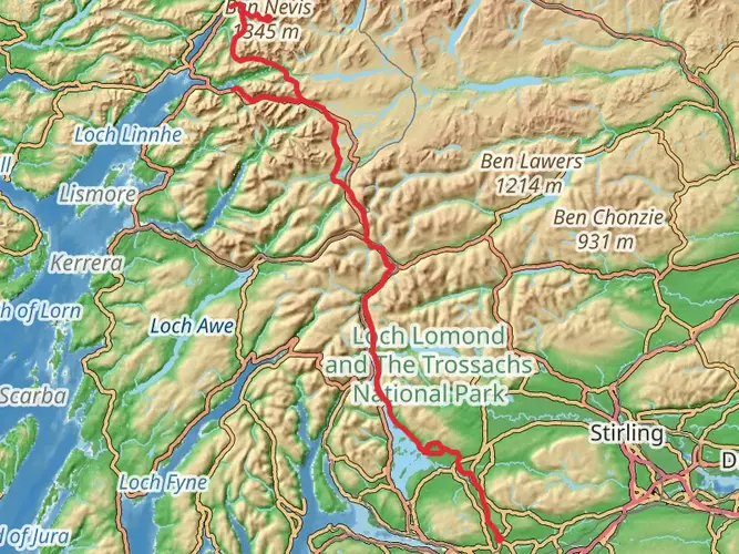
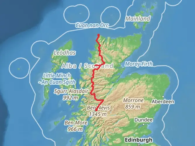
The East Highland Way is a captivating long-distance footpath that weaves through the heart of the Scottish Highlands, offering hikers a unique blend of wild landscapes, serene lochs, and historical intrigue. Spanning approximately 132 kilometers (82 miles), with an elevation gain of around 1400 meters (4593 feet), this trail promises an immersive experience into Scotland's rugged beauty.
Getting to the Trailhead
The journey begins near Fort William, a town well-connected by public transport. Trains and buses frequently service Fort William from major cities like Glasgow and Edinburgh. If you're driving, you can find parking in the town, which is a convenient base to start your trek. The trailhead itself is easily accessible from the town center, making it a straightforward starting point for your adventure.
Navigating the Trail
As you embark on the East Highland Way, you'll traverse a variety of terrains, from forested pathways to open moorlands. The route is not officially waymarked, so carrying a reliable navigation tool like HiiKER is essential to stay on track. The app will help you navigate through the less defined sections and ensure you don't miss any of the trail's highlights.
Landmarks and Scenery
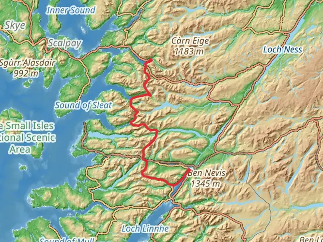
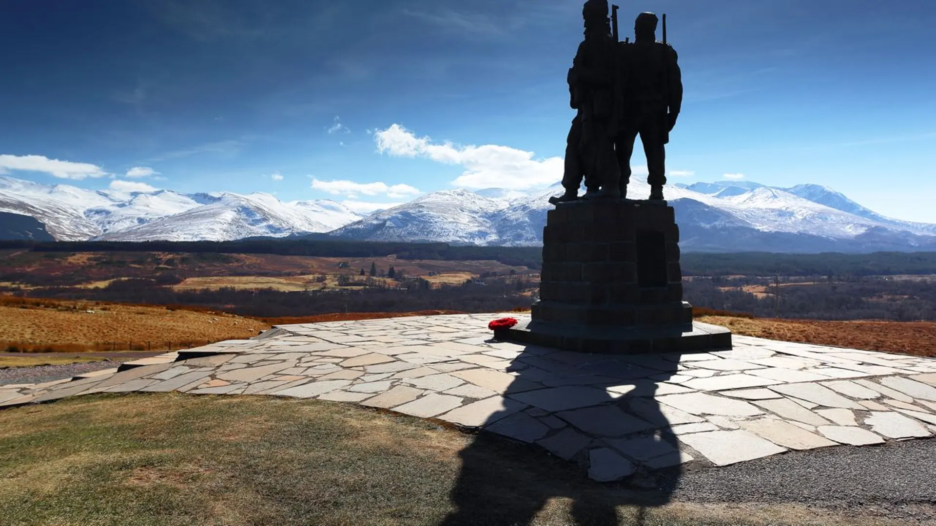
The trail offers a feast for the senses, with the majestic Ben Nevis, the UK's highest peak, looming in the background as you set off. You'll pass by the enchanting Leanachan Forest and the tranquil shores of Loch Laggan. Around the halfway mark, near Laggan, you'll find the ruins of Pictish forts, remnants of Scotland's ancient inhabitants.
Continuing on, the path takes you through the picturesque village of Newtonmore, where you can explore the Highland Folk Museum for a glimpse into the region's past. As you approach the final stretch, the trail meanders through the Cairngorms National Park, a haven for wildlife enthusiasts, where red squirrels, golden eagles, and red deer are often sighted.
Historical Significance
The East Highland Way passes through a landscape steeped in history. From the ancient Caledonian forests to the battlefields of the Jacobite risings, every step tells a story. The route also intersects with the old Wade Roads, built in the 18th century to suppress the Highland clans after the Jacobite rebellions.
Preparation and Planning
Given the trail's medium difficulty rating, it's suitable for hikers with some experience. The best time to walk the East Highland Way is between May and October when the weather is milder. However, Scottish weather can be unpredictable, so waterproof gear and layers are essential. Plan for accommodations in advance, as the trail passes through remote areas with limited services.
Conclusion
In conclusion, the East Highland Way is a journey through the heart of the Scottish Highlands, rich with natural beauty and historical depth. With careful planning and a spirit of adventure, it's a trail that offers a truly memorable hiking experience.

What to expect?
Activity types
Frequently asked questions
How long does it take to hike the East Highland Way from Fort William to Aviemore?
The East Highland Way is 131.77 km long, so most hikers treat it as a 6 to 7 day walk. A common stage breakdown is Fort William to Spean Bridge, then Inverlair, Feagour, Laggan, Newtonmore, Kincraig, and Aviemore, with daily distances ranging from about 8.5 km to 34 km.
Where does the East Highland Way start and finish?
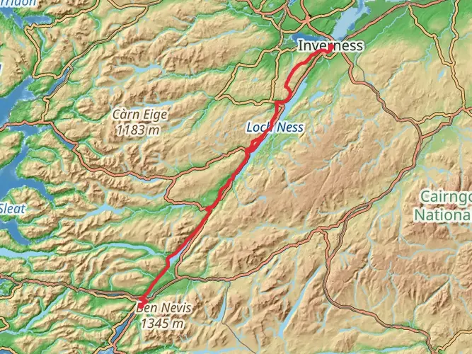
The East Highland Way runs from Fort William in Lochaber to Aviemore in the Cairngorms, linking the western Highlands with Badenoch and Strathspey. It is often described as a route connecting the West Highland Way and Great Glen Way at Fort William with the Speyside Way at Aviemore.
Is the East Highland Way waymarked and easy to follow?
The East Highland Way is not a fully waymarked National Trail, and only short sections are signposted. Much of the route follows forestry tracks and clear paths, but there are also tarmac stretches, pathless sections, and burn or river crossings, so reliable navigation is important.
How difficult is the East Highland Way and what is the hardest section?
The East Highland Way is generally rated medium, with 1,446 m of total ascent spread across 131.77 km. The toughest section is widely considered to be Laggan to Newtonmore through remote Glen Banchor, where there are three river crossings that can become impassable in spate conditions.
Can the East Highland Way be reached by public transport?
Yes. Both ends of the East Highland Way have strong public transport links: Fort William and Aviemore are both served by long-distance rail and bus services. Intermediate access is more limited, though Spean Bridge has rail and bus links, Tulloch has a rail stop, and Newtonmore and Kingussie are also connected by rail and bus.
Are there places to stay along the East Highland Way, or is camping necessary?
The East Highland Way has accommodation in Fort William, Spean Bridge, Laggan, Newtonmore, Kingussie, Kincraig, and Aviemore, but the central section is much more remote. From around Inverlair to Pattack there are no facilities, so that stretch often requires careful planning, a pickup arrangement, or camping.
What landscapes and landmarks does the East Highland Way pass?
The East Highland Way passes beneath Ben Nevis near the western end, then crosses forestry, lochside tracks, open moorland, and quieter mountain country before reaching the edge of the Cairngorms. Notable scenery along the route includes Leanachan Forest, Loch Laggan, Glen Banchor, Inshriach Forest, and views toward the Creag Meagaidh group and the Cairngorm mountains.
Comments and Reviews
User comments, reviews and discussions about the East Highland Way, Scotland.
4.67
average rating out of 5
48 rating(s)