Download
3D Flyover
Add to list
More
4.8 km
~1 hrs 13 min
164 m
Out and Back
“A short, rugged wander through bog and sandstone to a hidden loch beneath Assynt’s dramatic peaks.”
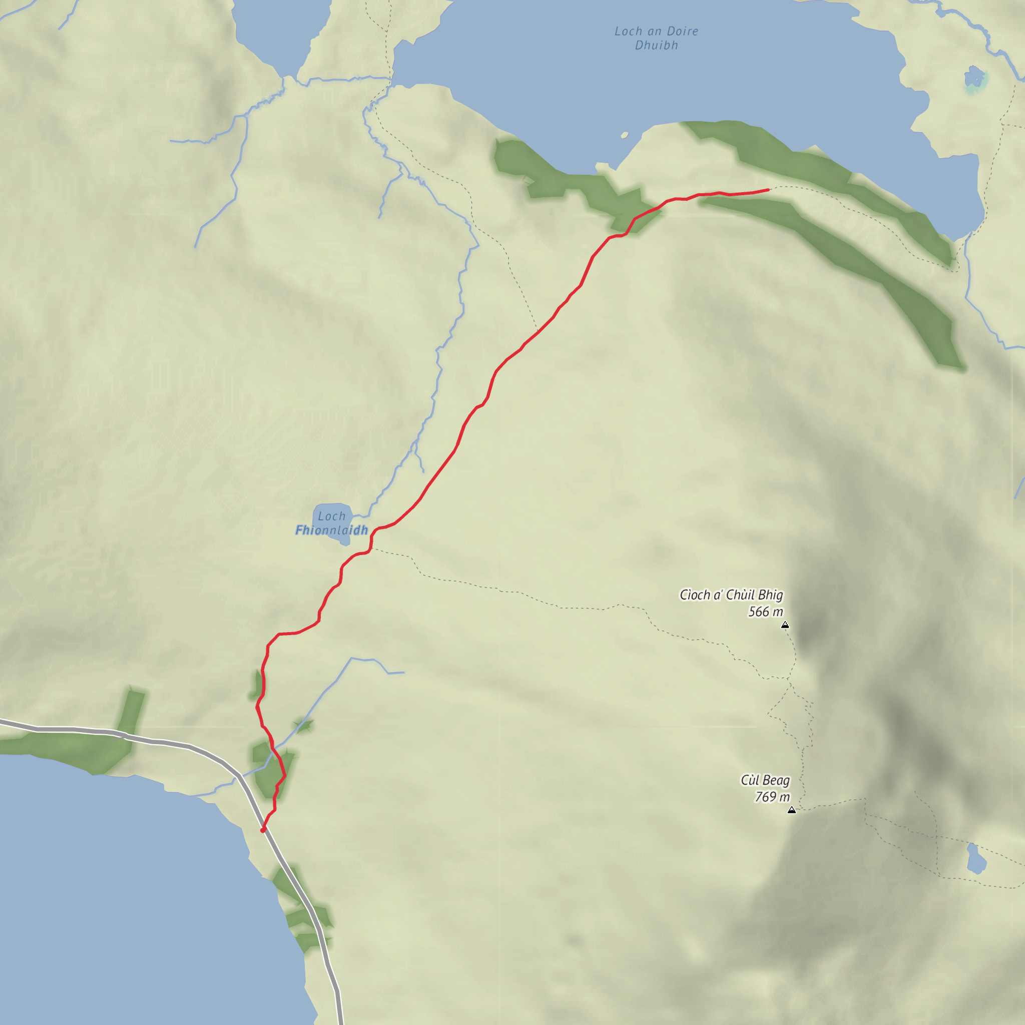
This is a short but very atmospheric out-and-back into the Inverpolly/Assynt landscape, leading from the shores of Loch Lurgainn to Loch an Doire Dhuibh. At around 5 km / 3.1 miles with roughly 200 m / 656 ft of ascent, it sits well in the medium category: not especially long, but often rough underfoot, pathless or faint in places, and very exposed to weather despite the modest distance. The start is best described as the roadside parking and passing-place area on the single-track B869 near the east end of Loch Lurgainn, close to the Stac Pollaidh / Inverpolly area, north of Ullapool. Sources describing access to this side of Loch Lurgainn place parking on the roadside or in passing places near the loch, with Stac Pollaidh’s well-known parking area nearby on the same road. (masarnenramblers.com)
From the roadside, the route heads away from the loch into a wild basin of rock, peat, heather and scattered burns. The first section is usually the trickiest for route-finding because the ground can be wet and the trod may be intermittent. Expect boggy patches, deer tracks that can mislead, and short uneven rises rather than a single steady climb. Even though the total ascent is only about 200 m / 656 ft, it can feel more strenuous than the numbers suggest because the terrain is broken and often soft. HiiKER is the best tool to have ready here, especially if mist drops over the moor or if the path fades in heather. The landscape opens quickly behind you, with Loch Lurgainn spreading out below and the unmistakable sandstone profile of Stac Pollaidh dominating the skyline. Accounts of this area repeatedly note the rough, wet approach and the strong views back over Loch Lurgainn and Stac Pollaidh. (walkhighlands.co.uk)
Terrain and route character
After the initial rise from Loch Lurgainn, the route crosses low moorland and a shallow ridge before easing toward Loch an Doire Dhuibh. This is classic north-west Highland terrain: glaciated knolls, peat hags, waterlogged hollows and slabs of Torridonian sandstone. There may be sections where the line on the ground is little more than a worn passage through heather, so progress can be slower than expected for such a short walk. In wet weather, burns can swell and the peat can become energy-sapping; after dry spells, the same ground is much easier and the route feels far more straightforward. Descriptions of the crossing between Loch Lurgainn and Loch an Doire Dhuibh mention a low moorland ridge and a gentle but noticeable rise before descending again toward the loch. (songofthepaddle.co.uk)
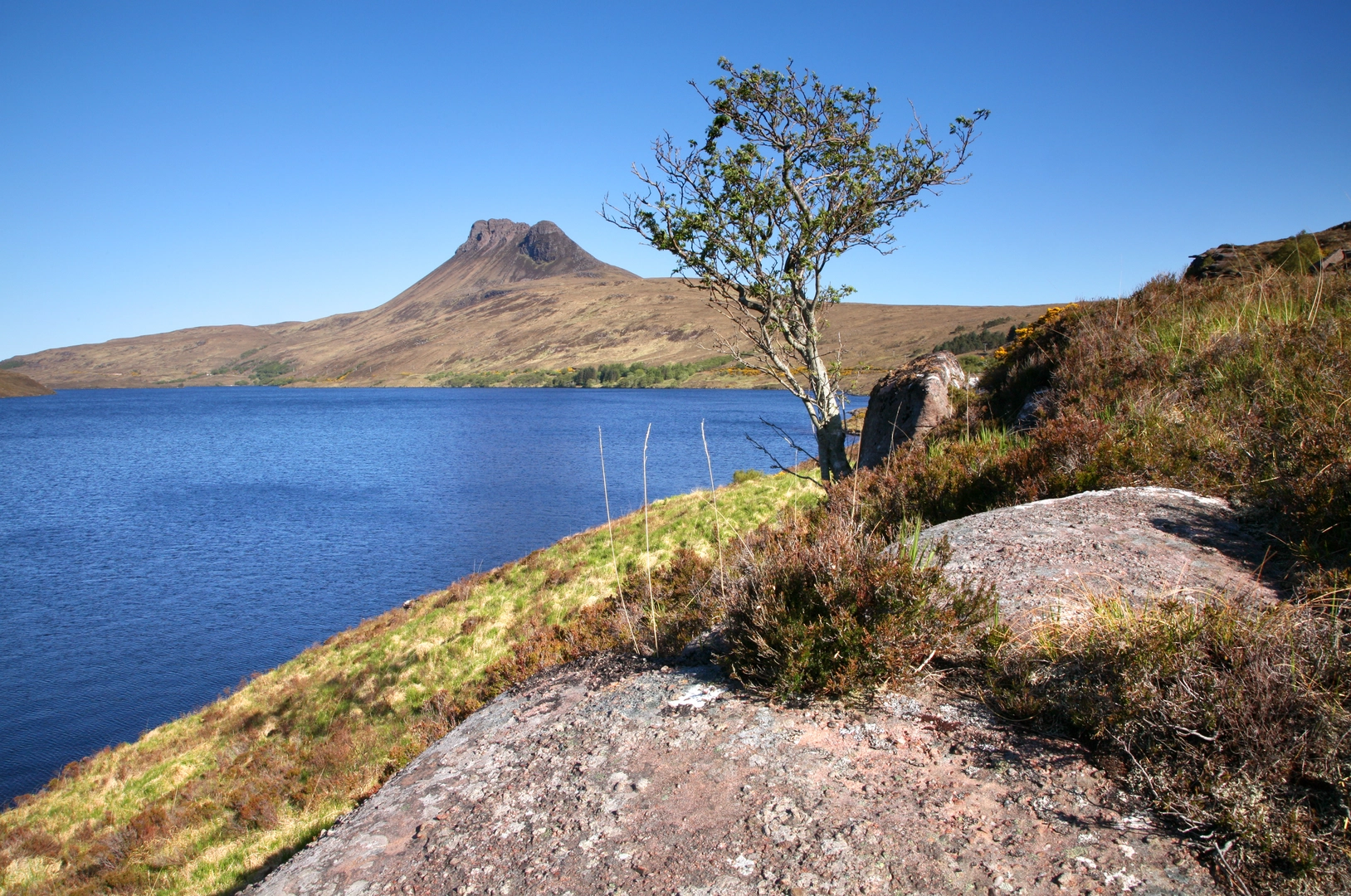
The reward is the arrival at Loch an Doire Dhuibh, a dark, beautifully set loch enclosed by some of the most distinctive mountains in Assynt and Inverpolly. The setting feels remote far beyond the mileage. To the west and south-west are views toward Stac Pollaidh; nearby stand Cùl Beag and Cùl Mòr, and the wider district is a maze of lochs and rocky hills shaped by ancient geology and glaciation. Loch an Doire Dhuibh is noted as being surrounded by other lochs, with Inverpolly Forest to the west and Drumrunie Forest to the southeast, and with major peaks including Stac Pollaidh and Cùl Beag close by. (en.wikipedia.org)
Landmarks, nature and wildlife
The main landmarks are the lochs themselves and the surrounding inselberg mountains. Loch Lurgainn is one of the most photogenic waters in the region, and as you gain height the changing angles across its inlets and islands become a major feature of the walk. Loch an Doire Dhuibh has a quieter, more enclosed character, with a darker, more intimate feel than the broader water behind you. The contrast between open views back to Loch Lurgainn and the more hidden basin of Loch an Doire Dhuibh is one of the
Comments and Reviews
User comments, reviews and discussions about the Loch An Doire Dhuibh from Loch Lurgainn, Scotland.
average rating out of 5
0 rating(s)
