Download
3D Flyover
Add to list
More
25.2 km
~6 hrs 35 min
924 m
Out and Back
“From pine-scented woodland to stark, sweeping uplands, this is a rewarding Cairngorm journey for prepared hikers.”
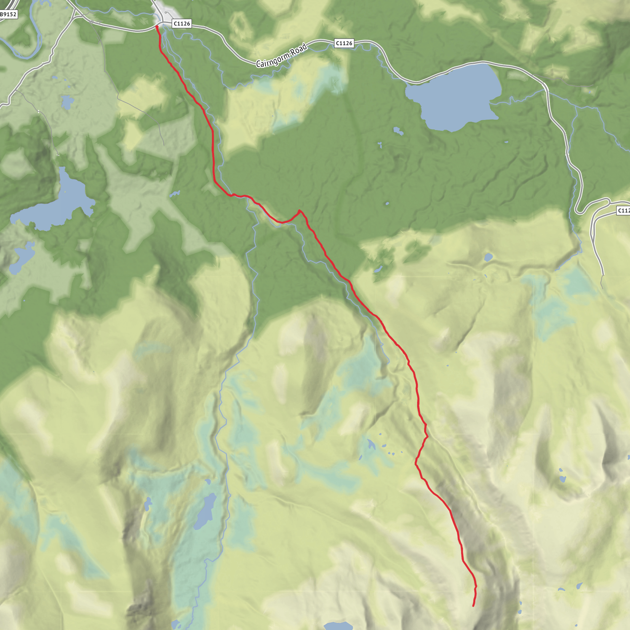
This is a long Cairngorm outing of about 25 km / 15.5 miles with roughly 900 m / 2,950 ft of ascent, starting from the Rothiemurchus side near Loch an Eilein Car Park, Rothiemurchus, Aviemore PH22 1QH, just south-east of Aviemore in the Cairngorms National Park. The route heads through the ancient pinewoods of Rothiemurchus, works its way into the upper reaches of the Lairig Ghru, and then climbs Sròn na Lairige, a broad, high shoulder with a notably wild and remote feel. Although the overall difficulty is often classed as medium, that rating assumes solid fitness, mountain judgment, and suitable weather; the distance alone makes it a serious day, and the upper mountain terrain can feel much harder in wind, rain, mist, or lingering snow. (outdoorscot.co.uk)
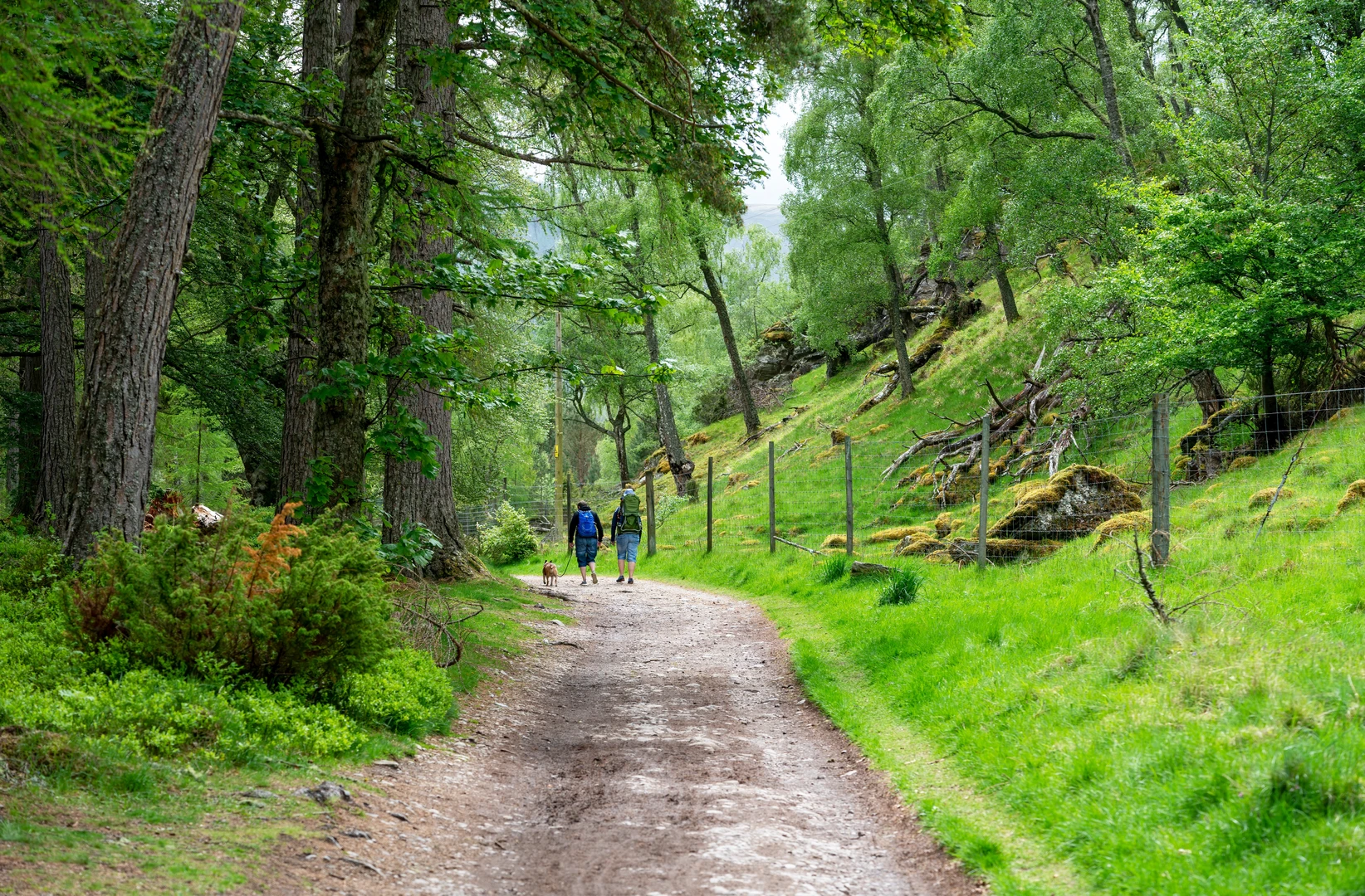
The opening section is usually the gentlest underfoot. From the Loch an Eilein side, the route uses estate tracks and forest paths through Rothiemurchus, one of the best-known remnants of the ancient Caledonian pine forest. Early on, expect a mix of Scots pine, heather, blaeberry, and open glades, with the walking generally straightforward as you build distance rather than height. This lower ground is rich in wildlife habitat, and the area is especially important for species such as crested tit and capercaillie, both closely associated with native pinewoods. Because capercaillie are highly sensitive to disturbance, sticking to main paths and keeping noise low is especially important in the breeding season. (cairngorms.co.uk)
Through Rothiemurchus Forest
For the first several kilometres, the route feels more like a forest expedition than a mountain climb. The tracks are usually clear, but this is a big landscape with many junctions and side paths, so careful route-following matters even before the open hill begins. If you are planning digitally, use HiiKER to check junctions, distances between landmarks, and your line of travel before the route leaves the easier estate ground. Around Loch an Eilein and the surrounding woods, there is also a strong sense of place: this estate has been associated with the Grant family since the 1540s, and the wider Rothiemurchus area has long been shaped by forestry, sporting use, and Highland estate history. (rothiemurchus.net)
A notable nearby landmark is Loch an Eilein, famous for its island castle ruin. Even if the main line of the hike does not linger there for long, it is one of the defining features of the approach area and adds a distinctly historic character to the start. The ruin is one of the best-known sights in Rothiemurchus, and the loch itself sits in exceptionally scenic woodland. (rothiemurchus.net)
Into the Lairig Ghru and the Climb to Sròn na Lairige
As the route pushes deeper beyond the forest, the character changes steadily. Estate tracks give way to rougher mountain paths, and the sense of remoteness increases. The Lairig Ghru is one of Scotland’s classic mountain passes, cutting through the central Cairngorms and historically serving as a major route through this high country. Approaching Sròn na Lairige from this side means gaining access to a landscape of broad glens, stony paths, burns, and increasingly open mountain views. (en.wikipedia.org)
The climb onto Sròn na Lairige is where the day becomes more demanding. The ascent is sustained rather than technical, but it can feel steep in places, especially after the long approach. Underfoot, expect a combination of constructed path, eroded sections, loose stone, and higher up, more exposed mountain ground. In clear weather, the expanding views are a major reward, with the upper Cairngorm massif dominating the skyline and the forested Rothiemurchus lands spreading far below. In poor visibility, however, this broad upland terrain can become confusing, and the transition from path to more open ground needs attention. This is the point where strong navigation becomes essential, and HiiKER is the right tool to have prepared in advance for bearings, route confirmation, and distance-to-return checks. (wanderlog.com)
The summit area itself is not about dramatic rock architecture so much as scale, exposure, and position.
Surfaces
Unknown
Gravel
Comments and Reviews
User comments, reviews and discussions about the Sron na Lairige via Rothiemurchus, Scotland.
average rating out of 5
0 rating(s)
