Download
Preview
Add to list
More
23.9 km
~2 days
1641 m
Multi-Day
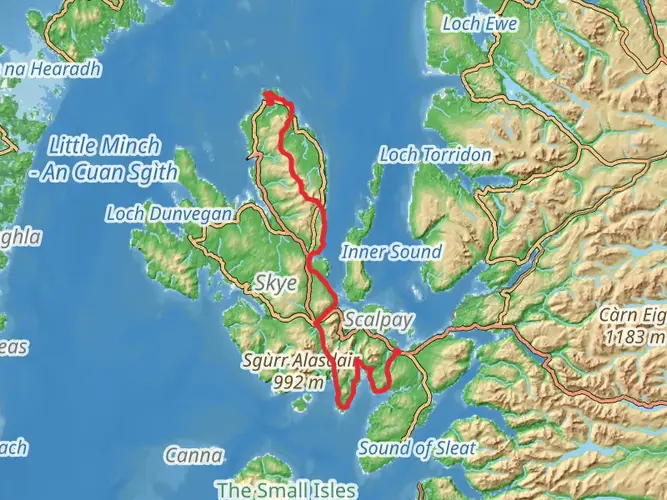
The The Trotternish Ridge is a 23.9 km trail that starts in , Highland, Scotland. Based on our data, the hike is graded as Difficult. For information on how we grade trails, please read measuring the difficulty of a hiking trail on hiiker. Also, check our latest community posts for trail updates. This hike can be completed in approx 7 hrs 31 mins. Caution is advised on trail times as this depends on multiple variables. For more info read about how we calculate hike time.

What to expect?
Activity types
Frequently asked questions
How long does The Trotternish Ridge hike take to complete?
The Trotternish Ridge is a 23.87 km difficult multi-day hike with 1,641 m of climbing, so it is usually treated as a full-day push for very strong hikers or an overnight route for most parties. On the ground, the ridge is long, committing, and exposed to Skye weather, which is why many walkers split it into two days.
Where do you start and finish The Trotternish Ridge on the Isle of Skye?
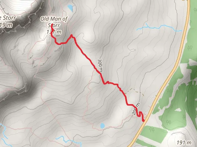
A common north-to-south line starts near Flodigarry on the Trotternish peninsula and finishes near the Storr area north of Portree. Some walkers extend farther north toward Duntulm or Rubha Hunish, but the classic ridge traverse links the high ground above the Quiraing with the southern end of the ridge near the Storr.
Is The Trotternish Ridge a hard hike?
Yes. The Trotternish Ridge is rated difficult, and the numbers back that up: 23.87 km with 1,641 m of elevation gain. The ridge is known for sustained ascent and descent, rough ground, and long sections with little or no built path, so it is much more demanding than a straightforward hillwalk of the same distance.
Can The Trotternish Ridge be done as a one-day hike or is it better as an overnight?
Both are possible, but the route is commonly done as an overnight because of its length, elevation gain, and the effort of moving across pathless ridge terrain. At 23.87 km and 1,641 m of ascent, it sits firmly in the category where many hikers prefer to camp or bivvy high on the ridge rather than rush the traverse in a single day.
Where can you park for The Trotternish Ridge hike?
Parking is commonly used near the Flodigarry side for the northern approach and at the Storr car park for the southern end of the traverse. The Storr lot is a formal parking area with toilets and other visitor facilities, and it is often used by hikers arranging a one-way crossing of the ridge.
Is there public transportation for The Trotternish Ridge?
Yes. Bus links on the Trotternish peninsula make a linear hike possible without a car shuttle. Walkers commonly use a bus from Portree toward the Flodigarry or Loch Langaig side to start, then finish near the Storr, where there is also a roadside bus stop by the car park area.
What is the terrain like on The Trotternish Ridge?
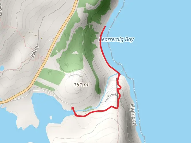
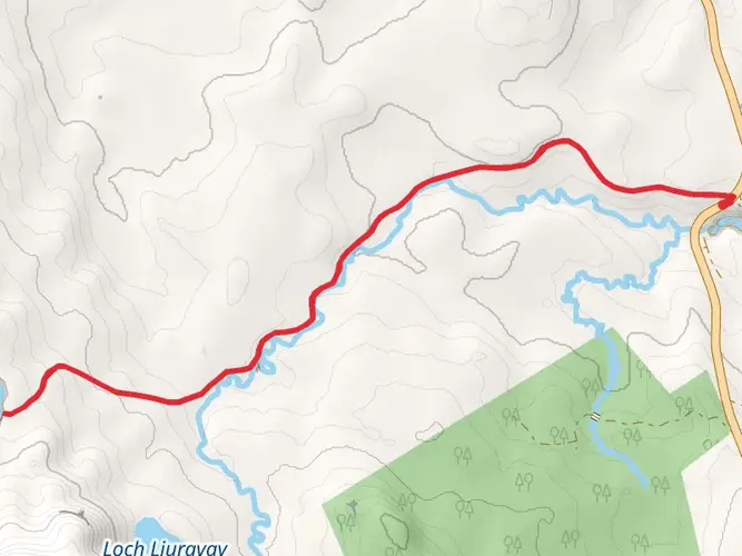
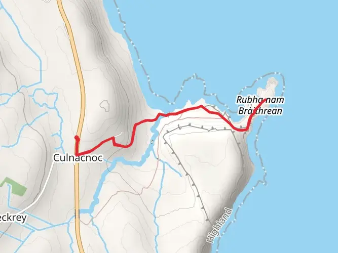
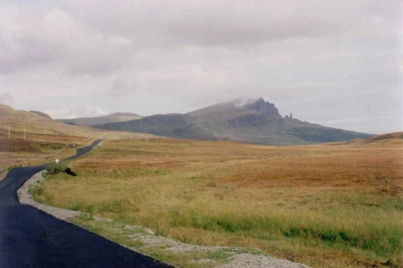
The terrain on The Trotternish Ridge is serious mountain ground rather than a simple trail. Much of the route follows firm grassy ridge, but there are also steep climbs and descents, uneven moorland, and long sections where there is no clear path, which adds to the difficulty even when the weather is good.
What is the best time of year to hike The Trotternish Ridge?
Late spring through early fall is usually the best window for The Trotternish Ridge because daylight is longer and the ridge is easier to manage in stable weather. Even in summer, Skye can bring strong wind, low cloud, and wet ground, and the route is known for boggy sections, so clear forecasts matter more here than on lower-level walks.
Comments and Reviews
User comments, reviews and discussions about the The Trotternish Ridge, Scotland.
4.64
average rating out of 5
22 rating(s)