Download
Preview
Add to list
More
4.6 km
~1 hrs 23 min
279 m
Out and Back
“A short, history-tinged climb delivers wild Pentland drama, sweeping views, and a bracing sting.”
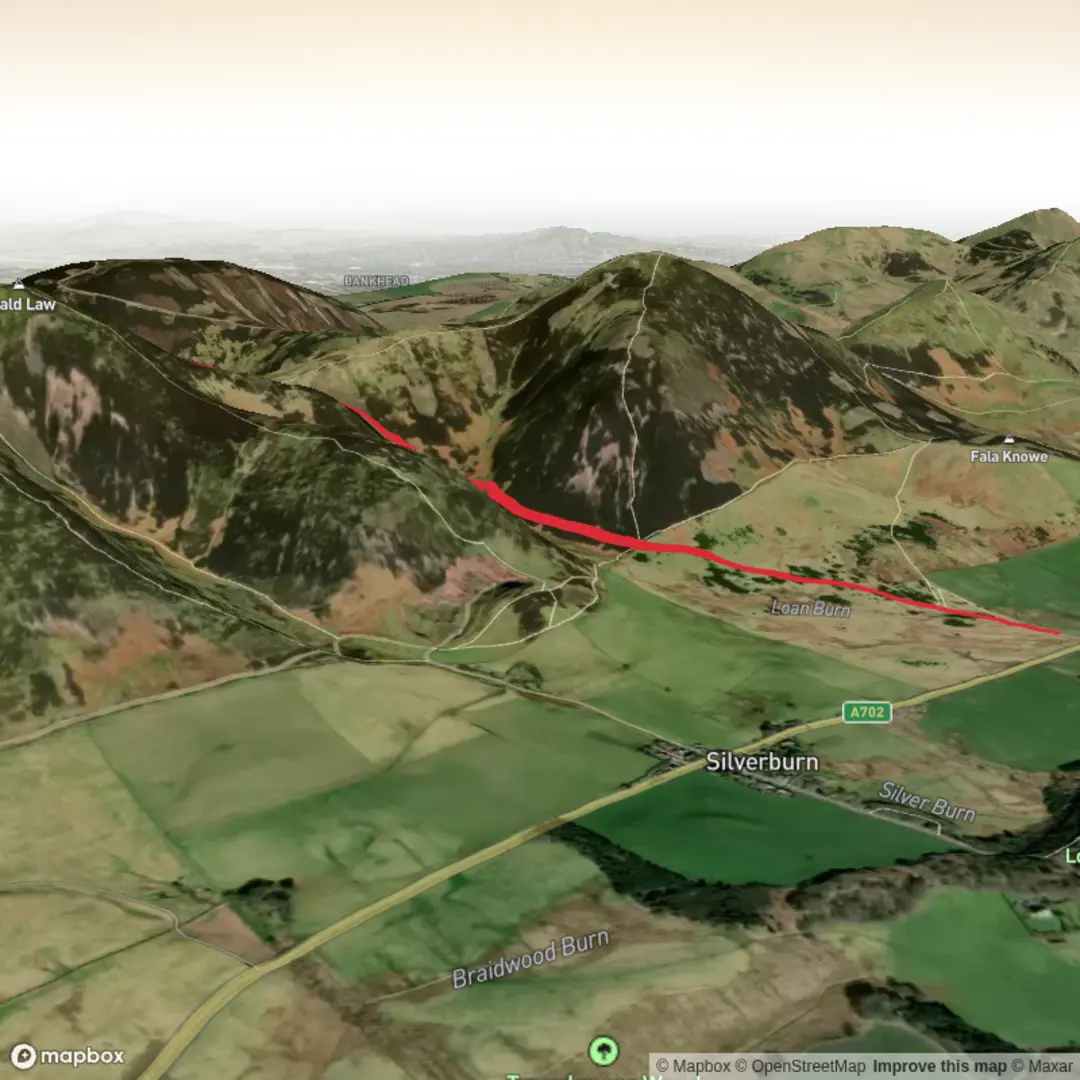
This short but demanding route climbs the highest hill in the Pentland Hills, giving a lot of reward for roughly 5 km / 3.1 miles of walking. Even though the mileage is modest, the ascent of about 300 m / 985 ft is concentrated enough to justify the difficult rating, especially in wet or windy weather. The walk starts from the Kirk Road End lay-by on the edge of the Pentland Hills Regional Park, the access point commonly used for Old Kirk Road approaches in the southern Pentlands. The nearest practical landmark is Kirk Road End near Penicuik, Midlothian, on the south-east side of the range. (pentlandhills.org)
From the start, the route follows the line of Old Kirk Road, an old hill track that once linked communities in Logan Glen with churchgoing routes toward Penicuik. That historical thread gives the walk more character than a simple summit out-and-back: you are not just climbing a hill, but using a route with a long local purpose across the moorland. The Pentland Hills themselves have deep cultural roots and a long history of farming, drove routes, and upland travel, while Scald Law stands out as the range’s highest point at 579 m / 1,900 ft. The hill is formed from Devonian volcanic rock, which helps explain the broad, sturdy shape of the summit and surrounding ridges. (southlanarkshire.gov.uk)
What the route feels like
The opening section is usually the most straightforward underfoot, with a clear hill path or track leading away from the roadside and into open country. Expect a steady build rather than an immediate all-out climb, but the gradient soon becomes more serious as the route leaves the lower ground and works uphill toward the broad shoulder of Scald Law. On a route of this length, there is not much time to “warm into it”; the climbing begins early and continues for most of the outward leg.
A useful way to think about the walk is in three parts:
- First 1 to 1.5 km / 0.6 to 0.9 miles: gradual to moderate climbing on a defined track.
- Middle 1 to 1.5 km / 0.6 to 0.9 miles: steeper uphill work as the route gains the open hillside.
- Final approach to the summit: the ground can feel more exposed, with rougher, rockier patches and stronger wind.
Because the route is short, many hikers underestimate it. The challenge comes from the combination of steep ascent, exposure, and fast-changing hill weather, not from distance alone. In dry, calm conditions it is a strong half-day hillwalk; in mist, rain, or winter conditions it becomes much more serious. Pentland Hills guidance stresses that walkers should carry warm and waterproof clothing, a torch, and map-based navigation, and be prepared for rapid weather changes. If you are planning digitally, use HiiKER for route planning and mapping support. (pentlandhills.org)
Summit and views
Scald Law’s summit is broad and high enough to feel like a true hilltop rather than a minor viewpoint. The top is marked by a cairn, and on a clear day the panorama is one of the best in the Pentlands: ridges rolling west and south, the rest of the Pentland chain spread around you, and long views back toward Edinburgh and beyond. Walkhighlands notes the summit as a superb viewpoint in all directions, which matches the hill’s status as the highest point in the range. (walkhighlands.co.uk)
The descent is by the same general line, and that is where many slips happen. Short steep routes often feel harder on the knees on the way down than on the way up. If the path is greasy, peaty, or loose with small stones, allow extra time and keep enough energy in reserve for the return.
Terrain, hazards, and what to look out for
Underfoot, expect a mix of hill track, worn earth path, grass, and occasional rocky sections. After rain, parts of the route can become slick, and exposed sections can feel much harder if strong wind is blowing across the slope. The summit area is particularly open, so low cloud can reduce visibility quickly.
Main things to prepare for:
- Steep gradients for a large part of the climb.
- Exposure to wind on upper slopes and summit.
- Mud and slippery ground after wet weather.
- Poor visibility in mist, which can make the broad upper ground less obvious.
- Cold conditions even when lower ground feels mild.
The

Surfaces
Unknown
Dirt
Gravel
Comments and Reviews
User comments, reviews and discussions about the Scald Law via Old Kirk Road, Scotland.
average rating out of 5
0 rating(s)