Download
3D Flyover
Add to list
More
40.3 km
~2 days
809 m
Multi-Day
The Isla Way is a 40.3 km trail that starts in , Moray, Scotland. Based on our data, the hike is graded as Easy. For information on how we grade trails, please read measuring the difficulty of a hiking trail on hiiker. Also, check our latest community posts for trail updates. This hike can be completed in approx 2 days. Caution is advised on trail times as this depends on multiple variables. For more info read about how we calculate hike time.

What to expect?
Activity types
Frequently asked questions
How long is the Isla Way in Moray, and how many days does the Isla Way usually take?
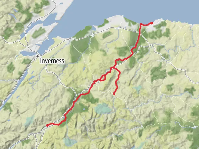
The Isla Way is 40.29 km long with 809 m of total elevation gain, so it sits in the range many walkers split over two days. Strong walkers can cover it in a long day, but the route is classed as a multi-day hike and links Dufftown and Keith through the River Isla valley.
Where does the Isla Way start and finish in Moray, Scotland?
The Isla Way links the distillery towns of Dufftown and Keith in Moray. Commonly used end points are the Old Clock Tower in Dufftown and Reidhaven Square in Keith, with the route following the valley of the River Isla between the two towns. ([morayways.org.uk](https://www.morayways.org.uk/routes/the-isla-way/?utm_source=openai))
Is the Isla Way an easy walk, and what is the terrain like on the Isla Way?
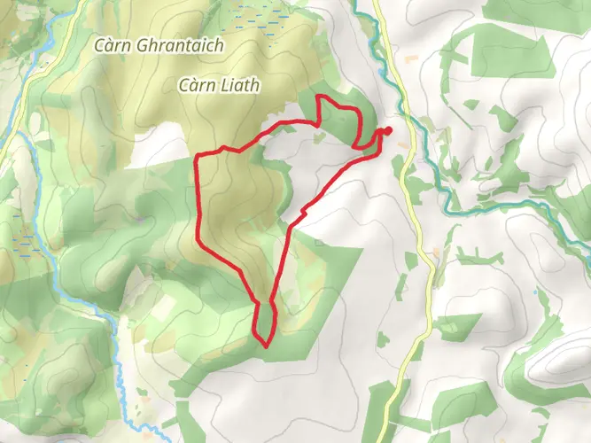
The Isla Way is generally considered easy, but it is still a 40.29 km route with 809 m of climbing, so the full distance requires stamina. Terrain includes woodland trails, field paths, narrow tarmac roads, pavements in Dufftown and Keith, some steps at Toon Widd, and a roadside section on the B9014 near Drummuir. ([morayways.org.uk](https://www.morayways.org.uk/routes/the-isla-way/?utm_source=openai))
Can the Isla Way be reached by public transport at Dufftown or Keith?
Yes. The Isla Way is set up well for point-to-point walking because it connects Dufftown and Keith, and public transport information is commonly given for the route. One established start option is near the car park for the Keith and Dufftown Railway on the Dufftown side, which helps with logistics for walkers not using two cars. ([walkhighlands.co.uk](https://www.walkhighlands.co.uk/moray/isla-way.shtml?utm_source=openai))
Where can you park for the Isla Way in Dufftown or Keith?
Parking for the Isla Way is available in both trail towns. Commonly referenced places are around the Old Clock Tower in Dufftown and Reidhaven Square in Keith, and there is also a car park by the Keith and Dufftown Railway near Dufftown that is often used as a practical starting point. ([cyclegrampian.co.uk](https://www.cyclegrampian.co.uk/trail/isla-way.html?utm_source=openai))
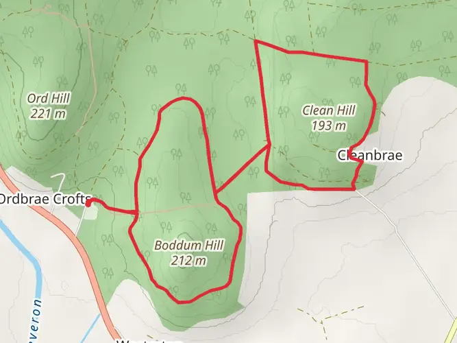
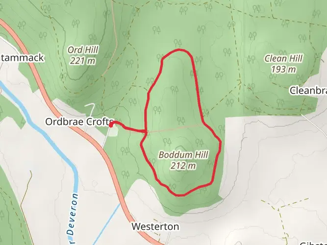
What towns and landmarks does the Isla Way pass on the way between Dufftown and Keith?
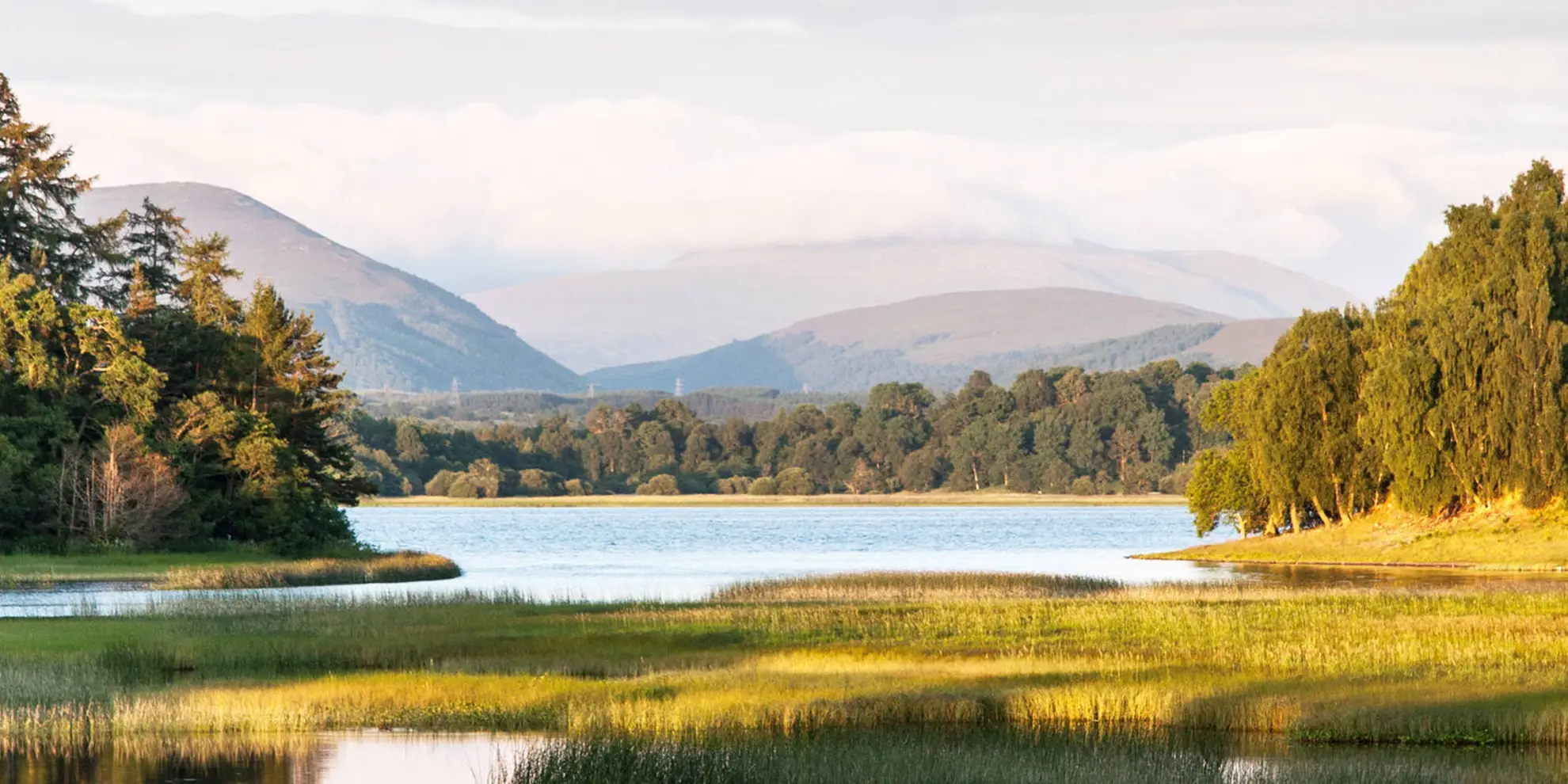
The Isla Way follows the River Isla valley from Dufftown toward Keith and passes through or near Loch Park and Drummuir. Along the way it is associated with places including Drummuir Castle, Botriphnie Kirk, and the woodland section at Toon Widd in Dufftown, giving the route a mix of river valley, village, and historic landmarks. ([morayways.org.uk](https://www.morayways.org.uk/routes/the-isla-way/?utm_source=openai))
Is the Isla Way suitable for families or less experienced walkers?
The Isla Way is one of the more approachable long walks in Moray because it is rated easy and uses a mix of paths, tracks, and minor roads rather than sustained mountain terrain. One section from Loch Park to Drummuir is described as all-abilities standard, though the full 40.29 km route is better broken into shorter stages for families or newer walkers. ([morayways.org.uk](https://www.morayways.org.uk/routes/the-isla-way/?utm_source=openai))
Comments and Reviews
User comments, reviews and discussions about the Isla Way, Scotland.
4.37
average rating out of 5
27 rating(s)