Download
3D Flyover
Add to list
More
157.6 km
~6 days
2066 m
Multi-Day
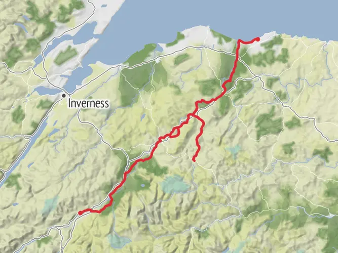
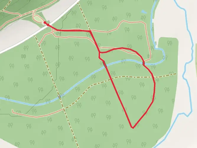
The Moray Way is a 157.6 km trail that starts in , Moray, Scotland. Based on our data, the hike is graded as Easy. For information on how we grade trails, please read measuring the difficulty of a hiking trail on hiiker. Also, check our latest community posts for trail updates. This hike can be completed in approx 6 days. Caution is advised on trail times as this depends on multiple variables. For more info read about how we calculate hike time.

What to expect?
Activity types
Frequently asked questions
How long is the Moray Way in Scotland and how many days does the Moray Way usually take?
The Moray Way is 157.62 km long with 2,066 m of total ascent, so it is a substantial multi-day circuit rather than a single-day walk. Many hikers split it into roughly 7 to 10 days, depending on daily mileage, because the route links the Dava Way, part of the Speyside Way, and the Moray Coast Trail around Moray.
Where does the Moray Way start and finish in Moray, Scotland?
The Moray Way is a circular route, so it can be started at several points, but Forres is one of the main gateways because it links directly with the Dava Way and the Moray Coast Trail. The full circuit also connects with the Speyside Way at Grantown-on-Spey and Garmouth, creating a loop through inland moorland, river country, and the Moray Firth coast.
Is the Moray Way difficult, and is the Moray Way suitable for beginner long-distance hikers?
The Moray Way is generally rated easy, which reflects its moderate overall climbing for a 157.62 km route and the fact that large sections follow established long-distance trails. Even so, it is still a long multi-day walk, and the combination of coastal sections, remote stretches on the Dava Way, and changing Scottish weather means it suits hikers who are comfortable with consecutive full walking days.
What kind of scenery and trail surfaces are on the Moray Way?
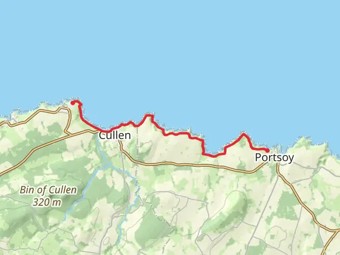
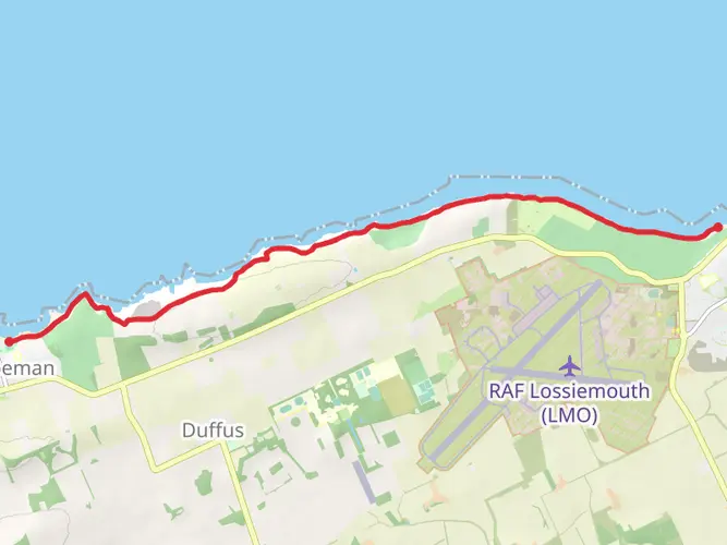
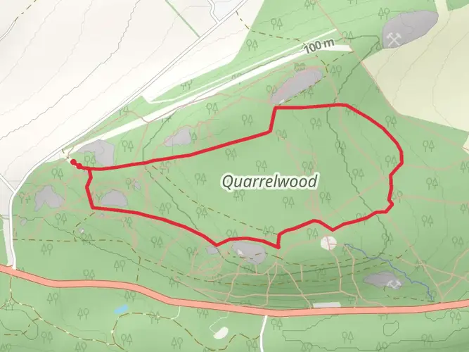
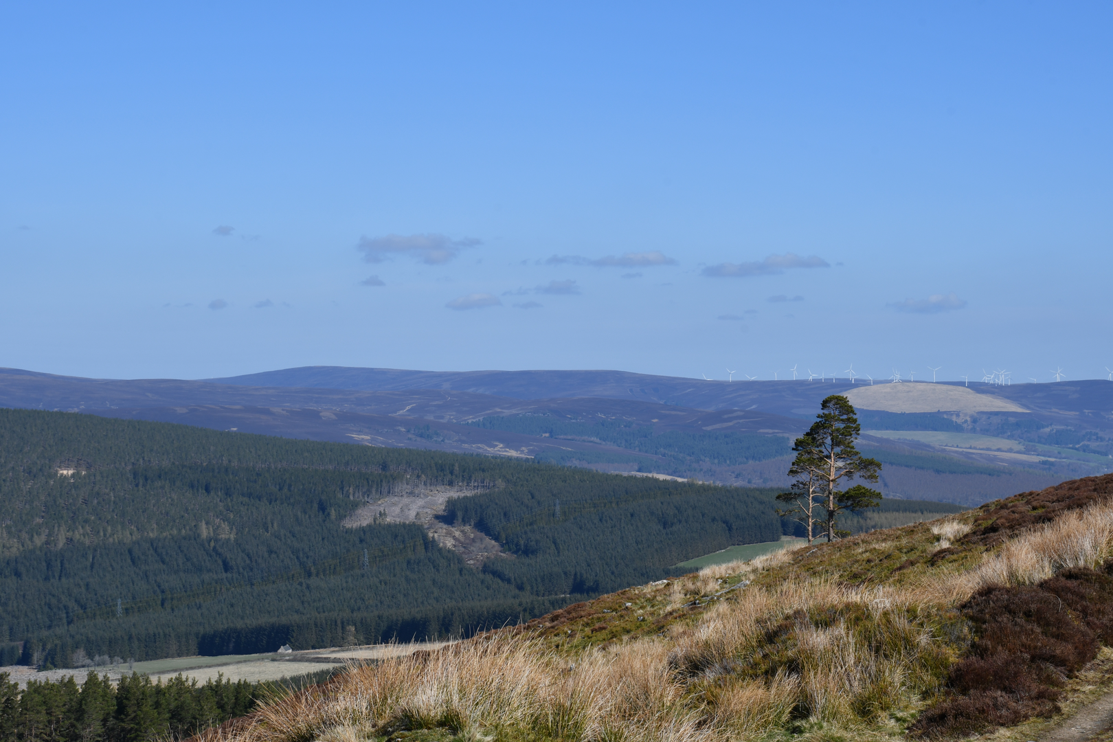
The Moray Way combines three distinct landscapes: the old railway line and moorland of the Dava Way, the River Spey corridor on the Speyside Way, and the cliffs, beaches, and fishing villages of the Moray Coast Trail. Underfoot, that means a mix of firm path, former railway trackbed, woodland trail, coastal path, and some road-linked sections between trail segments.
What are the main towns and landmarks on the Moray Way route?
Key places on the Moray Way include Forres, Grantown-on-Spey, Garmouth, Spey Bay, and Buckie, with the route also passing through the wider Speyside whisky region. Notable highlights named on the connected trails include Burghead on the coast, the River Spey, and the historic railway corridor that now forms the Dava Way between Forres and Grantown-on-Spey.
When is the best time of year to hike the Moray Way?
Late spring through early autumn is usually the best window for the Moray Way, when daylight is long and conditions on the coast, river paths, and moorland sections are generally more manageable. Summer offers the longest days for covering distance, while May, June, and September often give a good balance of milder temperatures and fewer weather-related disruptions on this 157.62 km circuit.
Comments and Reviews
User comments, reviews and discussions about the Moray Way, Scotland.
4.5
average rating out of 5
20 rating(s)