Download
3D Flyover
Add to list
More
12.7 km
~3 hrs 41 min
688 m
Point-to-Point
“A wild South Harris loop rises from flower-rich machair to airy summits and sweeping Atlantic views.”
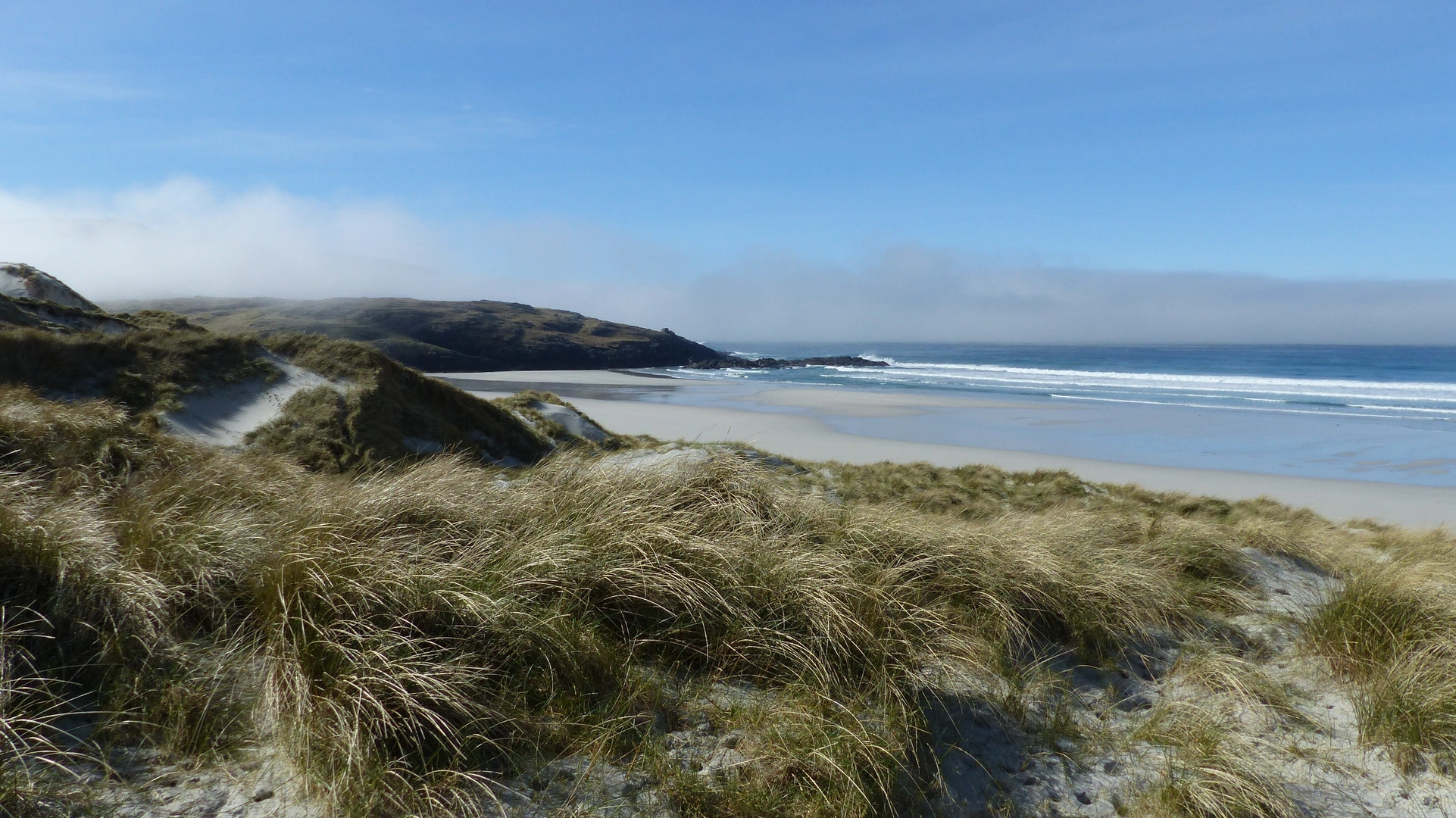
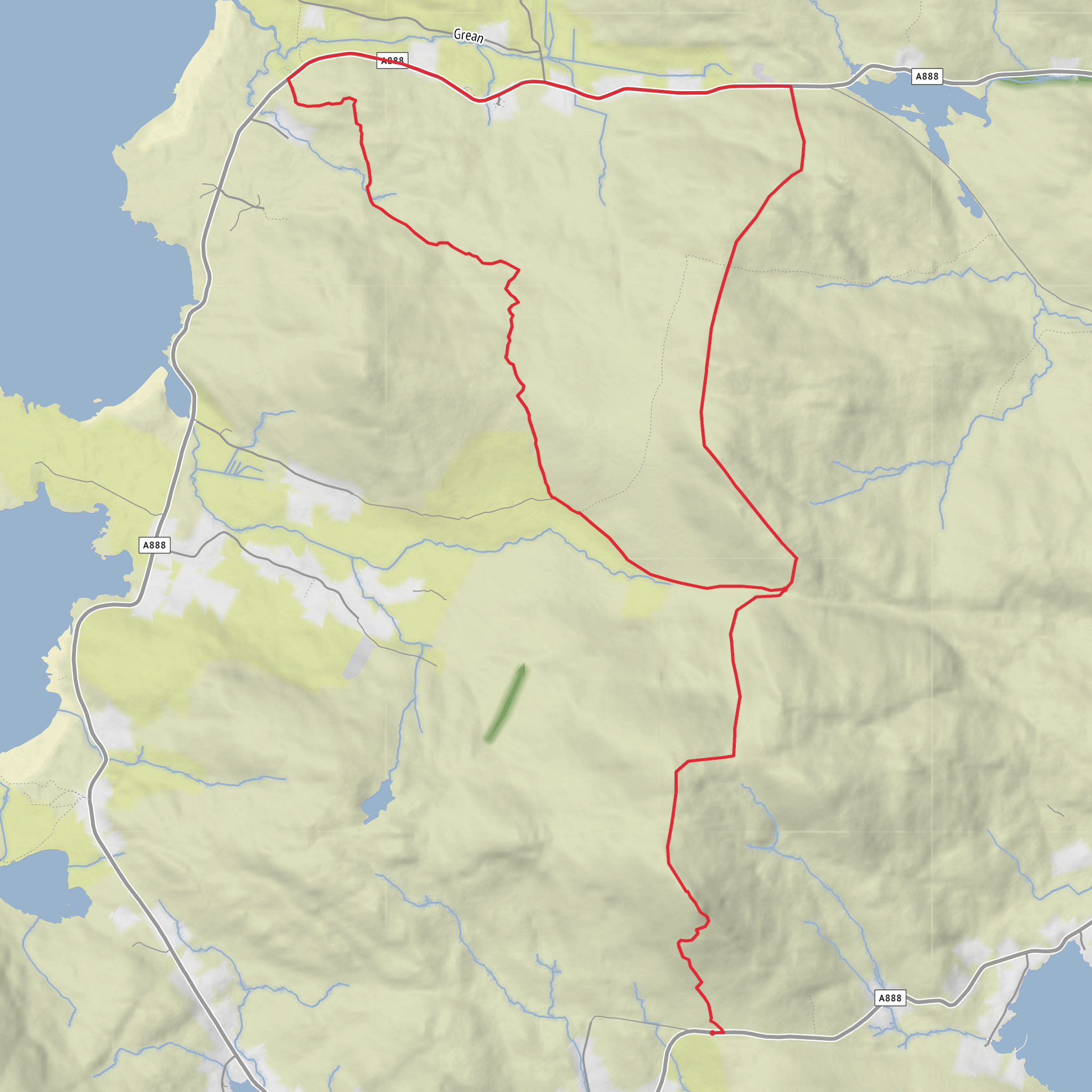
This 13 km (8.1 mile) loop on South Harris is a compact mountain-and-coast outing with roughly 700 m (about 2,300 ft) of ascent, combining a steep climb onto Heabhal with rougher upland ground toward Beinn Bhirisig and a visit to the prehistoric monument of Dun Bharpa. Expect a route that feels bigger than the numbers suggest: much of the terrain is exposed, often pathless or only faintly trodden, and the Atlantic weather can make the hillsides feel serious even in otherwise moderate conditions. The reward is a constantly changing panorama over the Sound of Harris, the west coast beaches, inland lochans, and the rugged spine of Harris beyond. The wider landscape of Lewis and Harris is known for its contrast between nutrient-rich coastal machair and stark rocky uplands, and that contrast is one of the defining pleasures of this walk. (nature.scot)
The route is generally best approached from the Northton/Taobh Tuath area on South Harris, near the road end northwest of Northton and the coastal headland of Rubh’ an Teampaill, a known landmark with roadside access used for local walks. If you are driving, Tarbert is the main service hub on Harris and the usual base before heading south by road; from there, follow the A859 toward Leverburgh and then the local roads toward Northton/Taobh Tuath. Parking in this part of Harris is typically informal roadside parking where space allows, so avoid blocking gates, passing places, or croft access. If using public transport, Tarbert is the key interchange for Harris bus services, and local services connect Tarbert with South Harris settlements, including the wider Northton area; check current island timetables before setting out because frequencies can be limited. HiiKER is the best tool to confirm the exact start point and route line before you go. (visitouterhebrides.co.uk)
The opening section is usually the gentlest underfoot, crossing lower coastal ground where machair, short grass, sandy soils, and crofted land create a softer introduction before the climb begins. Machair is one of the most distinctive habitats in the Hebrides: a shell-sand grassland shaped by wind, grazing, and traditional land use, often rich in wildflowers in summer and attractive to breeding birds and pollinators. On calm days this lower section can feel deceptively easy, but it is worth paying attention to wet patches, hidden hollows, and livestock. In spring and summer, birdlife can be active around the coast and croft land, and the area’s flower-rich grasslands can support species such as corn bunting and the great yellow bumblebee in suitable habitat. (nature.scot)
Climbing onto Heabhal
Once the route turns uphill, the character changes quickly. The ascent to Heabhal is the main physical test of the day, gaining a large share of the total 700 m (2,300 ft) over relatively short distance. You should expect steep grassy and rocky slopes, sections with little or no built path, and occasional boggier patches lower down before the ground firms up on rockier terrain. In dry weather the climb is straightforward but strenuous; in rain or strong wind it becomes much more demanding, especially where slick rock, peat, and heather combine. A medium difficulty rating is fair, but only if hikers are comfortable with route-finding on open hillside and with sustained climbing. (walkhighlands.co.uk)
As height is gained, the views broaden dramatically. South Harris is famous for the meeting of mountain, machair, and sea, and from the upper slopes you can often trace white beaches, offshore islets, and the broken coastline of the Sound of Harris
Surfaces
Unknown
Paved
Asphalt
Comments and Reviews
User comments, reviews and discussions about the Heabhal, Beinn Bhirisig and Dun Bharpa Loop, Scotland.
average rating out of 5
0 rating(s)
