Sannox Bay to Brodick Bay via Glen Sannox, Cir Mhor, Glen Rosa and Glenshurig Bridge
Download
3D Flyover
Add to list
More
15.4 km
~3 hrs 48 min
443 m
Point-to-Point
“A striking coast-to-coast crossing through wild glens and granite drama, ending gently at Brodick Bay.”
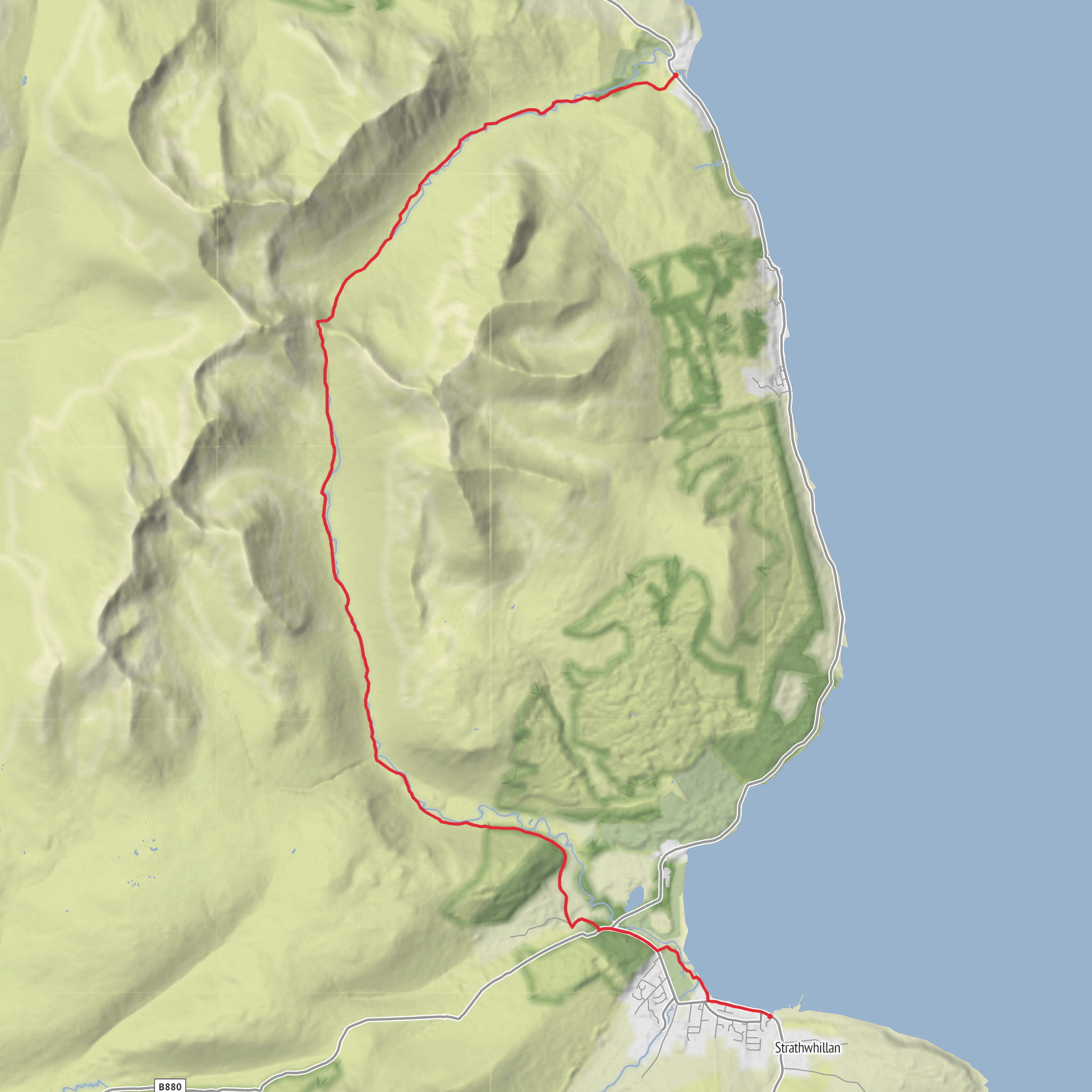
This point-to-point crossing of Arran links two very different sides of the island: the quieter, more rugged north around Sannox and the broader, more settled shoreline at Brodick. Over roughly 15 km / 9.3 miles with about 400 m / 1,300 ft of ascent, it is a medium-grade outing on paper, but it feels more serious than the numbers suggest because the route passes through remote mountain glens beneath Cìr Mhòr and then descends a long way through Glen Rosa before finishing near sea level at Brodick Bay. The terrain is varied rather than relentlessly steep, with coastal approach paths, glen tracks, rougher hill sections, stony and sometimes wet ground, and a long final descent. (walkhighlands.co.uk)
The start is near Sannox Bay and the Glen Sannox access lane by the Sannox car park and bus stop, a well-known trail access point on the A841 on the Isle of Arran. The finish is at Brodick Bay, near Brodick village and ferry port, the island’s main transport hub. Brodick is also the main bus interchange on Arran, which makes this route practical as a linear walk if you leave a car at one end or use the island bus network. (walkhighlands.co.uk)
By car, most walkers reach Arran by ferry and then drive to Sannox, where there is parking used for Glen Sannox walks; spaces can be limited in busy periods, so an early start is sensible. If arriving without a car, Brodick is the easiest gateway because it is the island’s ferry port and bus hub, and public transport can be used to reach Sannox before walking back south to Brodick. Ferry arrangements can change, and CalMac currently notes Brodick sailings from Troon on its Arran service information, so it is worth checking the latest sailing and bus connections before setting out. (calmac.co.uk)
What the route feels like
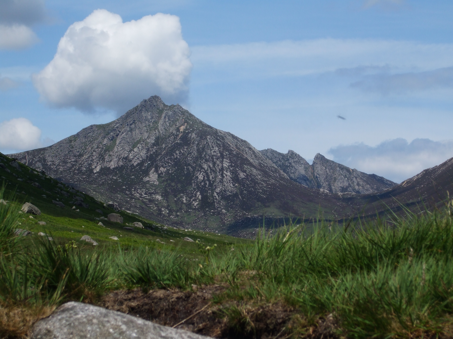
From Sannox, the route heads inland through Glen Sannox, where the landscape quickly shifts from coastal pasture and scattered buildings to a more enclosed mountain glen. Early on, the path passes features associated with older settlement and industry, including ruined mine workings noted on routes into the glen. The walking here is generally straightforward, with a clear path and a gentle build in height rather than an immediate climb. As the glen opens, the surrounding ridges become the main event, with the dramatic bulk of the north Arran hills closing in and the profile of Caisteal Abhail and nearby peaks dominating the skyline. (walkhighlands.co.uk)
The middle part of the walk is the most mountainous in character. Beneath Cìr Mhòr, the route enters the heart of Arran’s granite uplands, where paths can become rougher, wetter, and less forgiving underfoot. Even if the total ascent is moderate, this is the section where weather, visibility, and footing matter most. Expect loose stone in places, occasional boggy patches, and stretches where progress is slower than the distance alone would suggest. If low cloud drops onto the ridges, the mountain setting can feel much more committing, so route-finding should be checked carefully with HiiKER before and during the crossing. (walkhighlands.co.uk)
Once the route turns into Glen Rosa, the character changes again. The descent becomes longer and more flowing, with a much clearer sense of being funneled out of the mountains toward the coast. Glen Rosa is one of Arran’s classic glacial landscapes, a broad U-shaped valley with steep sides, corries, ridges, and striking rock architecture. One of the most memorable sights on this side is the Rosa Pinnacle, a distinctive tower of rock visible on the descent, while farther out the glen gradually softens into woodland, bridges, and easier tracks
Surfaces
Unknown
Unpaved
Asphalt
Gravel
Wood
Ground
Grass
Comments and Reviews
User comments, reviews and discussions about the Sannox Bay to Brodick Bay via Glen Sannox, Cir Mhor, Glen Rosa and Glenshurig Bridge, Scotland.
average rating out of 5
0 rating(s)
