Download
3D Flyover
Add to list
More
13.8 km
~3 hrs 32 min
468 m
Loop
“Airy moorland ridges above Brodick offer sweeping Arran views, rough ground, and a quietly demanding adventure.”
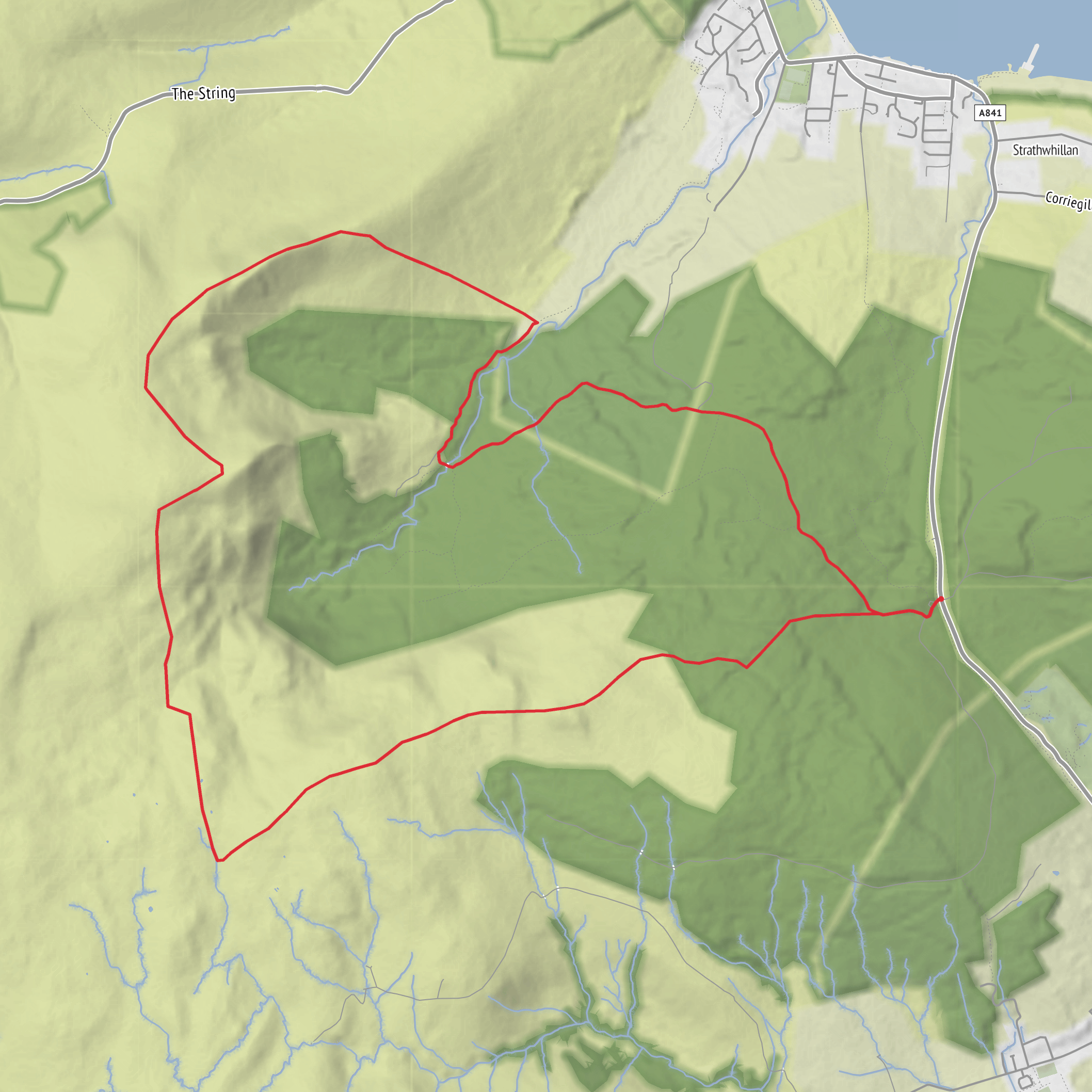
This 14 km / 8.7 mile loop on the Isle of Arran is a broad, airy hill circuit above Brodick, linking a string of rounded summits and ridges with about 500 m / 1,640 ft of ascent. It is best thought of as a moorland and hillwalking day rather than a path-led ramble: there are stretches of track and occasional trods, but much of the route can feel faint, wet, and rough underfoot, especially across heather, grass, and boggier ground between the tops. The overall difficulty sits well in the medium range for hikers with decent fitness, but poor visibility can make it feel more serious because the terrain is open and navigation becomes much more important. HiiKER is the tool to have ready before setting out. The route lies above Brodick on Arran, with the nearest practical start point usually taken from the Invercloy car park behind the Co-op on Brodick seafront, or nearby parking in Brodick itself. Brodick is the island’s main ferry port and transport hub. (walkhighlands.co.uk)
From the start near Invercloy car park, the route generally heads inland and uphill toward the open slopes south of the B880 String Road, climbing out of the lower ground above Brodick and Glen Cloy toward Muileann Gaoithe. The lower section is often the easiest going of the day, with tracks, gates, and grassy lines helping you gain height, but once you leave the more obvious access ground the hill character takes over quickly. Expect damp vegetation, uneven footing, and sections where the line of travel matters more than any built path. A geograph record places Muileann Gaoithe on the rising moorland just south of the B880 above Glen Shurig, which helps anchor the route geographically on the hills immediately west-southwest of Brodick. (geograph.org.uk)
Climbing onto the ridge
The first major objective, Muileann Gaoithe, gives an early sense of the day: open views, broad grassy-heathery slopes, and a feeling of leaving the village behind surprisingly quickly. From here the route continues across a chain of rounded tops including Torr nan Dearc, Cnoc Breac, and Sithein. These are not dramatic knife-edge mountains; they are gentler in profile, but the walking can still be tiring because the ground absorbs energy. On Arran, that often means springy peat, wet grass, hidden holes, and heather that slows progress. A Walkhighlands trip report from this hill group specifically describes wet grass, heather, faint quad tracks, and rough terrain on the way from Brodick toward Muileann Gaoithe and the nearby “Sheeans,” a local rendering of Sithein. (walkhighlands.co.uk)
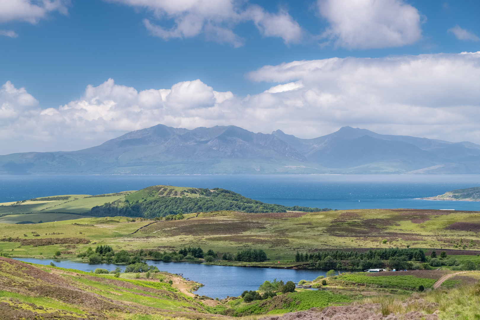
As height is gained, the views become one of the route’s biggest rewards. Looking north and northwest, the jagged Arran peaks around Goat Fell, Caisteal Abhail, and Cir Mhòr begin to dominate the skyline, while Brodick Bay opens behind you. Looking across Glen Cloy, the contrast between Arran’s granite high mountains and these lower moorland ridges is especially striking. This loop is excellent for hikers who enjoy spacious hill country and changing perspectives rather than a single standout summit.
The summits, landmarks, and what to expect
Muileann Gaoithe is followed by the undulating ridge toward Torr nan Dearc and Cnoc Breac, with Sithein usually providing one of the most distinctive high points on the circuit. Sithein is associated with the “Sheeans” name used locally, reflecting the
Surfaces
Unknown
Gravel
Paved
Grass
Comments and Reviews
User comments, reviews and discussions about the Sithein, Cnoc Breac, Torr nan Dearc and Muileann Gaoithe Loop, Scotland.
average rating out of 5
0 rating(s)
