Download
3D Flyover
Add to list
More
14.6 km
~3 hrs 21 min
262 m
Loop
“Wild moor, mirror-loch, and cliff drama make this Hoy loop feel remote and richly varied.”
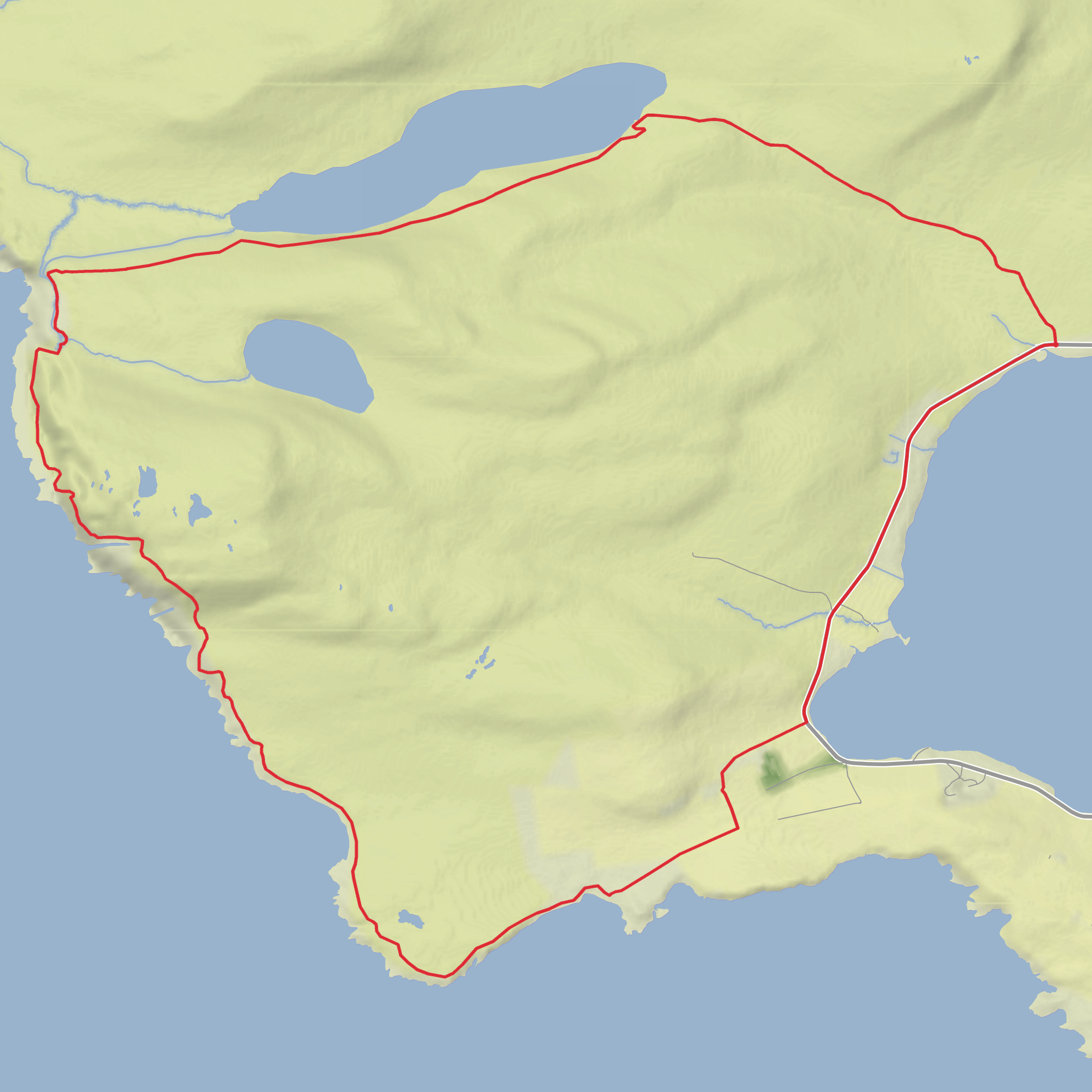
This 15 km / 9.3 mile loop on Hoy and South Walls in Orkney is an easy-going outing by island standards, but it still feels wild, remote, and wonderfully exposed to sea and sky. With around 300 m / 985 ft of ascent, the gradients are generally gentle for much of the route, especially on the approach to Heldale Water, though there are rougher and steeper sections nearer the coast around Ha Wick and the cliff country beyond Sweinn Geo. The route begins just east of the Heldale road and B9047 junction above Longhope, on the signed access track for Heldale Water. That start point is best described as the roadside pull-in near the Heldale Water access track on the B9047, above North Bay and Longhope on South Walls, Hoy. (stromnessmuseum.org.uk)
The opening stretch leads northwest across open moor on a good track with only a slight gradient, making for a relaxed start and a chance to settle into the landscape before the route becomes more dramatic. Heldale Water itself is a large freshwater loch in a quiet upland setting above Longhope, and the lochside section gives the walk a very different character from the coast later on: broad skies, peatland, heather, and a sense of distance from the settled parts of the island. Brown trout are known in the loch, and the area has the feel of a traditional working landscape as much as a scenic one. (stromnessmuseum.org.uk)
What to expect on the route
From the eastern end of Heldale Water, the route follows the south side of the loch. This is where conditions can become rougher underfoot. The ground below Skird Hill is noted for deep heather and uneven going, so even though the overall difficulty is modest, hikers should not expect a manicured path throughout. After the western end of the loch, the terrain eases again before the route cuts southwest across open moor toward the rocky coastal ground at Sweinn Geo. In poor visibility, this is the section where navigation becomes more serious, so carrying and checking the route in HiiKER is sensible. The local walking guide specifically notes that map and compass skills may be required in poor weather. (stromnessmuseum.org.uk)
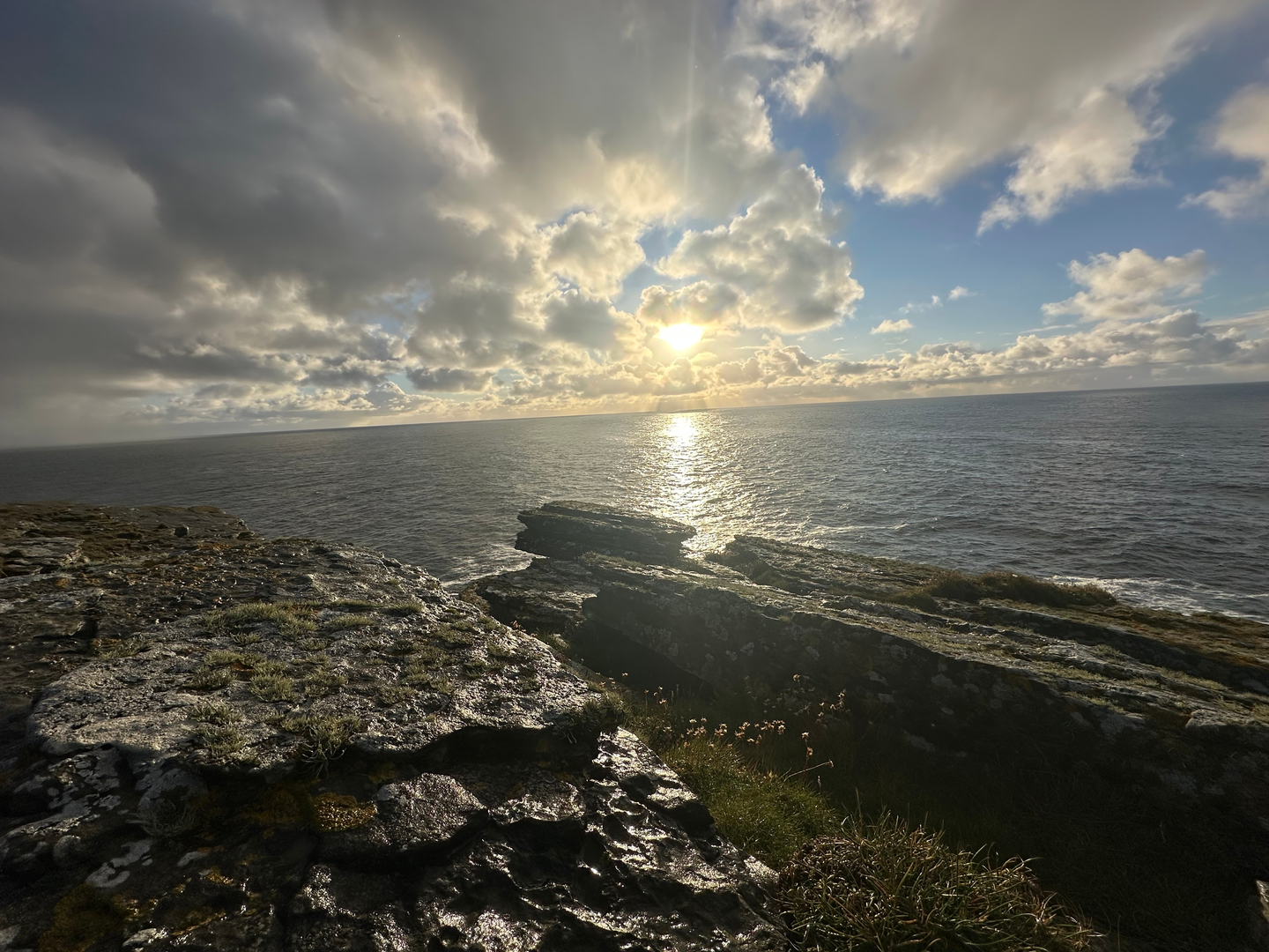
The coastal section is the highlight for many walkers. Beyond the moor, the route reaches cliff-top country with striking rock architecture, geos cut into the land, and a much stronger sense of exposure. Near the Needle, a huge rock spike set in a narrow gulf below the cliffs, the scenery becomes especially dramatic. The descent south toward Ha Wick then needs care: this part is described as steep, and the indented coastline means there are large inlets and broken cliff edges to watch for. In dry, calm weather it is exhilarating; in wind, rain, or fog it demands much more caution. (stromnessmuseum.org.uk)
As the route approaches Ha Wick, the ground levels out and the cliffs lower, opening views ahead to Tor Ness Lighthouse. Ha Wick itself is a lovely sandy bay, a softer and more sheltered-feeling interlude after the harsher cliff scenery. From there, a short walk brings you toward the lighthouse at Tor Ness, a prominent landmark on this side of the island. NatureScot notes that Tor Ness was the last lighthouse built in Orkney, completed in 1980, and it remains an important navigational marker on this hazardous coast. (stromnessmuseum.org.uk)
Landmarks, wildlife, and landscape character
One of the pleasures of this loop is how many distinct landscapes it packs into a moderate distance. You begin in moorland and freshwater country, pass along a substantial loch, cross open peatland, then reach a cliff-fringed coast with geos, stacks, and sandy bays before returning through dunes, farmland, and the historic estate landscape around Melsetter. That variety makes the walk feel longer and richer than the mileage suggests. (stromnessmuseum.org.uk)
Wildlife can be excellent here, especially birdlife. The Hoy walking guide warns that bonxies and terns may defend nests, which is worth taking seriously in breeding season. On moor and coast you may also encounter seabirds riding the updrafts, waders around wetter ground, and the usual mix of island grazers in the lower farmland sections. The dune and bay areas near Tor Ness and Melsetter add another habitat
Comments and Reviews
User comments, reviews and discussions about the North Bay, Heldale Water, HaWick and Tor Ness Loop, Scotland.
average rating out of 5
0 rating(s)
