Download
3D Flyover
Add to list
More
15.6 km
~4 hrs 42 min
949 m
Loop
“A wild, committing ridge day over Beinn a’ Ghlò’s sweeping summits and weather-worn plateaus.”
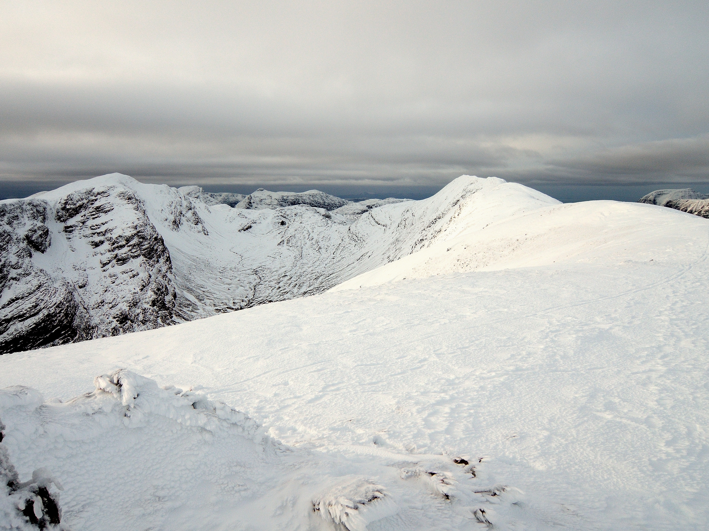
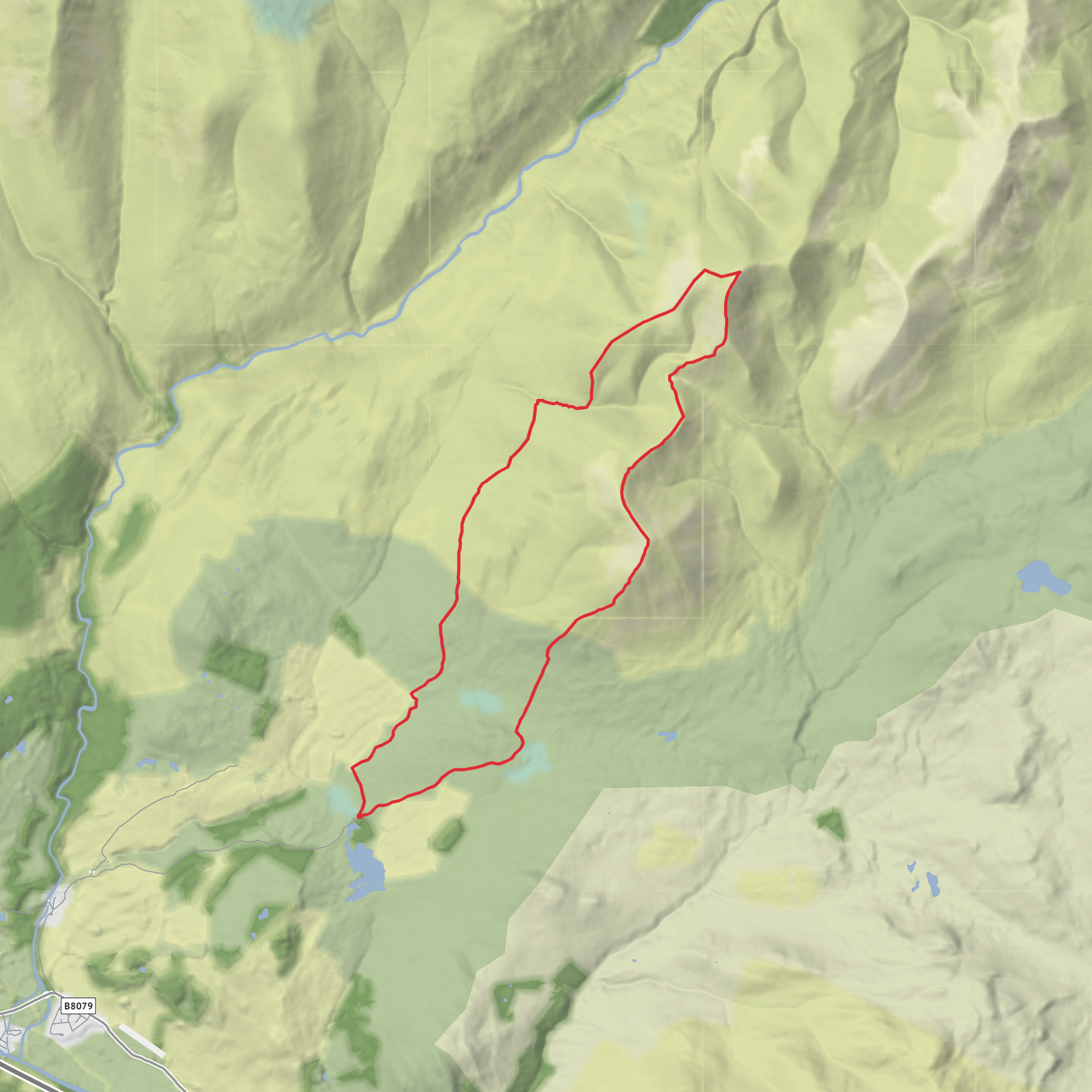
This is a big, serious hill day on the Beinn a’ Ghlò massif above Blair Atholl, linking Càrn Liath, Beinn Mhaol and Bràigh Coire Chruinn-bhalgain on a high, exposed loop of about 16 km / 10 miles with roughly 1,000 m / 3,280 ft of ascent. The terrain is classic Highland mountain ground: a good approach path at first, then long stretches of open ridge, stony summit plateaus, peatier sections, and steep drops into broad bealachs. Although the distance is moderate for a mountain loop, the sustained climbing, exposure to weather, and the seriousness of the return over high ground make the difficult rating well deserved. The usual start is the Beinn a’ Ghlò car park near Loch Moraig, above Blair Atholl. Current route information for this massif consistently places the standard start at the Loch Moraig car park, near postcode PH18 5TT, at around 340 m above sea level. (ramblers.org.uk)
From the start, the route heads in on the estate track and path system toward the south-western shoulder of Càrn Liath. The first part tends to feel straightforward, but it quickly turns into a sustained climb. Over roughly the first 4 to 5 km / 2.5 to 3 miles, most of the day’s early height gain is banked as the path rises from around 340 m to the first Munro summit of Càrn Liath at 976 m / 3,202 ft. Càrn Liath is the western summit of Beinn a’ Ghlò and is known for its broad, rounded profile and large cairn. On a clear day, the views open west toward Glen Tilt and north and east across the wider Cairngorms. Sources describing the massif note Càrn Liath at about 976 m and identify it as the first summit on the classic traverse from Loch Moraig. (en.wikipedia.org)
The ridge between the summits
After Càrn Liath, the character of the walk changes. The ridge swings onward over Beinn Mhaol, a broad intermediate top that gives the traverse its sense of scale. This section is not especially technical in dry summer conditions, but it is committing. The ridge undulates, and the descent from Càrn Liath toward the bealach costs a noticeable amount of hard-earned elevation before the next climb begins. Older route descriptions and hill references place the drop to the col at around 760 m / 2,493 ft before the rise to Bràigh Coire Chruinn-bhalgain at 1,070 m / 3,510 ft. (aberdeenhillwalking.org.uk)
Beinn Mhaol itself is more of a broad ridge feature than a sharply defined summit, but it is an important landmark on the traverse because it breaks up the journey between the two Munros and marks the point where the ridge begins to feel more remote and more complex. Bràigh Coire Chruinn-bhalgain is often described as the least distinct of the Beinn a’ Ghlò summits, with a wide, rolling summit area rather than a dramatic point. That can make navigation trickier in mist than the map might suggest. In poor visibility, this is the section where careful bearing work matters most, and HiiKER is especially useful for checking the line of the ridge, the bealach position, and the broad summit area. Route descriptions for this massif specifically note the twisting ridges and complex shape of Bràigh Coire Chruinn-bhalgain. (walkhighlands.co.uk)
For a loop that turns back after Bràigh Coire Chruinn-bhalgain rather than continuing to Càrn nan Gabhar, expect the return to feel longer than the map suggests. You will either retrace the ridge or use a linking descent depending on the exact line chosen, but in either case the day remains strenuous because the re-ascent over high ground is significant. If the weather closes in, the broad shoulders and multiple spurs on Beinn a’ Ghlò can make route-finding more serious than on
Surfaces
Unknown
Grass
Comments and Reviews
User comments, reviews and discussions about the Carn Liath, Beinn Mhaol and Braigh Coire Chruinn-bhalgain Loop, Scotland.
average rating out of 5
0 rating(s)
