Download
3D Flyover
Add to list
More
10.1 km
~2 hrs 14 min
136 m
Loop
“A gentle Border loop threads river, farmland, forest, and old Castleton’s haunting historic traces.”
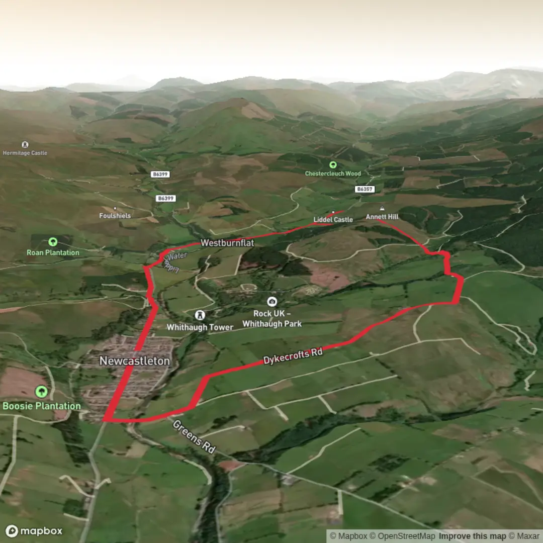
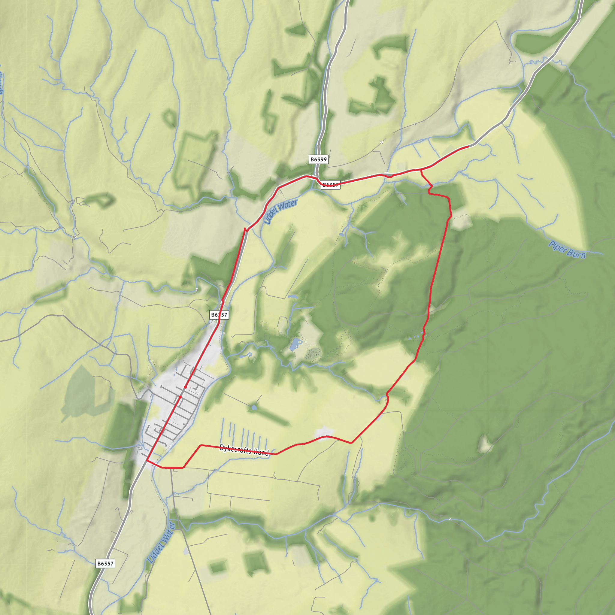
This easy loop of about 10 km / 6.2 miles starts and finishes in Douglas Square, Newcastleton, Scottish Borders, and makes a varied circuit through quiet lanes, open farmland, forest edge, and historic ground linked to old Castleton. Expect roughly 100 m / 330 ft of ascent, spread gently enough that most walkers will find it manageable, with the main climbing coming early as the route rises out of the village toward Dykecrofts. The usual underfoot mix is good paths, forest tracks, and minor roads, though short sections can be muddy after rain, especially near burns, ponds, and softer forest margins. Boots or sturdy walking shoes are the sensible choice. (scotborders.gov.uk)
The walk begins near Douglas Square in central Newcastleton, the village hub and the clearest landmark for navigation, with toilets and refreshments available nearby. From there, the route heads south through the village and crosses Holm Bridge over the Liddel Water. Holm Bridge dates to 1823, and the first stretch gives a good sense of the landscape that defines this part of Liddesdale: a broad river valley, pastoral ground, and the long historical pull of the Anglo-Scottish Border. (scotborders.gov.uk)
What the route feels like
After leaving the village, the lane climbs gradually toward Yethouse and the Dykecrofts side of the loop. This opening section is the steadiest ascent of the day, but with only around 100 m / 330 ft total elevation gain on the whole route, it stays within easy territory for most hikers. The fields here are historically significant: when Newcastleton was founded in 1793, villagers were allocated strips of land, and parts of that narrow field pattern still survive in the hedges and boundaries you pass. Just before the next cattle grid, you may notice the turf dykes of the old farm called Jingles, a small but telling reminder of earlier settlement and land use. (scotborders.gov.uk)
Beyond the former cottages and Dykecrofts Farm, the route reaches a car park and picnic area on the edge of Newcastleton Forest. This is a good mental halfway marker for many walkers, though not the halfway point by distance. The woodland behind the farm is noted as the oldest piece of forest in the area, which adds a different texture to the walk after the more open agricultural start. From here, the route drops toward Whithaugh Burn, crossing by footbridge before continuing on waymarked forest-side track. (scotborders.gov.uk)
The track through this middle section is generally straightforward, with a short stony stretch followed by easier green track and gentle undulations. If the weather has been wet, expect soft patches. This is the kind of route where steady pacing matters more than fitness, and where checking the line on HiiKER before and during the forest section is useful, especially around junctions where multiple tracks and local trails meet.
Landmarks, wildlife, and local character
One of the nicest natural features on the loop is the cluster of ponds near Whithaugh Burn, where dragonflies are specifically noted in season. Around the river and wetter ground, birdlife can also be rewarding. In the wider Newcastleton area, walkers may see species such as dipper, pied wagtail, oystercatcher, and heron along the watercourses, while the surrounding forest is known as a wildlife haven. Forestry and Land Scotland also highlights views over Priest Hill and the Liddel valley, and notes local wildlife including badgers in the forest area. (scotborders.gov.uk)
As the route continues, the scenery opens enough to give broader views across Liddesdale, a landscape shaped by farming, forestry, river systems, and centuries of Border history. The Liddel Water is especially important geographically, as it forms part of the border between Scotland and England along some of its course. That borderland setting is part of what gives the walk its atmosphere: even on an easy outing, there is a strong sense of old routes, old settlements, and contested ground. (forestryandland.gov.scot)
The most historically important stop on the loop is the area around old Castleton churchyard and Liddel Castle. The churchyard stands on the site of the original parish church and manse, and a short distance beyond are the grassy earthworks of Liddel Castle, a Scheduled Monument. Across the road stands a stone pillar, the remains of a former market cross. These features are among the last visible traces of the old village
Surfaces
Unknown
Asphalt
Comments and Reviews
User comments, reviews and discussions about the Dykecrofts, Liddel Castle and Newcastleton Forest Loop, Scotland.
average rating out of 5
0 rating(s)
