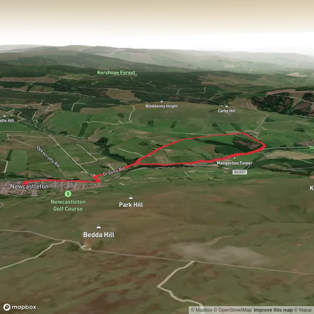
Download
3D Flyover
Add to list
More
7.1 km
~1 hrs 32 min
65 m
Loop
“A gentle Newcastleton loop mingles riverside calm, railway echoes, and Border history beneath whispering woods.”
This easy loop of about 7 km (4.3 miles) with roughly 100 metres (330 feet) of ascent makes a good short outing from Douglas Square, Newcastleton, Scottish Borders, which is the practical start point for the route. The walking is mostly on riverside paths, quiet minor roads, an old railway line, and a short rougher woodland climb, so it suits walkers looking for a relaxed half-day route rather than a strenuous hill day. Boots or sturdy shoes are still a sensible choice, especially if the woodland section is damp. (scotborders.gov.uk)
The route begins in Douglas Square, Newcastleton, near the village centre and public toilets, then heads down toward the Liddel Water. If you are arriving by car, Newcastleton is the obvious place to park and prepare before setting out. For anyone navigating the route, loading the walk in HiiKER is useful for confirming turns around the riverside, old railway section, and woodland climb. (scotborders.gov.uk)
Public transport is limited in this part of the Borders, so most walkers will find driving to Newcastleton the simplest option. If using public transport, plan to travel first to Newcastleton village and then start on foot from Douglas Square; because rural services can be infrequent, it is worth checking current bus times before travel. Once in the village, the route is straightforward to access without any additional transfer. The nearest significant start landmark is therefore Douglas Square, Newcastleton, Scottish Borders, TD9 0QD area, rather than a remote roadside trailhead. This is the clearest known access point associated with the loop. (scotborders.gov.uk)
Route and terrain
From Douglas Square, the walk quickly settles into an easy rhythm along the river, passing houses and the sports field before climbing steps onto Holm Bridge, a structure dating to 1823. This opening section is gentle and nearly flat, making it a comfortable warm-up over the first 1 to 1.5 km (0.6 to 0.9 miles). Around the river and bridge, keep an eye out for small water-loving birds such as dippers and other riparian species. (scotborders.gov.uk)
After the bridge, the route follows a quiet road past caravans and continues for about 500 metres (0.3 miles) to the crossing of Tweeden Burn. Soon after, a seat marks a turning point where the landscape begins to reveal more of the valley’s layered history. Through the trees, you can look toward the former crossing of the railway over the river at the site known locally as Caul’ Pool Brig, once an impressive arched viaduct and demolished in 1986. This section is easy underfoot and gives the walk much of its relaxed, accessible character. (scotborders.gov.uk)
Approaching Mangerton Farm, the route turns onto the old railway line, signed as Mangerton Walk. This is one of the most pleasant stretches of the loop: broad, easy-going, and often edged with wildflowers in summer. After about 400 metres (0.25 miles), steps lead down to the remains of Mangerton Tower, one of the route’s key landmarks and the feature that gives the walk much of its historical interest. (scotborders.gov.uk)
History and landmarks
Mangerton Tower is the scant ruin of a former Armstrong fortified house, part of the network of defensive tower houses that once marked the Borders. These strongholds belonged to families who lived in a region shaped for centuries by cross-border conflict, raiding, and shifting loyalties. One surviving wall reportedly bears a carved stone with the initials of a 16th-century Armstrong and his wife, a Forster, a small but vivid reminder of the families who once occupied the site. The tower has been in ruin for at least 200 years. (scotborders.gov.uk)
This historical backdrop is one of the most rewarding aspects of the loop. Even though the walk is short and easy, it passes through a landscape tied to the story of the Border Reivers, fortified farmsteads, and old transport corridors. The disused railway line and the lost viaduct add a second layer of history, showing how the valley later evolved from a defensive frontier into a more connected rural landscape. (scotborders.gov.uk)
Woodland climb and views
Beyond the tower, the route continues along the old line with the Liddel Water off to the right until reaching Clerkleap Cottage. About 50 metres (165 feet) past the cottage, the walk turns into the wood and begins the roughest section of the loop. This is where most of the route’s roughly 100 metres / 330 feet of ascent is gained. The climb is not long, but the path is narrower, ste
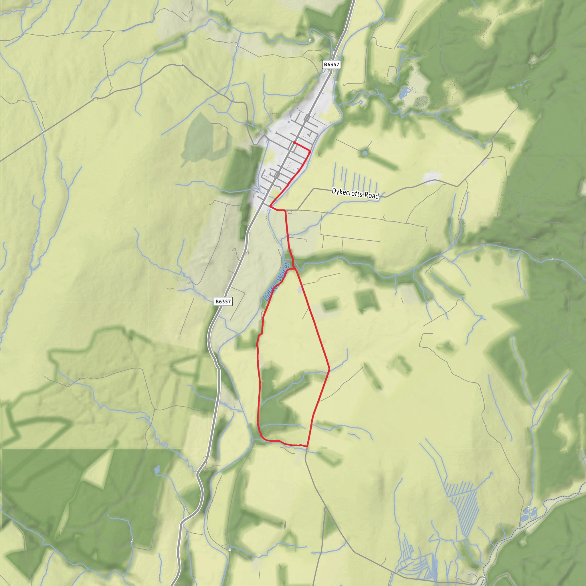
Surfaces
Unknown
Asphalt
Comments and Reviews
User comments, reviews and discussions about the Foutysike Wood and Mangerton Tower Loop, Scotland.
average rating out of 5
0 rating(s)
