Download
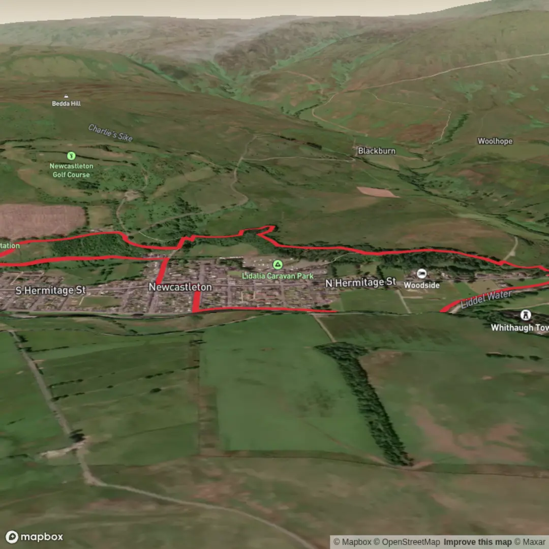
3D Flyover
Add to list
More
3.7 km
~45 min
13 m
Loop
“A gentle Newcastleton loop weaves river murmur, shady woods, and Border history into a quietly charming outing.”
This easy loop around Newcastleton is a gentle riverside-and-woodland walk of about 4 km / 2.5 miles with virtually no climbing, making it well suited to families, casual walkers, and anyone looking for a shorter outing with plenty of local character. The route explores the edge of the village, follows the Liddel Water, and then threads through nearby woodland before returning to town. It is generally low level throughout, with total ascent close to 0 m / 0 ft, though short banks, path roots, and muddy patches can still make sections feel a little more uneven after rain. (scotborders.gov.uk)
The walk starts in or near the centre of Newcastleton, with Douglas Square serving as the most practical landmark and nearest well-known starting point. From there, the route heads toward the Liddel Water, the river that shapes the village setting and, farther downstream, forms part of the border between Scotland and England. Expect a relaxed opening section with easy walking beside the water, where the pace is more about scenery than effort. (scotborders.gov.uk)
What to expect on the route
Early on, the riverside path gives the walk much of its appeal. The Liddel Water adds movement and sound to an otherwise calm route, and the banks can be especially attractive in spring and summer when vegetation thickens along the water’s edge. One local feature often noted on walks here is Whithaugh Pool, once known as a popular bathing place, which adds a small but memorable historical detail to the riverside section. (scotborders.gov.uk)
As the loop continues, the character shifts from open riverbank to woodland edge. The paths around Newcastleton are known for combining village surroundings with pleasant hill-country scenery, and this shorter circuit captures that well without demanding much effort. In the wooded stretches, expect a more enclosed feel, with tree cover, leaf litter, and occasional roots underfoot. If conditions have been wet, these sections may be slippery, so lightweight waterproof footwear is often a better choice than road shoes. (scotborders.gov.uk)
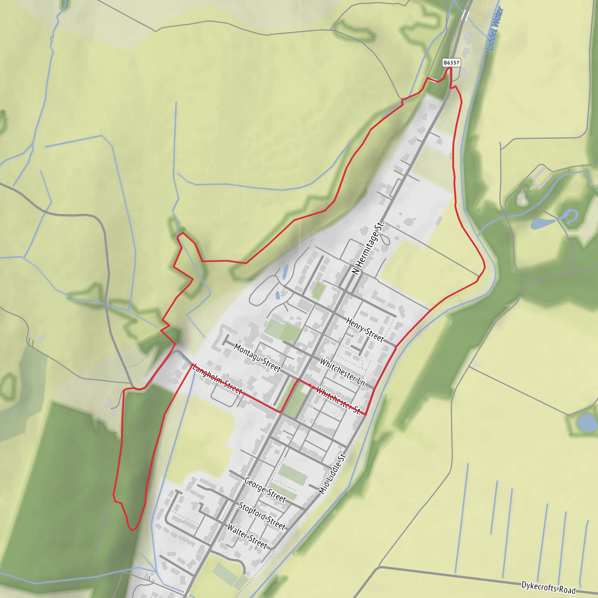
Some versions of the local river-and-woodland circuit cross small bridges and pass along the edge of the wood before returning by road and riverside links into the village. Because this is a short community path network rather than a remote mountain route, navigation is usually straightforward, but it is still worth checking the line carefully on HiiKER before setting out, especially where multiple local paths, bridges, and woodland tracks meet. (scotborders.gov.uk)
Terrain, access, and preparation
Although the route is rated easy, hikers should still expect mixed surfaces: paved village approaches, compacted riverside paths, grassy or earthy sections, and potentially muddy woodland ground. With almost no elevation gain, the main things to plan for are weather and footing rather than fitness. After prolonged rain, low-lying riverside paths can feel soft underfoot, and short descents or banks may be slick. In dry weather, this is a very approachable outing for most walkers. (scotborders.gov.uk)
Because the walk stays close to Newcastleton, it is a good option for a half-day outing or a shorter leg-stretcher combined with time in the village. Standard hill gear is not usually necessary, but a waterproof layer is sensible in the Borders, and insect repellent can be useful in warmer months near water and woodland. If visibility is poor or you are walking in winter, daylight timing matters more than route difficulty, as shaded woodland and riverside sections can feel dim earlier in the day.
Nature and wildlife
This area of the Scottish Borders supports a mix of river, woodland, and open-country wildlife. Along the Liddel Water and around the surrounding forests and moorland, walkers may spot common woodland birds, river birds, and, if quiet and lucky, roe deer. Dawn and dusk are often the best times for wildlife activity, though even a daytime walk can bring sightings of small birds moving through the trees or along the river corridor. Seasonal changes are a big part of the appeal here: fresh green woodland in spring, fuller cover in summer, color in autumn, and a more open, structural feel in winter when views through the trees improve. (newcastleton.net)
Historical background
Newcastleton, also known as Copshaw Holm, sits in Liddesdale, a region with a strong Border history shaped by movement, farming, and centuries of cross-border tension. The wider landscape around the village is tied to old drove roads, river crossings, and the long story of the Anglo-Scottish borderlands. Forestry and Land Scotland notes that nearby trails begin along a historic drove road, reflecting the area’s past as a route for moving livestock through the Borders. The river itself is also historically important, not just as a landscape feature but as part of the line that helped define this frontier region.
Surfaces
Unknown
Dirt
Asphalt
Comments and Reviews
User comments, reviews and discussions about the Newcastleton Liddle Water and Woodland Loop, Scotland.
average rating out of 5
0 rating(s)
