Download
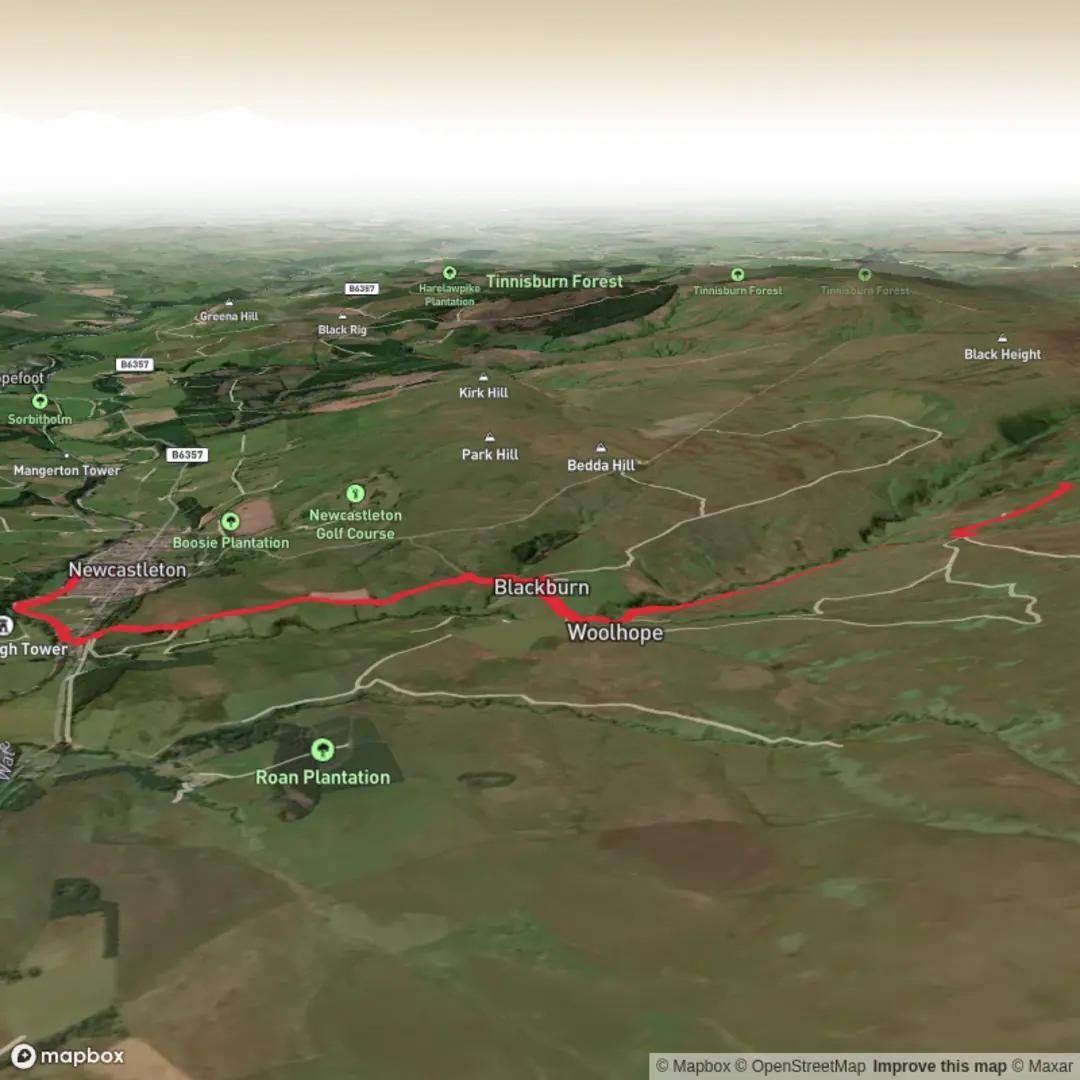
3D Flyover
Add to list
More
11.7 km
~2 hrs 51 min
312 m
Out and Back
“From riverside calm to wild moorland drama, this Borders walk ends with stirring views of Blackburn Falls.”
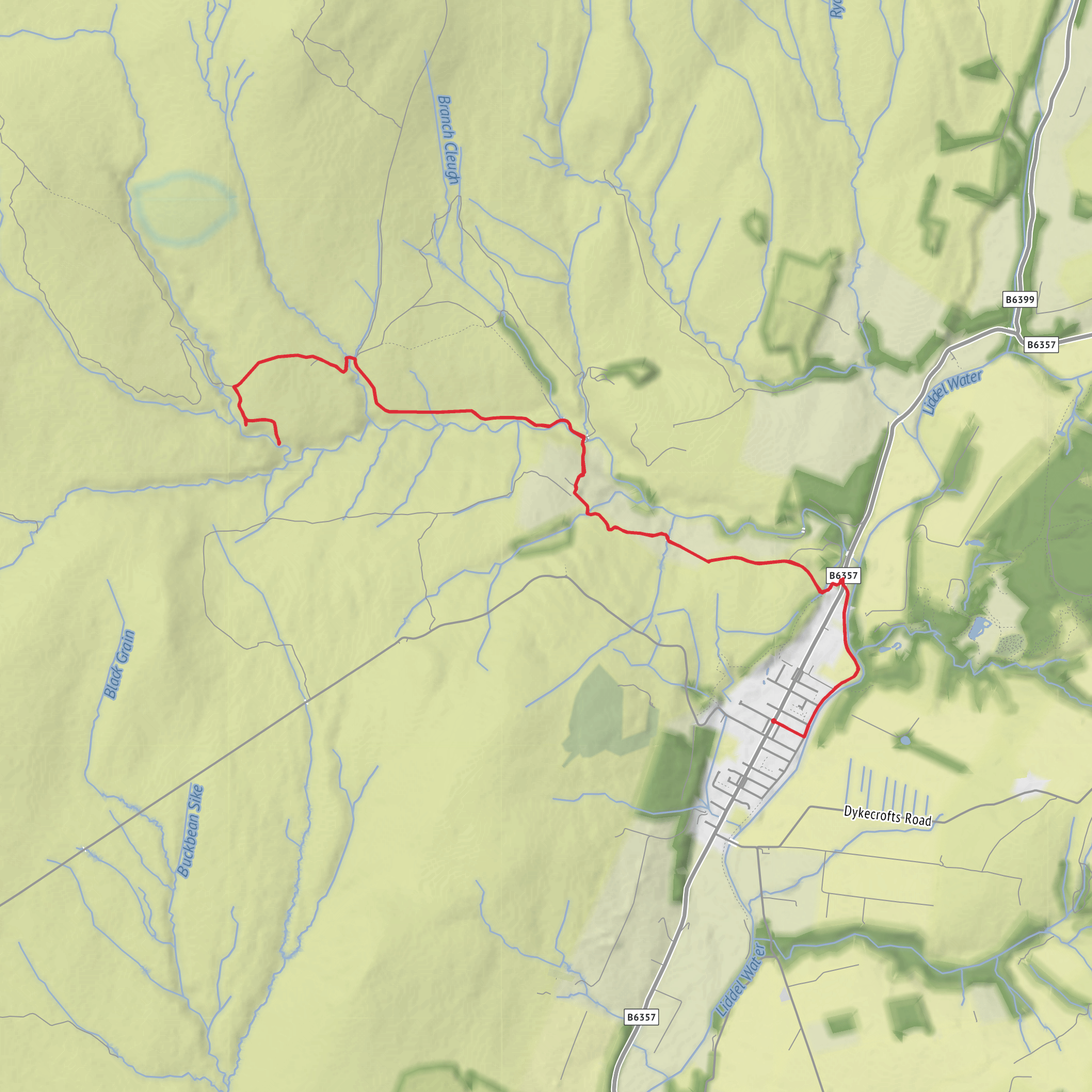
This out-and-back walk begins in the heart of Newcastleton, with the usual start point at Douglas Square, Newcastleton, Scottish Borders, TD9 0QD, and heads west and northwest into open country before reaching the falls above the Black Burn. The route is about 11–12 km / 7–7.5 miles in total with roughly 290–300 metres / 950–985 feet of ascent, which fits a solid medium outing: not especially long, but rougher and more exposed than the distance alone suggests. Official local route information describes it as 11 km / 7 miles over tracks, paths and rough ground, with the moorland section specifically noted as exposed and not recommended in poor weather or after heavy rain. (scotborders.gov.uk)
From the square, the walk eases you out gently rather than throwing the climbing at you immediately. Early on, the route follows the Liddel Water and passes Whithaugh Pool, Whithaugh Bridge, and the edge of the village near the auction mart before turning into farmland and hill ground. That opening section is useful for settling into pace, checking footwear comfort, and making sure layers are right before the more open terrain begins. Public toilets are available just off Douglas Square on Langholm Street next to the Fire Station, and refreshments are available in Newcastleton itself. (scotborders.gov.uk)
What the route feels like
The first part is straightforward village-and-riverside walking, then the character changes as you move through gates, fields and farm access tracks toward Blackburn Farm. After the farm, the route crosses the Black Burn and becomes more upland in feel, with rougher ground, a clearer sense of remoteness, and broader views over Liddesdale. Expect a mix of firm track, grassy sections, uneven moorland path and potentially wet patches, especially after rain. Boots or strong trail shoes are the sensible choice here, not least because the return uses the same line and tired feet notice rough ground more on the way back. (scotborders.gov.uk)
The climbing is spread out in stages rather than concentrated in one steep haul. Around 300 m / 985 ft of ascent over 12 km / 7.5 miles means most walkers will find it manageable, but the exposed middle section can make it feel harder in wind, rain or low cloud. The route is best treated as a half-day walk with enough time to stop, look over the valley, and move carefully near the falls. (plotaroute.com)
Landmarks, terrain and the falls
One of the route’s notable features is the transition from settled valley edge to open hillside. After Blackburn Farm and the burn crossing, the path keeps close to the water for a while, then works across the hillside by fence lines and open grazing ground. There are sheep pens on part of the route, and this is working countryside, so gates should be left as found and extra care is sensible around livestock and farm machinery. (scotborders.gov.uk)
A particularly useful landmark on the upper section is the John Byres Memorial Cairn, shown on the local route map, and later a stone stell marks the point where the return becomes easier and mostly downhill. Views open out across the Black Burn valley and wider Liddesdale, giving the walk much more of a border-hills feel than a simple waterfall stroll. (scotborders.gov.uk)
The falls themselves sit near the meeting of Long Gill and Rough Gill, though they are known locally as Blackburn Falls. The local route notes that you will see the falls below and to the right, but also warns that getting closer is difficult and that scrambling down the slope is only for those fully confident in their footing and ability to climb back up. That is an important planning point: this is a viewpoint walk to the falls rather than a casual waterside wander right to the plunge pool. After heavy rain the waterfall is more dramatic, but the same conditions also make the ground slicker and the burn-side slopes more hazardous. (scotborders.gov.uk)
Below the falls lies the site of Annatshiel, adding a quiet historical note to the turnaround point. Even if little is immediately obvious on the ground, it reinforces the sense that this landscape was once more actively settled and worked than it appears today. (scotborders.gov.uk)
Wildlife and landscape character
This is classic Borders hill-and-burn country: pasture near the village, rough grazing higher up, and open moorland with broad skies and long views. Around the river and burns, look for
Surfaces
Unknown
Dirt
Asphalt
Comments and Reviews
User comments, reviews and discussions about the Newcastleton to Blackburn Falls, Scotland.
average rating out of 5
0 rating(s)
