Download
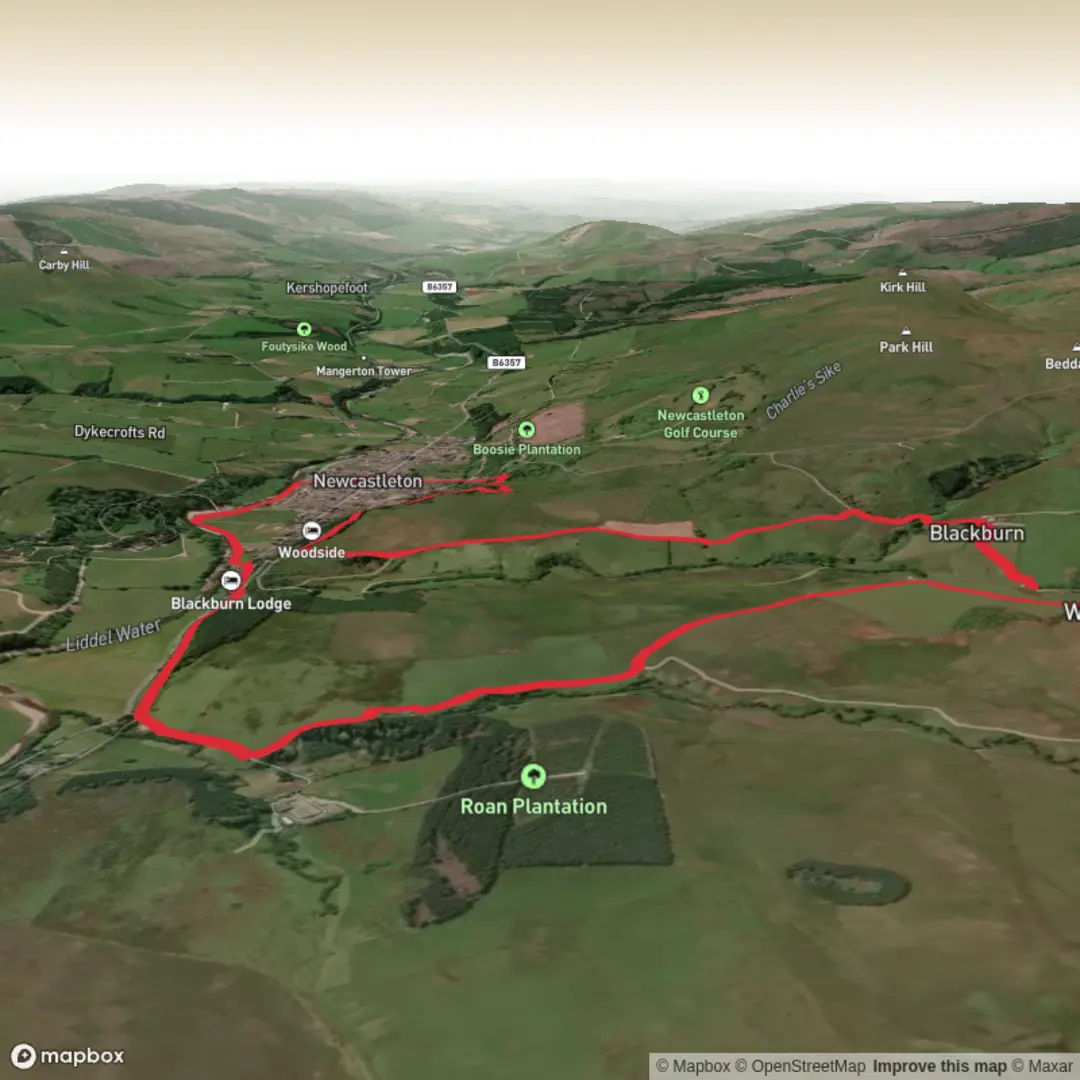
3D Flyover
Add to list
More
7.7 km
~1 hrs 41 min
85 m
Loop
“A gentle Woolhope wander threads orchards, limestone folds and ancient village charm through Herefordshire’s living countryside.”
This easy loop of about 8 km (roughly 5 miles) is best understood as a gentle countryside circuit around Woolhope in Herefordshire, with low overall climbing of around 100 m (about 330 ft). The route moves through a mix of quiet lanes, pasture, hedged field paths and lightly undulating ground, so it suits walkers looking for a relaxed half-day outing rather than a strenuous hill walk. The nearest clear start point for this area is Woolhope village, with the most practical trailhead being around Woolhope Village Hall, Woolhope, Hereford HR1 4QS, where Herefordshire Council notes ample parking; there are also a few spaces on Broadmoor Common. (herefordshire.gov.uk)
Expect a rural landscape rather than a dramatic mountain setting. The gradients are generally modest, but the ground can still feel uneven underfoot after rain, especially where paths cross fields or pass through gateways. Even on an easy-rated walk, waterproof footwear is sensible in wet weather, and walkers should be prepared for stiles, gates and potentially muddy sections typical of Herefordshire field paths. On nearby official Woolhope circular information, Herefordshire Council highlights numerous stiles and gates and notes two steeper sections on the longer village circuit, which gives a useful indication of the kind of path furniture and terrain found around Woolhope. (herefordshire.gov.uk)
What the route feels like
The walk unfolds across the distinctive Woolhope Dome, a geologically important ring of hills and folds formed from Silurian limestone. That limestone helps create species-rich grassland and gives the area a noticeably varied rural character, with open views, old orchards, wooded edges and flower-rich patches that can be especially attractive in spring and summer. On an 8 km / 5 mile loop with only about 100 m / 330 ft of ascent, most of the elevation gain tends to come in short rises rather than one sustained climb, so the route usually feels broken into easy, manageable sections. (herefordshire.gov.uk)
Because the terrain is relatively gentle, this is a good walk for taking time over the details: old hedgebanks, pastureland, church-centered village scenery and the broader folds of the Herefordshire countryside. If following the route with digital navigation, HiiKER is the most useful tool for checking field boundaries, junctions and lane transitions, especially where waymarking may be intermittent.
Landmarks, nature and wildlife
Woolhope itself is one of the main points of interest. The village grew around St George’s Church, a 12th-century church on a site with much older origins, and it gives the walk a strong sense of continuity between landscape and settlement. The church and surrounding village core are among the most historically significant features in the area, and they help anchor the route in a landscape that has been occupied and shaped for centuries. (visitherefordshire.co.uk)
The wider countryside around Woolhope is well known for wildlife. Nearby Common Hill Nature Reserve is noted by Herefordshire Wildlife Trust for its rich grassland habitat and for butterflies, with more than 20 species recorded there, including the wood white, which has an important local stronghold in the Woolhope Dome. Depending on season, walkers may also notice orchard blossom, wildflowers along field margins, birds using hedgerows and small woodland edges alive with insect activity. (visitherefordshire.co.uk)
The geology is part of the area’s appeal as well as its ecology. The Woolhope Dome has long attracted naturalists because the limestone supports habitats that are less common elsewhere in the county. That scientific interest helped make Woolhope an important place in the study of local natural history, and the village gave its name to the Woolhope Naturalists’ Field Club, founded in 1851 for the study of Herefordshire’s natural history, geology, archaeology and history. (herefordshire.gov.uk)
Historical background
Historically, Woolhope is more than just a pretty village stop. The church site is described as dating back to prehistory, suggesting the area has been significant for a very long time. The surrounding landscape also reflects the long agricultural history of Herefordshire: enclosed fields, old routeways, commons and orchards all point to centuries of farming and rural land use. (visitherefordshire.co.uk)
The name “Woolhope” also sits within a wider Herefordshire pattern of place names ending in “hope,” a term often associated with a small enclosed valley. Herefordshire Council specifically notes that several places in the county share this element, which helps place the walk within the region’s older landscape vocabulary as well as its physical geography. (herefordshire.gov.uk)
Getting to the start
By car, the simplest approach is to head for Woolhope Village Hall, Woolhope, Hereford HR1 4QS, or the village center near **
Surfaces
Unknown
Dirt
Asphalt
Comments and Reviews
User comments, reviews and discussions about the Raltonside, Blackburn and Woolhope Loop, Scotland.
average rating out of 5
0 rating(s)
