Download
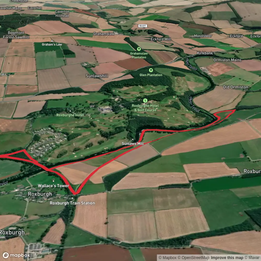
3D Flyover
Add to list
More
5.4 km
~1 hrs 5 min
12 m
Loop
“A peaceful Teviot-side loop blends river, woodland, farmland, and Border history in gentle, shifting scenery.”
This easy loop in the Kelso area is a gentle riverside outing of about 5 km / 3.1 miles with virtually no climbing, making it a good choice for families, casual walkers, and anyone wanting a short circuit with a strong mix of water, woodland edge, farmland, and Borders history. The route is generally low-level throughout, with elevation gain close to 0 m / 0 ft, so the main things to prepare for are not steepness or exposure but underfoot conditions, weather, and a few potentially muddy or uneven sections beside the river and through field-edge paths.
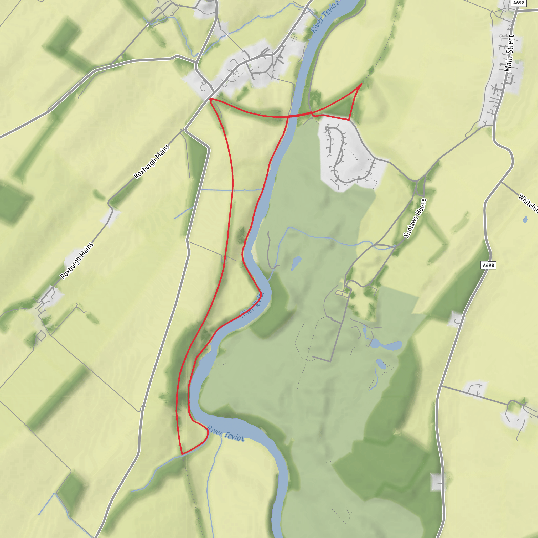
The walk is best understood as a scenic circuit near Heiton, just south of Kelso in the Scottish Borders, following stretches around the River Teviot and the wooded area known as Heiton Strip, with the wider setting tied closely to Kelso, Roxburgh, and the confluence of the Teviot and Tweed. Heiton itself lies on the A698 near Kelso, postcode area TD5, and is a useful landmark for planning arrival. (wikishire.co.uk)
For drivers, the simplest approach is to head for Kelso town centre first and then continue south toward Heiton on the A698. Kelso is well connected by road in the Borders and is the main service hub nearby, so it is the most practical place for fuel, food, toilets, and last-minute supplies. If you are arriving by public transport, Kelso has regular bus services, but it does not currently have its own railway station; the most practical rail access is typically via Tweedbank station, then onward by bus or taxi toward Kelso. (walkhighlands.co.uk)
Because this is a short, easy route, many hikers will complete it in around 1.5 to 2 hours at a relaxed pace, though that can stretch longer if you stop often for views, birdwatching, or exploring nearby historic points of interest. Even on a modest loop, waterproof footwear is worth considering after rain, as riverside paths in the Borders can hold moisture and become slick in places. A light waterproof layer is sensible year-round, and if you are checking the route in advance, HiiKER is the navigation tool to use.
What the route feels like
Expect a calm, mostly undemanding walk through a classic Borders landscape. The River Teviot is the defining feature, and the route’s character comes from broad water views, grassy or earth paths, occasional tree cover, and open agricultural land. On a route of this length, the scenery changes quickly without ever becoming strenuous: one moment you are beside the river, the next near woodland or field margins, with the sense of old transport corridors and historic settlement never far away.
The terrain is usually straightforward, but “easy” does not always mean perfectly smooth. Short sections may include compacted path, grassy track, field-edge walking, and potentially damp ground. After wet weather, expect mud in shaded or low-lying spots. If any part of the loop uses roadside links near Heiton or Kelso approaches, take care with traffic, especially where there is limited verge space.
Landmarks and points of interest
The wider area around this loop is rich in historical context. The River Teviot flows north toward its meeting with the River Tweed at Kelso, and that confluence has long been important both strategically and economically. Kelso itself grew into one of the Borders’ most significant towns, and nearby Roxburgh was once a major royal burgh. Roxburgh Castle was a favored royal residence in medieval Scotland, and the old settlement of Roxburgh was later destroyed during the wars with England. (scotlandstartshere.com)
That history gives extra depth to what might otherwise seem like a simple riverside ramble. In this landscape, rivers were not just scenic features; they shaped trade, defense, agriculture, and settlement. Kelso Abbey, founded in 1128 by David I, is one of the region’s major historic monuments and helps explain why the surrounding countryside feels so layered with medieval significance. (walkhighlands.co.uk)
Another notable feature in the area is the legacy of the old railway. Walks around Roxburgh and Heiton often make use of former rail alignments and the old Roxburgh Viaduct corridor, which now serves as a walking link across the Teviot area. Even if your exact 5 km loop only brushes part of this setting, the old transport infrastructure is one of the most distinctive visual and historical elements nearby.
Surfaces
Unknown
Grass
Comments and Reviews
User comments, reviews and discussions about the Nine Wells, River Teviot and Heiton Strip Loop, Scotland.
average rating out of 5
0 rating(s)
