Download
3D Flyover
Add to list
More
9.0 km
~2 hrs 9 min
223 m
Loop
“A windswept Shetland loop threads kirkyard, moor, and haunting fishing ruins to a thrilling northern finale.”
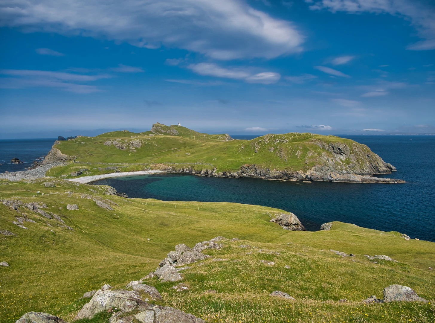
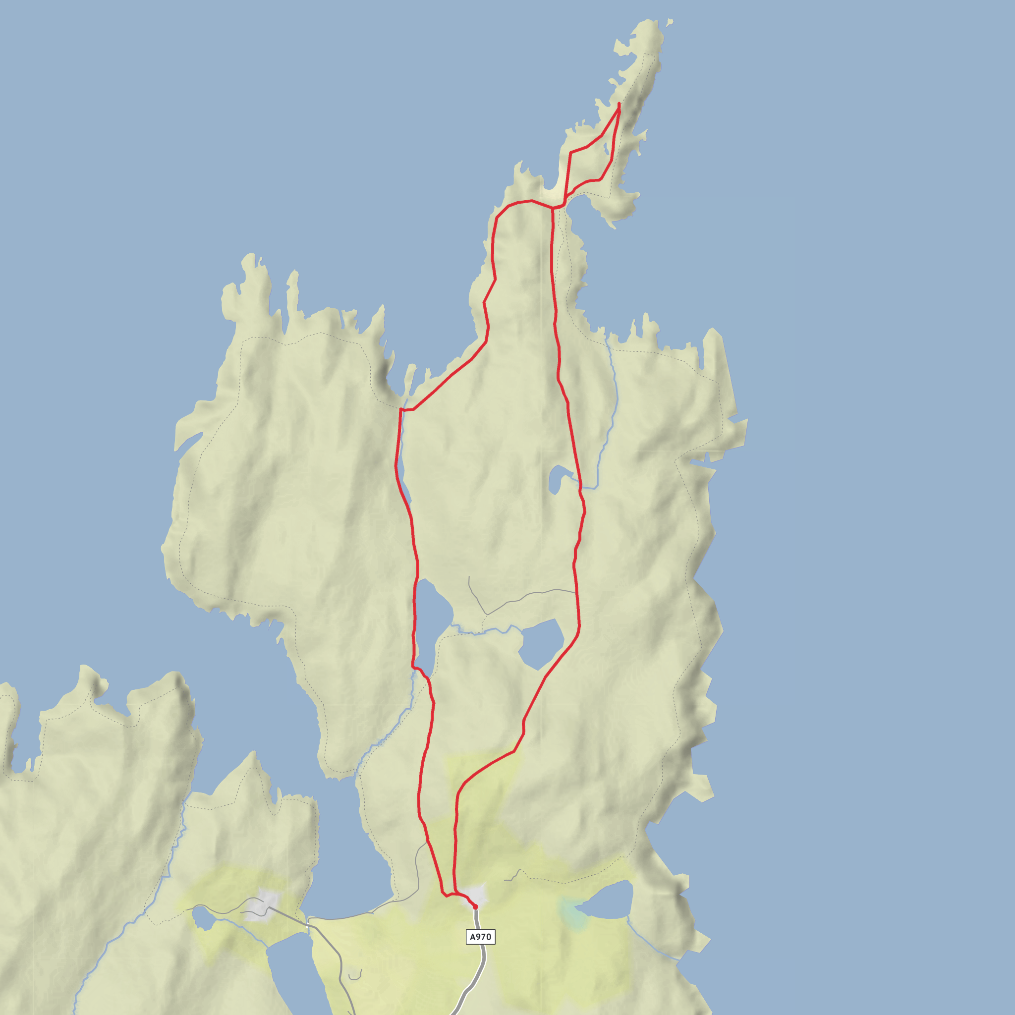
This roughly 9 km / 5.6 mile loop in Northmavine, Shetland, is a medium outing with about 200 m / 656 ft of ascent, combining easy track walking with rougher coastal ground, exposed headland sections, and a memorable finish at one of mainland Shetland’s most northerly points. The start is at Isbister, Northmavine, Shetland, where the road ends and the walking track heads north toward Fethaland. The route is generally straightforward in clear weather, but the northern section is serious enough to demand care: cliff edges can be hazardous, especially in strong wind, rain, or poor visibility. (shetland.org)
Getting to the start is simplest by car. Drive to Isbister, Northmavine, at the end of the public road, and park considerately without blocking entrances, farm access, or local residents. Public transport is limited here, and the route is not considered accessible by bus, so most walkers should plan on self-driving or arranging a taxi from elsewhere on Mainland Shetland. If you are planning the route in advance, HiiKER is the best tool to use for checking the line of the loop and confirming distances between landmarks. (shetland.org)
The opening section leaves Isbister on a track heading east and then north, easing you into the landscape rather than throwing the hardest terrain at you immediately. Early on, the walk passes the old kirkyard at Isbister, notable for its rare wooden grave markers among the stone memorials, an unusual detail that gives the route a strong sense of place from the outset. Soon after, the track goes by Loch of Housaquoy, where ducks and, at times, divers may be seen. This first stretch is a good place to settle into the walk, with broad moorland views and a feeling of increasing remoteness as the houses fall behind. (shetland.org)
Terrain and route character
Most hikers will find the loop moderate rather than technically difficult, but the challenge comes from exposure, footing, and weather rather than steep climbing. The ascent is spread across rolling ground and low rises rather than one long sustained climb, so the 200 m / 656 ft of elevation gain tends to accumulate gradually. Underfoot, expect a mix of farm track, grassy paths, moorland, and uneven coastal sections. After wet weather, some stretches can be soft or boggy, and the headland can feel much more committing when the wind is up. Good waterproof footwear, windproof layers, and enough food and water for a remote coastal walk are sensible even on a relatively short day.
As the route continues north, the scenery becomes more dramatic. There are fine views across the surrounding coast and inland toward Ronas Hill, and the sense of walking into an older, harder-working Shetland becomes stronger with every kilometre. Wildflowers can be especially good from May to August, adding color to what is otherwise a rugged palette of moor, rock, sea, and sky. (shetland.org)
Landmarks, wildlife, and historical interest
The standout landmark is the old Fethaland fishing station, reached after roughly 3 km / 1.9 miles from Isbister. Today it appears as a cluster of roofless stone buildings near the shore, but in the 19th century this was one of Shetland’s largest summer fishing stations. Around twenty booths once stood here, and at busy times perhaps 400 fishermen and shore workers were active on the site. From places like this, crews launched sixareens—open six-oared boats built on Norse lines—to fish far offshore at the “Far Haaf,” around 50 miles / 80 km west, on dangerous expeditions for cod, ling, and other species. The remains you pass are not just picturesque ruins; they are evidence of an industry that shaped livelihoods, rents, and survival across Shetland. (shetland.org)
The area is much older than the fishing station alone suggests. Near Fethaland are the remains of an Iron Age broch, other prehistoric structures, and the outlines of a large Neolithic house, showing that this headland has attracted people for thousands of years. There is also an old soapstone (steatite) quarry at Cleber Geos, now a protected archaeological site. Soapstone was valuable because it is soft enough to carve, and bowls and troughs made from this material have been found at archaeological sites elsewhere in Shetland. For hikers interested in history, this loop is unusually rich: Norse-influenced fishing heritage, prehistoric settlement, and industrial traces all sit within a relatively short walk. (shetland.org)
Beyond the fishing station, the
Comments and Reviews
User comments, reviews and discussions about the Fethaland Lighthouse and Lower Loch of Setter Loop, Scotland.
average rating out of 5
0 rating(s)
