Download
3D Flyover
Add to list
More
1.8 km
~42 min
209 m
Out and Back
“A sharp grassy dome above the Stinchar rewards a punishing climb with sparkling coastal panoramas.”
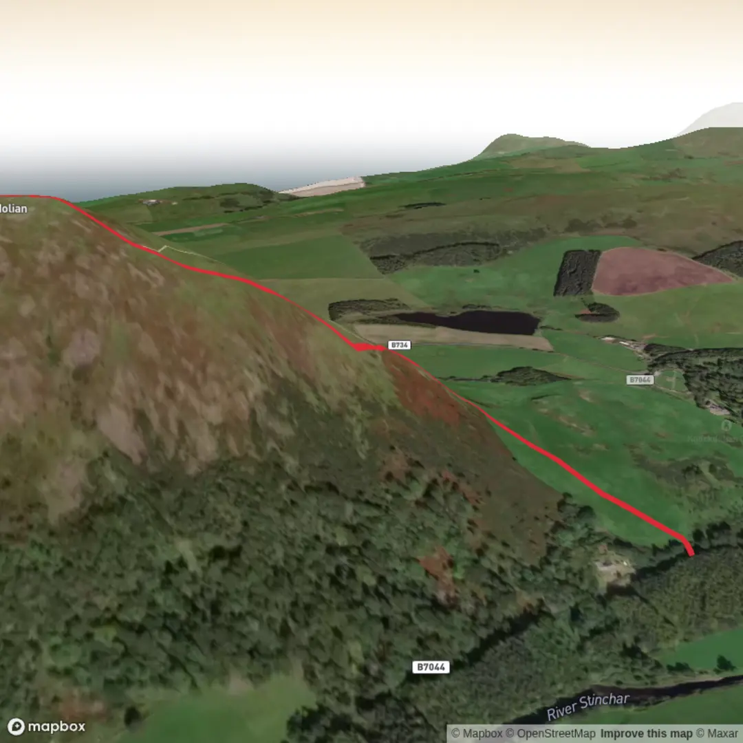
This is a short, steep hill outing on the edge of South Ayrshire, climbing roughly 2 km / 1.2 miles with about 200 m / 656 ft of ascent to the top of Knockdolian, a distinctive volcanic-looking dome above the lower Stinchar valley near Ballantrae and Colmonell. Although the distance is modest, the gradient makes it feel much more serious than the numbers suggest, and an “extra difficult” rating is best understood as a warning that the climb is abrupt, the ground can be slippery, and the route is not one to underestimate in wet or windy weather. The hill itself rises to about 265 m / 869 ft and is widely noted for its excellent views over the River Stinchar and out to Ailsa Craig. (sobt.co.uk)
The usual start is near the track junction on the B7044, about 2 miles / 3.2 km west of Colmonell, close to the remains of Knockdolian Castle. The coordinates published for the start are approximately 55.125091, -4.944526, which corresponds most closely to the B7044 near Knockdolian Castle, Colmonell, South Ayrshire. Parking is very limited, with space for only one or two small cars, so it is important not to block access on the roadside. There are also bus stops just north of the B7044/B734 junction, about 0.5 miles / 0.8 km from the start. (sobt.co.uk)
Getting there by car is the simplest option. Ballantrae is the main nearby village, and from there you approach inland toward Colmonell and the B7044. If you are relying on public transport, Ballantrae and Colmonell are both served by local bus links in the Stinchar Valley area, and Ballantrae is also identified as a stop on the Ayrshire Coastal Path transport network. Services in this part of southwest Scotland can be limited, so checking current timetables before setting out is essential. (sacommunitytransport.org)
What the route feels like
From the roadside start, the walk begins without much ceremony and quickly turns into a direct grassy ascent. On a clear day, navigation is fairly straightforward because the ridge line is obvious, but this is still open hill terrain rather than a fully engineered path. The short distance means there is very little warm-up before the steepest work begins. Expect a sustained pull uphill over grass, with uneven footing and the possibility of slick patches after rain. Early in the year, shorter grass can make the line of ascent easier to read, while in wetter or later-season conditions the hill can feel rougher underfoot. (sobt.co.uk)
The climb gains most of its height quickly. Over only around 2 km / 1.2 miles, 200 m / 656 ft of ascent is enough to make calves and lungs work hard, especially if the ground is greasy or the wind is pushing across the exposed slope. Because the hill stands apart from higher surrounding ground, it catches weather readily. Strong coastal winds can make the upper section feel much more committing than the map suggests.
Near the top, the reward is immediate. The summit area opens broad views west and northwest toward Ailsa Craig, inland up the River Stinchar, and across the rolling farmland of southern Ayrshire. On a very clear day, wider coastal and sea views are possible, and more extended local walking accounts note panoramas stretching as far as Arran and even toward Northern Ireland from the broader area around Knockdolian. (sobt.co.uk)
Terrain, hazards, and navigation
The main challenge here is not distance but steepness, exposure, and footing. Grass-covered hills can look gentle from below, but they often become slippery when wet, especially on descent. Trekking poles can help, though careful foot placement matters more than speed. Good boots with reliable grip are strongly recommended.
There is no reason to treat this as a technical mountain day, but it does deserve proper hillwalking preparation. Low cloud can flatten the shape of the slope and make route choice less obvious than expected. If visibility is poor, using HiiKER for route planning and position checks is the sensible approach. In clear weather, the ridge is easy to follow; in mist, the openness of the hill can make people drift off line.
Livestock may be present on surrounding farmland, and local route descriptions for the wider Knockdolian area also mention sheep, cattle, and gates on nearby access land.

Comments and Reviews
User comments, reviews and discussions about the Knockdolian, Scotland.
average rating out of 5
0 rating(s)