Download
Preview
Add to list
More
7.5 km
~1 hrs 52 min
231 m
Loop
“A varied Trossachs loop above Loch Lubnaig pairs steady climbing with wide, glacially sculpted views.”
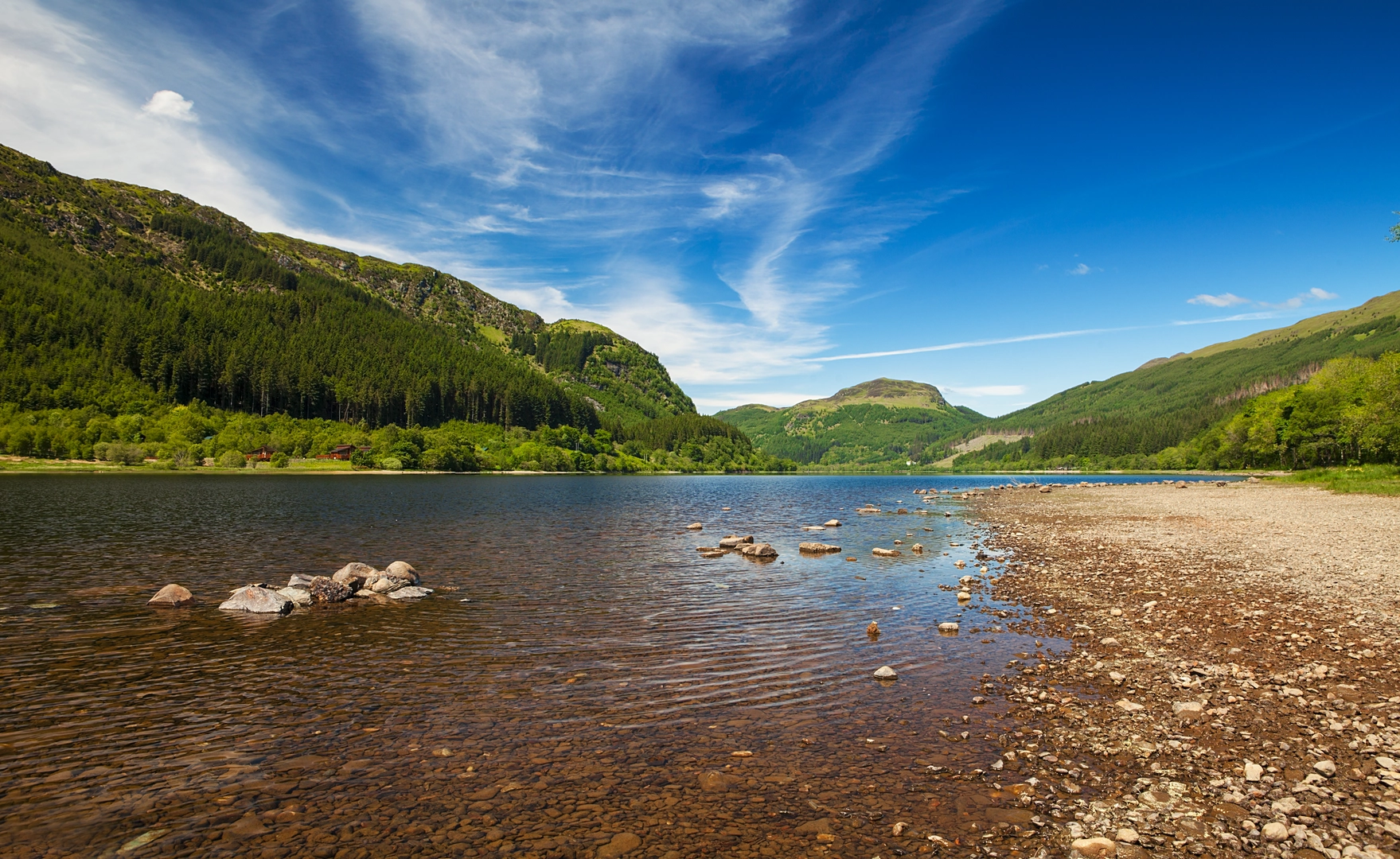
This roughly 7 km / 4.3 mile loop with about 200 m / 656 ft of ascent is a good medium-grade outing above Loch Lubnaig, combining lochside scenery, short but steady climbing, and broad views into the Trossachs. The route is compact enough for a half-day walk, but it still feels varied: you can expect a mix of forest track, hill path, open slopes, and quieter stretches where the landscape opens out over water and surrounding ridges. The high points around Meall Dubh and Tom Bheithe are not especially lofty, yet they give a rewarding sense of elevation above the loch without requiring a full mountain day. Loch Lubnaig itself sits in Loch Lomond & The Trossachs National Park, between Callander and Strathyre, with Ben Ledi and Benvane to the south-west and Ben Vorlich to the north-east. (lochlomond-trossachs.org)
The start is best understood as being near the Loch Lubnaig roadside visitor area on the A84, between Callander and Strathyre, close to the National Park parking areas on the eastern shore of the loch. If your mapping only shows coordinates, the nearest clear landmark to use is Loch Lubnaig North / The Cabin at Loch Lubnaig visitor area, A84, near Strathyre, Stirling, Scotland. That is the most practical reference point for drivers and for anyone arranging a drop-off. The A84 gives straightforward road access, and the National Park notes that Loch Lubnaig is easy to reach by vehicle because the road runs along the eastern side of the loch. There are visitor stops and parking areas along the shore, and toilets are available at The Cabin at Loch Lubnaig. (lochlomond-trossachs.org)
For public transport, the simplest plan is usually to travel to Callander first and then continue toward Loch Lubnaig/Strathyre by local bus or taxi, as the National Park advises using its journey-planning resources for public transport into the area. Services can change, so it is worth checking current timetables before setting out, but the Callander–Strathyre corridor is the key access line for this walk. If you are combining walking with cycling, National Cycle Network Route 7 also runs through the Loch Lubnaig area on the line of the former Callander and Oban Railway, which can help with approach planning. (lochlomond-trossachs.org)
What the route feels like
The outing usually begins gently, with the loch immediately setting the tone. Early on, the walking is often the easiest underfoot, giving you time to settle in before the route turns uphill. The climb is modest in total, but 200 m / 656 ft over a relatively short loop means some sections can feel quite direct, especially if the ground is damp. On a dry day, this is a very manageable hill circuit for regular walkers; after rain, roots, mud, and slick rock can make it feel more serious than the numbers suggest.
As height is gained, the character changes from sheltered lochside and woodland edges to more open hillside. This is where the route earns its appeal. The views back over Loch Lubnaig become wider, and the surrounding hills begin to frame the water in that classic Trossachs way: long, narrow loch below, steep-sided slopes around it, and a strong sense of glacial shaping in the landscape. NatureScot describes this part of the National Park as enclosed by the hills and ridges containing Loch Lubnaig, which matches what walkers can expect from the outlooks on this loop. (nature.scot)
Tom Bheithe is especially interesting as a place-name. Research on the Gaelic place-names of the Callander landscape identifies Tom Bheithe as relating to birch, which is a useful clue to the older vegetation character of the area. Even where commercial forestry and mixed woodland now shape the immediate surroundings, the name preserves an older ecological memory of birch-covered ground.

Surfaces
Gravel
Asphalt
Unknown
Comments and Reviews
User comments, reviews and discussions about the Meall Dubh, Tom Bheithe and Loch Lubnaig Loop, Scotland.
average rating out of 5
0 rating(s)