Download
3D Flyover
Add to list
More
113.0 km
~6 days
7153 m
Multi-Day
“Embark on the El Anillo de Picos trek, a captivating journey through Spain's rugged mountain splendor and rich cultural tapestry.”
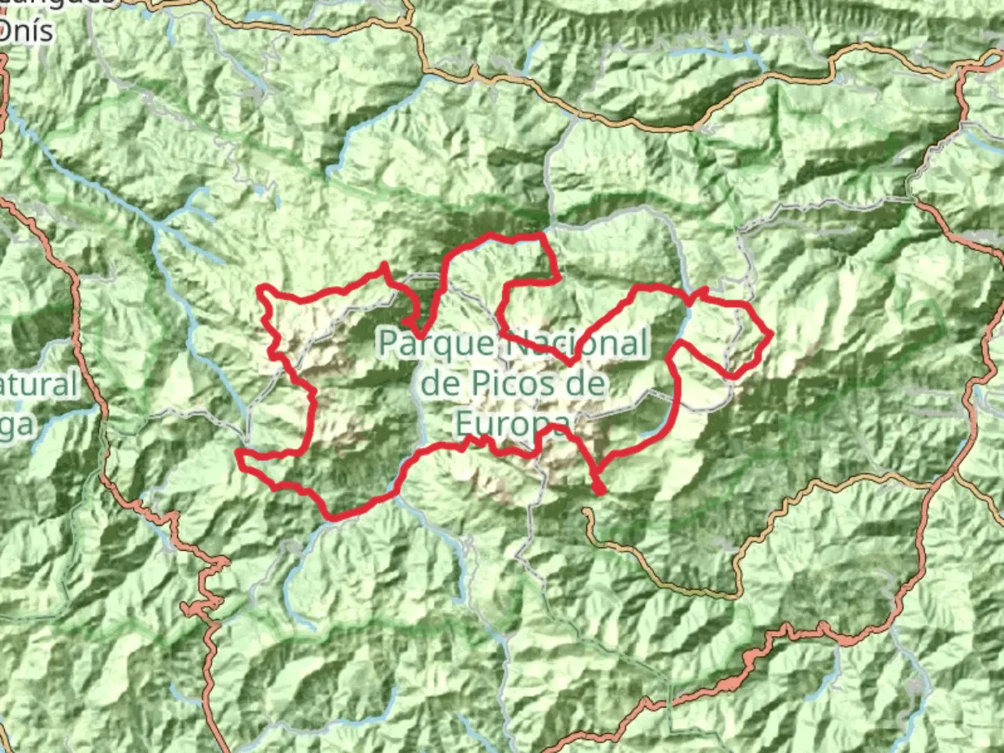
El Anillo de Picos, also known as The Ring of the Picos, is a challenging yet rewarding trek that encircles the heart of the Picos de Europa National Park. This approximately 113 km (70 miles) journey with an elevation gain of around 7100 meters (23,300 feet) is a true test of endurance and offers hikers a comprehensive experience of the dramatic landscapes of northern Spain.
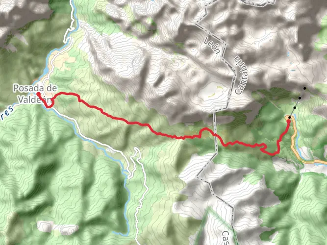
Getting to the Trailhead The adventure begins near the small village of Camaleño, which is accessible by car or public transport. If you're driving, you can reach Camaleño by taking the N-621 road. For those relying on public transportation, buses from nearby cities such as Santander can drop you off at Potes, from where you can take a taxi or a local bus to Camaleño.
Navigating the Trail As you embark on this point-to-point trail, it's crucial to have a reliable navigation tool. HiiKER is an excellent resource for trail maps and can help you stay on track throughout your hike. The trail is well-marked in most sections, but weather conditions can sometimes obscure the path, so having a digital map on hand is advisable.
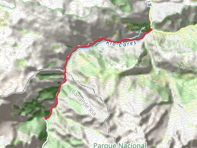
Landmarks and Nature The route takes you through a variety of terrains, from lush valleys and forests to rocky passes and alpine meadows. Early in the trek, you'll encounter the iconic Cares Gorge, a stunning narrow canyon with a path carved into the rock face. This section alone is a highlight for many, with its vertical walls and the river rushing below.
As you progress, you'll pass through charming mountain villages like Bulnes and Sotres, which offer a glimpse into the region's culture and history. These villages are also perfect spots to rest and resupply.
Wildlife and Flora The Picos de Europa is home to a rich array of wildlife, including chamois, wolves, and the occasional golden eagle. The flora is equally diverse, with a range of plant life that changes with the altitude. Keep an eye out for the beautiful alpine flowers that bloom in the spring and summer months.
Historical Significance The region is steeped in history, with ties to the Reconquista and the Christian reconquest of Spain. The Picos de Europa mountains were among the first areas to be reclaimed. The trail itself may not have significant historical structures, but the surrounding area, including the Covadonga Monastery, is a testament to the region's past.
Preparation and Planning Given the trail's difficulty rating, it's essential to be well-prepared. Ensure you have appropriate gear for varying weather conditions, as the high elevations can bring about sudden changes. It's also wise to plan for sufficient food and water, although there are opportunities to restock in the villages along the way.
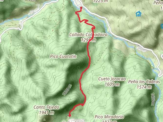
Elevation and Distance The trail's elevation gain is significant, with some days involving steep ascents and descents. Be prepared for long stretches of walking, averaging around 15 to 20 km (9 to 12 miles) per day, depending on your pace and the specific route you choose.
Conclusion El Anillo de Picos is a trail that offers an immersive experience into the natural beauty and cultural heritage of the Picos de Europa National Park. With its challenging terrain and breathtaking vistas, it's a must-do for seasoned hikers seeking an adventure in the heart of Spain's majestic mountains.

Frequently asked questions
How long does it take to hike El Anillo de Picos?
El Anillo de Picos is a 112.98 km multi-day circuit with 7,153 m of climbing, so it is normally completed over several days rather than as a single outing. The route is built around a network of mountain refuges in the Picos de Europa, and the full Tres Macizos version links nine refugios around the national park.
What is El Anillo de Picos in Spain?
El Anillo de Picos is a long-distance hut-to-hut trekking circuit in and around Picos de Europa National Park in northern Spain. The full route is about 112.98 km with 7,153 m of elevation gain, forming a demanding ring through high mountain terrain near Camaleño and the central Picos massifs.
How difficult is El Anillo de Picos de Europa?
El Anillo de Picos is an Extra Difficult trek, and the numbers explain why: 112.98 km of distance and 7,153 m of ascent make it a serious endurance route. It crosses steep limestone mountain terrain in Picos de Europa, where weather, exposure, and long days between refuges can make the route feel much harder than the mileage alone suggests.
What is the route of El Anillo de Picos?
El Anillo de Picos is the full circular route around the heart of Picos de Europa, passing through all three main massifs in its Tres Macizos form. The trek is organized around nine refugios and includes major mountain landscapes such as the Cares corridor and the high limestone terrain for which the park is known.
Does El Anillo de Picos include the Cares Gorge?
Yes, El Anillo de Picos is commonly associated with the Cares area, one of the best-known landscapes in Picos de Europa National Park. The Cares Gorge follows the river between the Central and Western massifs, and it is one of the named landmarks many hikers connect with the broader Anillo de Picos experience.
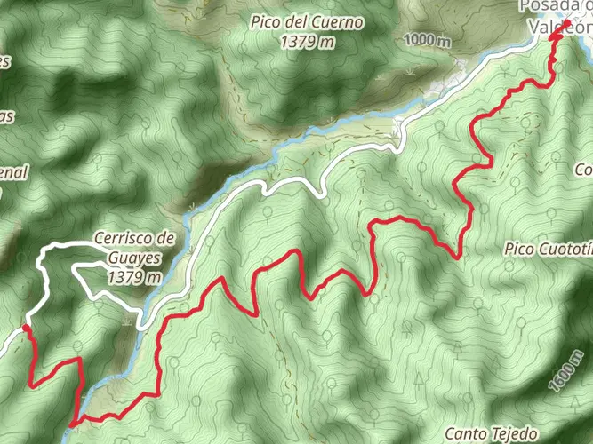
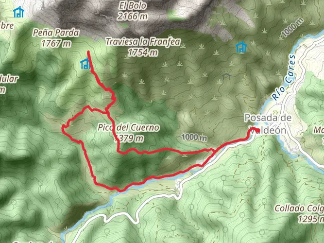
Where does El Anillo de Picos start near Camaleño?
El Anillo de Picos is linked to the Camaleño area on the Cantabria side of Picos de Europa, with access typically made via the Potes valley and the road toward Fuente Dé. Camaleño works as a practical gateway for reaching the southern side of the national park before joining the multi-day circuit.
Comments and Reviews
User comments, reviews and discussions about the El Anillo de Picos, Spain.
4.8
average rating out of 5
5 rating(s)