Download
3D Flyover
Add to list
More
13.7 km
~4 hrs 8 min
838 m
Multi-Day
“Embark on the Ruta del Trevenque to experience Granada's natural splendor and historical tapestry through diverse terrains and captivating panoramas.”
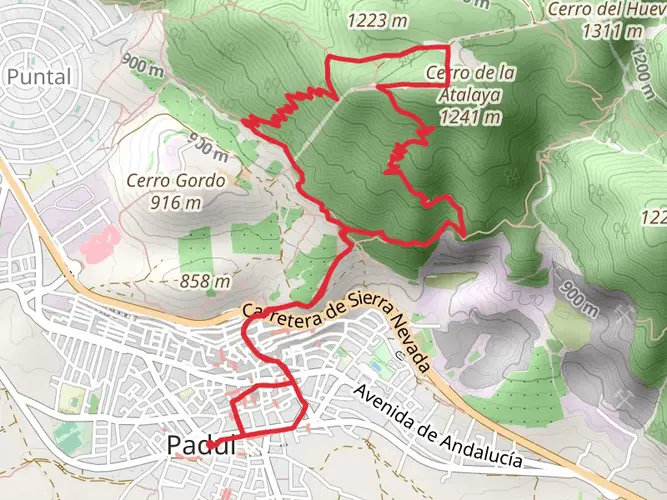
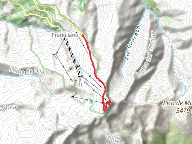
The Ruta del Trevenque is a scenic loop trail that spans approximately 14 kilometers (about 8.7 miles) and features an elevation gain of around 800 meters (roughly 2625 feet), offering hikers a moderately challenging experience. The trailhead is conveniently located near the Comarca de la Vega de Granada in Spain, a region known for its rich history and stunning landscapes.
Getting to the Trailhead
To reach the starting point of the Ruta del Trevenque, hikers can either drive or use public transportation. For those opting to drive, parking is available near the trailhead. If using public transport, one can take a bus from Granada to the nearby towns and then a short taxi ride to the trailhead.
Navigating the Trail
Hikers can utilize the HiiKER app to navigate the trail, ensuring they stay on the correct path throughout their journey. The app provides detailed maps and waypoints that are particularly helpful in areas where the trail may be less marked.
Trail Highlights and Landmarks
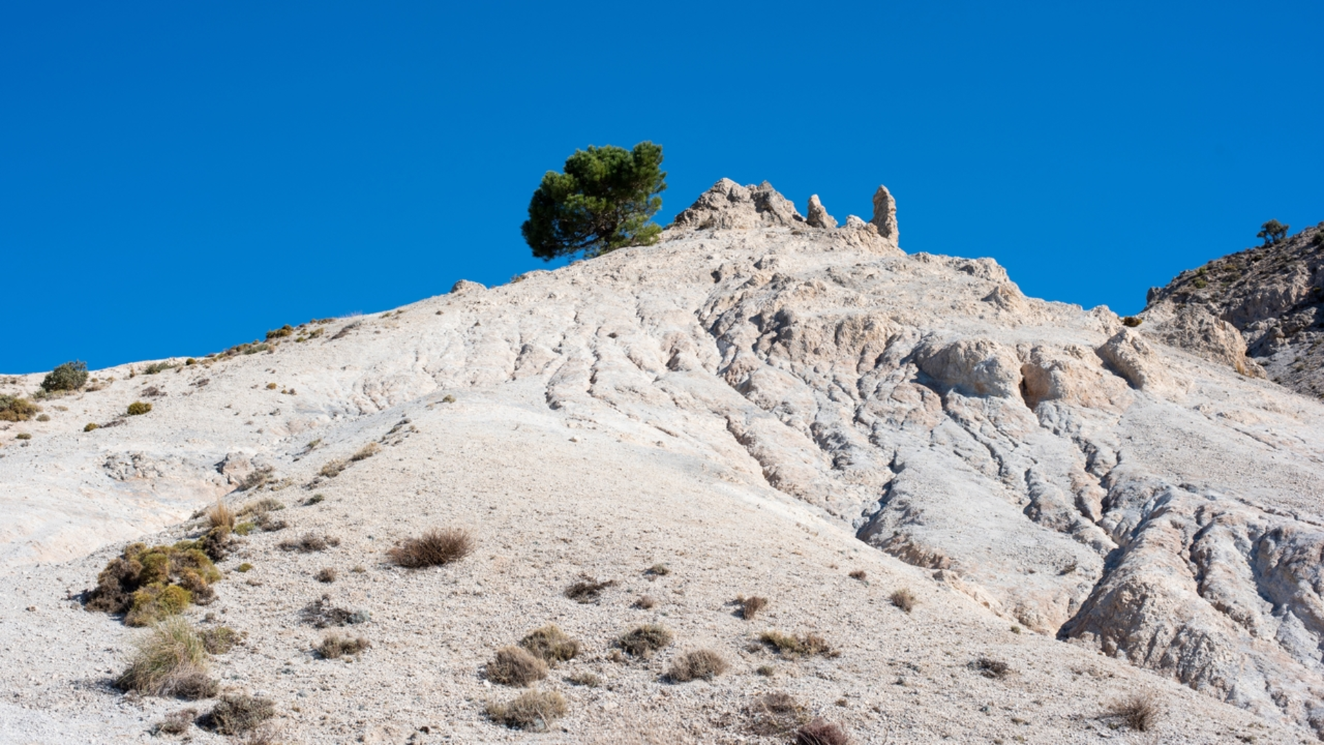
As you embark on the Ruta del Trevenque, you'll traverse through diverse terrains, including pine forests, rocky outcrops, and meadows dotted with wildflowers, especially during the spring and early summer months. The trail offers breathtaking views of the Sierra Nevada mountain range, with the peak of Trevenque being a prominent feature on the horizon.
Approximately 3.5 kilometers (about 2.2 miles) into the hike, you'll encounter the Fuente del Hervidero, a natural spring where you can refill your water bottles and enjoy a moment of rest. The trail continues to ascend, and at the halfway point, you'll reach the summit of Trevenque, standing at an elevation of 2079 meters (about 6821 feet). Here, you can take in panoramic views of the surrounding landscape, including the Alhambra and the city of Granada in the distance.
Flora and Fauna
The Ruta del Trevenque is home to a variety of wildlife, including mountain goats, birds of prey, and numerous species of butterflies. The vegetation along the trail is typical of the Mediterranean climate, with broom, juniper, and holm oak trees providing shade and habitat for the local fauna.
Historical Significance
The region around the Ruta del Trevenque is steeped in history, with the nearby city of Granada being a former Moorish stronghold. The influence of past civilizations can be seen in the architecture and cultural landmarks throughout the area.
Preparation and Safety
Before setting out on the Ruta del Trevenque, hikers should be prepared with adequate water, sun protection, and sturdy footwear. The trail can be rocky and uneven in places, so a good pair of hiking boots is recommended. Additionally, it's wise to check the weather forecast and start early to avoid the midday heat.
Remember to respect the natural environment by staying on the trail and packing out all trash. By following these guidelines, you'll ensure a safe and enjoyable hiking experience on the Ruta del Trevenque.

Frequently asked questions
How long does Ruta del Trevenque usually take to complete from Fuente del Hervidero?
Ruta del Trevenque covers 13.73 km with 838 m of climbing, so it is a full mountain day rather than a short walk. Most hikers should allow roughly 5 to 7 hours, especially on the steeper sections around the Trevenque massif and the return toward Fuente del Hervidero.
Is Ruta del Trevenque a circular hike in Granada?
Yes. Ruta del Trevenque is commonly done as a circular route in the Trevenque area above Granada, linking the Fuente del Hervidero area with the Arenales del Trevenque and the Canal de la Espartera before returning to the start. The total distance is about 13.73 km.
Where does Ruta del Trevenque start, and is there parking near the trailhead?
Ruta del Trevenque is typically started from the Fuente del Hervidero area in the mountains above Granada. Parking is commonly used near Fuente del Hervidero and by the Canal de la Espartera access track, which makes this one of the standard starting points for the Trevenque loop.
How hard is Ruta del Trevenque compared with other hikes near Granada?
Ruta del Trevenque is rated Extra Difficult and includes 838 m of elevation gain over 13.73 km. That combination makes it a demanding route near Granada, with sustained climbing and mountain terrain that is better suited to experienced hikers than casual walkers.
Does Ruta del Trevenque go by the Canal de la Espartera?
Yes. The Canal de la Espartera is one of the named features regularly associated with Ruta del Trevenque and with circular Trevenque routes from Fuente del Hervidero. It is part of the mountain infrastructure and path network used to approach or loop around the Trevenque area.
What landmarks are on Ruta del Trevenque in the Sierra Nevada area?
Named landmarks associated with Ruta del Trevenque include Fuente del Hervidero, the Arenales del Trevenque, the Canal de la Espartera, and the Trevenque massif itself. The route is in the Sierra Nevada area above Granada, where the terrain shifts from forest approaches to more open, rocky mountain ground.
Comments and Reviews
User comments, reviews and discussions about the Ruta del Trevenque, Spain.
average rating out of 5
0 rating(s)