Download
3D Flyover
Add to list
More
4.1 km
~55 min
68 m
Loop
“Salt-sprayed clifftops and hidden coves lead to Cabo Mayor’s lighthouse, with wind-wise footing.”
This short coastal walk links two of Santander’s best-known headlands: the cliffside path of Senda de Mataleñas and the panoramic viewpoint by Faro de Cabo Mayor (Cabo Mayor Lighthouse). Expect roughly 4 km / 2.5 miles total with about 100 m / 330 ft of cumulative ascent—mostly gentle, with a few short rises where the path rolls over small headlands and dips into sheltered coves. It’s well-suited to beginners and families, but it’s still an Atlantic cliff walk, so wind and wet rock are the main things to plan for.
Getting to the start (car + public transport)
A practical place to begin is by Parque de Mataleñas / Playa de Mataleñas (the park and beach area just west of Cabo Mayor), which is a common access point to the coastal path and keeps the route straightforward.
- By car: Navigate to Parque de Mataleñas (Santander) and look for parking around the park entrances and nearby streets. Arriving earlier in the day helps in peak season, as this is a popular beach-and-walk area.
- By public transport: Santander’s city buses regularly serve the coastal neighborhoods and the Sardinero area; from there it’s typically a short walk to the Mataleñas park/beach access. Use HiiKER to confirm the exact start point you choose and to match it with the nearest bus stop for the day you’re hiking (routes and stop names can vary by season and service updates).
What the walk is like underfoot
From the Mataleñas side, you’ll quickly pick up a well-used coastal footpath that alternates between compacted dirt, gravel, and short paved segments near viewpoints. The “easy” rating comes from the modest distance and elevation, but there are a few details to keep in mind:
- Cliff-edge exposure: Much of the route runs above rocky shoreline. The path is generally wide enough for comfortable walking, but there are sections where the drop is immediate beyond the edge. Keep children close and avoid stepping off-trail for photos.
- Wind: Cabo Mayor is a headland that catches Atlantic gusts. Even on warm days, windchill can be noticeable; a light shell is often useful.
- Wet rock and mud: After rain or sea mist, shaded corners and stone steps can be slick. Shoes with decent tread make the walk more relaxed.
Landmarks, viewpoints, and the “why it’s worth it”
You’ll spend most of the hike with open views over the Bay of Biscay, with the coastline forming a sequence of small promontories and inlets. The scenery changes subtly as you go:
- Mataleñas area: Near the park and beach access, you’ll often see people heading down toward Playa de Mataleñas, a small cove backed by greenery. If you detour to the beach, note that the return involves a short climb back up (still modest, but it adds a little extra effort).
- Clifftop viewpoints: As you follow the path east/northeast, the route repeatedly crests low rises—these are where most of your ~100 m / 330 ft of gain accumulates in small increments rather than one sustained climb. Several informal lookouts appear along the way; the best ones are usually on the outer edges of the headlands where the horizon opens up.
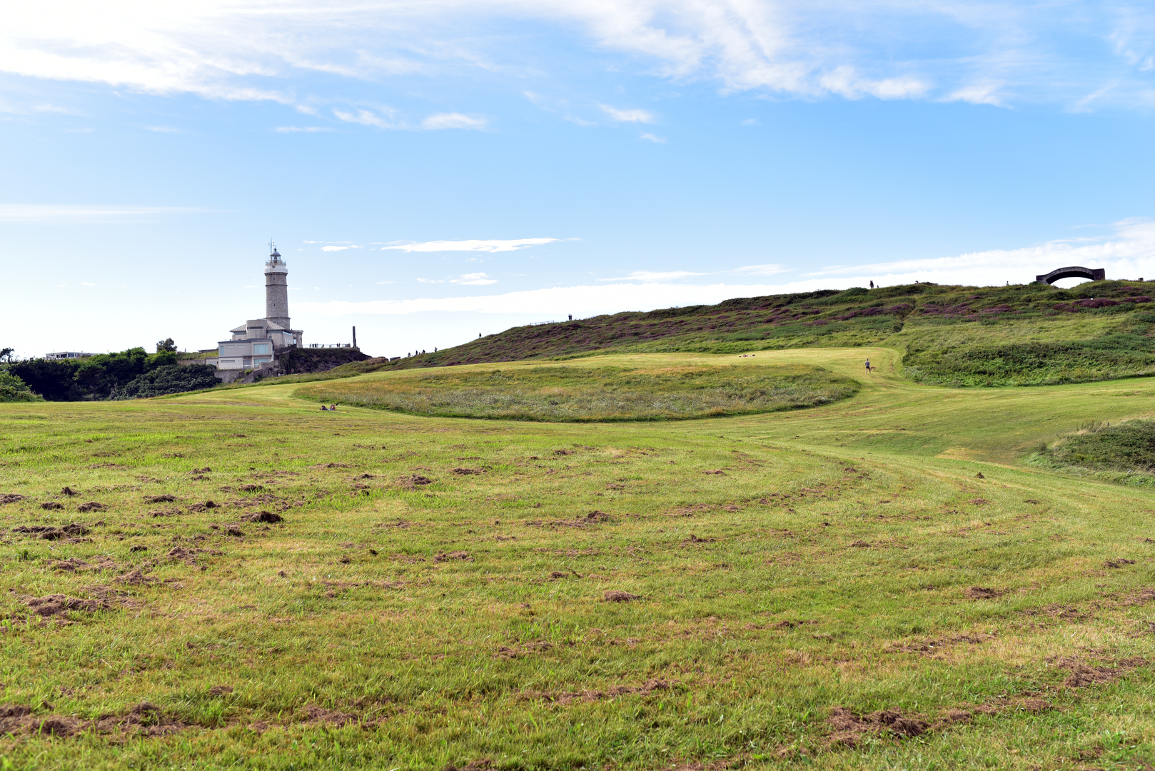
- Cabo Mayor Lighthouse viewpoint: The lighthouse area is the headline stop. The setting is dramatic: a prominent headland with broad sea views and a strong sense of place. Lighthouses along this coast are part of the region’s long maritime story—built to improve navigation and safety along a shoreline known for rough seas and frequent fog. Even if you don’t go inside any facilities, the exterior viewpoint alone is a highlight.
Nature and wildlife to look for
This is a coastal environment where you’ll notice the interplay of salt air, wind-pruned vegetation, and seabird activity.
- Plants: Expect hardy coastal shrubs and grasses adapted to wind and salt spray. In spring and early summer, small wildflowers often appear along the path edges, especially where the trail widens and the soil is less compacted.
- Birdlife: Watch for gulls and other seabirds riding the updrafts along the cliffs. On calmer days, you may spot birds working the water below the headland. Bringing binoculars can add a lot to a short walk like this.
- Marine views: From higher points you can sometimes see wave patterns over submerged rocks and reefs; at lower tide, the shoreline texture becomes more detailed with exposed rock shelves.
Planning notes: timing, safety, and navigation
- Time needed: Many hikers will take 1–1.5 hours for 4 km / 2.5 miles at an easy pace, but it can easily become 2 hours with photo stops and viewpoint detours.
- Best conditions: Clear or partly cloudy days give the best visibility; windy days can still be enjoyable but require more care near edges.
- What to carry: Water, a light windproof layer, sun protection (the clifftops can be surprisingly exposed), and grippy footwear.
- Navigation: The route is generally intuitive—follow the coastal path toward Cabo Mayor—but use HiiKER to keep to the intended line, especially where side paths branch toward viewpoints or down toward coves.
If you share the start-point coordinates (or any lon/lat you have for “Hike head: near …”), I can pin it to the nearest recognizable landmark/address and tailor the directions and route flow to that exact access point.

Surfaces
Unknown
Concrete
Gravel
Asphalt
Ground
Grass
Cobblestone
Comments and Reviews
User comments, reviews and discussions about the Senda de Matalenas and Cabo Mayor Lighthouse Viewpoint, Spain.
average rating out of 5
0 rating(s)